Safety Score: 3,0 of 5.0 based on data from 9 authorites. Meaning we advice caution when travelling to United Kingdom.
Travel warnings are updated daily. Source: Travel Warning United Kingdom. Last Update: 2024-04-25 08:17:04
Delve into Cilcain
Cilcain in Flintshire (Wales) is located in United Kingdom about 175 mi (or 281 km) north-west of London, the country's capital town.
Current time in Cilcain is now 06:07 AM (Friday). The local timezone is named Europe / London with an UTC offset of one hour. We know of 10 airports close to Cilcain, of which 5 are larger airports. The closest airport in United Kingdom is Hawarden Airport in a distance of 11 mi (or 17 km), East. Besides the airports, there are other travel options available (check left side).
There are several Unesco world heritage sites nearby. The closest heritage site in United Kingdom is Castles and Town Walls of King Edward in Gwynedd in a distance of 20 mi (or 33 km), West. Also, if you like playing golf, there are some options within driving distance. If you need a hotel, we compiled a list of available hotels close to the map centre further down the page.
While being here, you might want to pay a visit to some of the following locations: Halkyn, Mold, Holywell, Ruthin and Whitford. To further explore this place, just scroll down and browse the available info.
Local weather forecast
Todays Local Weather Conditions & Forecast: 8°C / 46 °F
| Morning Temperature | 1°C / 35 °F |
| Evening Temperature | 8°C / 46 °F |
| Night Temperature | 4°C / 39 °F |
| Chance of rainfall | 0% |
| Air Humidity | 59% |
| Air Pressure | 1006 hPa |
| Wind Speed | Gentle Breeze with 6 km/h (4 mph) from West |
| Cloud Conditions | Scattered clouds, covering 40% of sky |
| General Conditions | Light rain |
Saturday, 27th of April 2024
10°C (50 °F)
6°C (42 °F)
Overcast clouds, gentle breeze.
Sunday, 28th of April 2024
5°C (41 °F)
5°C (40 °F)
Moderate rain, moderate breeze, overcast clouds.
Monday, 29th of April 2024
12°C (54 °F)
8°C (47 °F)
Light rain, moderate breeze, overcast clouds.
Hotels and Places to Stay
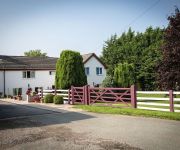
Glan Llyn Guest House
Springfield Hotel Holywell
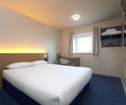
TRAVELODGE HALKYN
Videos from this area
These are videos related to the place based on their proximity to this place.
Day to Night at Loggerheads Country Park
This time-lapse video show the transition from day to night at Loggerheads Country Park, near Mold in North Wales. Check out more photos and videos at my website www.gohowie.com.
Raft Building
Bedford Drive Y6 Raft Building at Kingswood, Colomendy. Aerial Photography by www.hi-impact.co.uk using GoPro and Quadcopter.
Moel Famau.15.06.13
Our walk completed on the 15th June 2013 from the car park at Moel Famau Country Park, to the summit of Moel Famau, over to Moel Dywll, along part of the Clwydian Way to the base of Moel Arthur,...
Moon and Clouds Time Lapse
This short time lapse sequence shows the full moon dodging in and out behind fast moving clouds. To see more of my images and videos, visit my website www.gohowie.com. Thanks for watching.
Time lapse video of moonset in July, Vale of Clwyd
This time lapse video sequence shows the new moon setting into a bank of cloud over the Vale of Clwyd, North Wales.
Clouds at Sunset time lapse
A cold front had just moved through North Wales, leaving behind a lovely backdrop of layered cloud towards the west as the sun was setting. Hoping to film a ...
Videos provided by Youtube are under the copyright of their owners.
Attractions and noteworthy things
Distances are based on the centre of the city/town and sightseeing location. This list contains brief abstracts about monuments, holiday activities, national parcs, museums, organisations and more from the area as well as interesting facts about the region itself. Where available, you'll find the corresponding homepage. Otherwise the related wikipedia article.
Moel Famau
Moel Famau (or, more correctly, Moel Fama) is the highest hill within the Clwydian Range on the border between Denbighshire and Flintshire in Wales. The hill, which also gives its name to the Moel Famau country park, has been classed as an Area of Outstanding Natural Beauty since 1985. It is also surrounded by several well-preserved Iron-Age hill forts.
Loggerheads, Denbighshire
Loggerheads is a village in Denbighshire, Wales on the River Alyn, a tributary of the River Dee. It has a country park which follows the course of the River Alyn through karstic limestone countryside including the sites of old lead mines and mills. there is a working flour mill on site. A leat or leete, built around 1824 follows the side of the valley nearby and was used to carry water to the lead mines of Mold Mines, on land owned by the Grosvenor family. It is now the popular Leete Walk.
Clwydian Range
The Clwydian Range is a series of hills and mountains in north east Wales that runs from Llandegla in the south to Prestatyn in the north, with the highest point being the popular Moel Famau. The range is designated as an area of outstanding natural beauty. The summits of these hills provide extensive views across north Wales, to the high peaks of Snowdonia, eastwards across the Cheshire Plain, Peak District and towards Manchester and Liverpool to the northeast.
Mold and Denbigh Junction Railway
The Mold and Denbigh Junction Railway was a 15+⁄4-mile link railway in North Wales, between the Mold Railway and the Vale of Clwyd Railway. It was incorporated on 6 August 1861 and closed to passengers in 1962.
Pantymwyn
Pantymwyn is a small village just outside Mold in North Wales in the county of Flintshire. The village is located within a designated Area of Outstanding Natural Beauty, lying on the east side of the Clwydian Range. Pantymwyn is 4 miles west of Mold in Flintshire, North Wales. It is 16 miles west of Chester (See map for detailed view). The village has a pub (the Crown Inn), a post office and convenience store, a garage and an 18-hole uplands golf course (the home of Mold Golf Club).
Alyn Gorge
The Alyn Gorge is a spectacular forested gorge section of the River Alyn north between Loggerheads and Rhydymwyn in Wales. The west side of the valley rises gently to Moel Famau, while the east bank is along parts a cliff with evidence of tram lines and old quarry workings. The path along the edge of the gorge is well maintained, with metal bridges and barriers across sites which are popular with climbers.
St Mary's Church, Cilcain
St Mary's Church, Cilcain, is in the village of Cilcain, Flintshire, Wales. It is an active Anglican church in the parish of Cilcain, Nannerch and Rhydymwyn, the deanery of Mold, the archdeaconry of Wrexham and the diocese of St Asaph. The church is a Grade II listed building.
Cilcain Hall
Cilcain Hall is a country house 2 miles north-northeast of the village of Cilcain, Flintshire, Wales. It was built in 1875–77 for W. B. Buddicom and designed by the Chester architect John Douglas. The hall is built in stone and has a red tile roof. Its architecture includes Elizabethan elements. Douglas also designed an entrance lodge which was built around the same time on the main road. The lodge is no longer present.


