Safety Score: 3,0 of 5.0 based on data from 9 authorites. Meaning we advice caution when travelling to United Kingdom.
Travel warnings are updated daily. Source: Travel Warning United Kingdom. Last Update: 2024-04-29 08:03:39
Discover Waddington
Waddington in Lancashire (England) with it's 1,028 citizens is a city in United Kingdom about 190 mi (or 306 km) north-west of London, the country's capital city.
Local time in Waddington is now 03:16 PM (Monday). The local timezone is named Europe / London with an UTC offset of one hour. We know of 10 airports in the vicinity of Waddington, of which 5 are larger airports. The closest airport in United Kingdom is Blackpool International Airport in a distance of 26 mi (or 42 km), West. Besides the airports, there are other travel options available (check left side).
There are several Unesco world heritage sites nearby. The closest heritage site in United Kingdom is Liverpool – Maritime Mercantile City in a distance of 67 mi (or 107 km), South-East. Also, if you like golfing, there are a few options in driving distance. Looking for a place to stay? we compiled a list of available hotels close to the map centre further down the page.
When in this area, you might want to pay a visit to some of the following locations: Blackburn, Burnley, Bolton, Bury and Chorley. To further explore this place, just scroll down and browse the available info.
Local weather forecast
Todays Local Weather Conditions & Forecast: 10°C / 50 °F
| Morning Temperature | 7°C / 45 °F |
| Evening Temperature | 10°C / 50 °F |
| Night Temperature | 9°C / 49 °F |
| Chance of rainfall | 3% |
| Air Humidity | 89% |
| Air Pressure | 1008 hPa |
| Wind Speed | Strong breeze with 18 km/h (11 mph) from North |
| Cloud Conditions | Overcast clouds, covering 100% of sky |
| General Conditions | Light rain |
Tuesday, 30th of April 2024
16°C (60 °F)
9°C (48 °F)
Light rain, fresh breeze, overcast clouds.
Wednesday, 1st of May 2024
14°C (57 °F)
12°C (53 °F)
Light rain, moderate breeze, overcast clouds.
Thursday, 2nd of May 2024
14°C (57 °F)
11°C (52 °F)
Overcast clouds, moderate breeze.
Hotels and Places to Stay
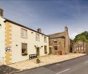
The Red Pump Inn
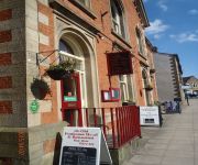
The Old Post House Hotel
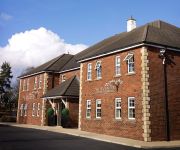
The Avenue Hotel at Brockhall
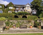
Best Western Higher Trapp Country House
NORTHCOTE
Videos from this area
These are videos related to the place based on their proximity to this place.
Clitheroe Castle
An aerial tour of Clitheroe Castle, shot using a quadcopter aerial video platform. www.camerainthesky.co.uk.
Clitheroe Gas Works
Historic video footage of the Clitheroe Gas Works in Lancashire where coal gas production ceased in 1968. Two short films together one one movie.
Building Clitheroe Skatepark
A montage of photos documenting the build of Clitheroe skatepark circa 2006.
A Duchess at Clitheroe - 30/08/2014
46233 'Duchess of Sutherland' powers through Clitheroe station on the Northbound working of the 'Cumbrian Mountain Express' from Crewe to Carlisle via Manchester and the S&C. Apologies for...
Merry Hell live @ The Grand Clitheroe 1st febuary 2014 clip 2
last n final youtube account folks here is the fantastic merry hell earlier on in the year at the grand in clitheroe.
VisitLancashire: Clitheroe
The ancient market town of Clitheroe in the Ribble Valley is a perfect place to stay for visitors wishing to explore Lancashire's Forest of Bowland, one of England's 36 Areas of Outstanding...
Fellsman steam train in clitheroe 12-8-09 5690 'LEANDER'
taken from Kemple View Clitheroe Done in slow motion.
Clitheroe Line - The Sound of Skateboarding.mov
Slow motion warm up line at Clitheroe Skatepark before the scooters turn up! RE-DO.
Videos provided by Youtube are under the copyright of their owners.
Attractions and noteworthy things
Distances are based on the centre of the city/town and sightseeing location. This list contains brief abstracts about monuments, holiday activities, national parcs, museums, organisations and more from the area as well as interesting facts about the region itself. Where available, you'll find the corresponding homepage. Otherwise the related wikipedia article.
Ribble Valley (UK Parliament constituency)
Ribble Valley is a constituency represented in the House of Commons of the UK Parliament since 1992 by Nigel Evans, a Conservative.
Clitheroe railway station
Clitheroe railway station serves the town of Clitheroe in Lancashire, England. The station is the northern terminus of the Ribble Valley Line operated by Northern Rail and is 10 miles north of Blackburn. The station forms part of Clitheroe Interchange, which has won a number of awards.
Low Moor, Lancashire
Low Moor is a district of the town of Clitheroe, located in Lancashire, England. It has a local club called the Low Moor Reading Room and Club with two snooker tables, one pool table, one dartboard, a few slot machines and much more. Some of the residents of Clitheroe and Low Moor come here to socialize. World famous UFC Fighter Michael Bisping grew up in this part of town. There is also a nursery situated in the area named St Paul's Nursery as well as St Paul's Church.
Bashall Brook
Bashall Brook is a minor river in the English county of Lancashire. The stream rises at the confluence of several rills descending from around Braddup Clough and flows south and east through the Waddington area before joining the River Ribble.
Moorland School
Moorland School is a non-selective independent day and boarding school situated in the Ribble Valley, Clitheroe in North West England. The original building is a listed building, situated in 15 acres of countryside.
St Mary Magdalene's Church, Clitheroe
St Mary Magdalene's Church, Clitheroe, is located in Church Street, Clitheroe, Lancashire, England. It is the Anglican parish church of the town, and is in the deanery of Whalley, the archdeaconry of Blackburn, and the diocese of Blackburn. The church has been designated by English Heritage as a Grade II* listed building.
Waddow Hall
Waddow Hall is a 17th-century Grade II listed building within a 178-acre estate that serves as a conference and activity centre for Girlguiding UK near Clitheroe, Lancashire. Waddow Hall has been managed by Girlguiding since 1927.
St Helen's Church, Waddington
St Helen's Church, Waddington, is located in the village of Waddington, Lancashire, England. It is an active Anglican parish church in the deanery of Bowland, the archdeaconry of Craven, and the diocese of Bradford. Its benefice is united with that of St Catherine, West Bradford. The church has been designated by English Heritage as a Grade II* listed building.


