Safety Score: 3,0 of 5.0 based on data from 9 authorites. Meaning we advice caution when travelling to United Kingdom.
Travel warnings are updated daily. Source: Travel Warning United Kingdom. Last Update: 2024-04-27 08:23:39
Delve into Padiham
Padiham in Lancashire (England) with it's 11,338 habitants is a city located in United Kingdom about 183 mi (or 295 km) north-west of London, the country's capital town.
Current time in Padiham is now 08:10 PM (Saturday). The local timezone is named Europe / London with an UTC offset of one hour. We know of 10 airports closer to Padiham, of which 5 are larger airports. The closest airport in United Kingdom is Leeds Bradford Airport in a distance of 27 mi (or 44 km), East. Besides the airports, there are other travel options available (check left side).
There are several Unesco world heritage sites nearby. The closest heritage site in United Kingdom is Liverpool – Maritime Mercantile City in a distance of 60 mi (or 97 km), South-East. Also, if you like playing golf, there are some options within driving distance. In need of a room? We compiled a list of available hotels close to the map centre further down the page.
Since you are here already, you might want to pay a visit to some of the following locations: Burnley, Blackburn, Bury, Rochdale and Bolton. To further explore this place, just scroll down and browse the available info.
Local weather forecast
Todays Local Weather Conditions & Forecast: 9°C / 49 °F
| Morning Temperature | 2°C / 35 °F |
| Evening Temperature | 8°C / 46 °F |
| Night Temperature | 4°C / 40 °F |
| Chance of rainfall | 0% |
| Air Humidity | 68% |
| Air Pressure | 1006 hPa |
| Wind Speed | Moderate breeze with 9 km/h (6 mph) from West |
| Cloud Conditions | Broken clouds, covering 57% of sky |
| General Conditions | Light rain |
Sunday, 28th of April 2024
4°C (40 °F)
3°C (38 °F)
Rain and snow, moderate breeze, overcast clouds.
Monday, 29th of April 2024
11°C (53 °F)
9°C (48 °F)
Light rain, fresh breeze, overcast clouds.
Tuesday, 30th of April 2024
14°C (58 °F)
10°C (50 °F)
Light rain, fresh breeze, overcast clouds.
Hotels and Places to Stay
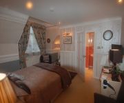
Norwood Guest House
The Barley Mow
Mercure Blackburn Dunkenhalgh Hotel and Spa
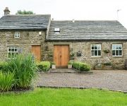
Dam Head Barn
Best Western Higher Trapp Country House
JCT.10 Holiday Inn Express BURNLEY M65
The Pendle Inn
BEST WESTERN MYTTON FOLD HOTEL AND GOLF
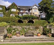
Sparth House Hotel
Best Western Oaks Hotel & Leisure Club
Videos from this area
These are videos related to the place based on their proximity to this place.
Accrington v Church Cricket Match (1902)
This film is part of the Mitchell and Kenyon collection - an amazing visual record of everyday life in Britain at the beginning of the twentieth century. To buy the DVD click here - http://www.b...
Accrington , Huncoat , Pendle, Burnley, Nelson, & Surrounding Area
View around the A56, Huncoat, Hapton, Burnley , Pendle ,
Steam at Huncoat Power Station in the 60s
8mm cine film taken at Huncoat Power Station February 1968 and was a special event to mark the closing of Huncoat Colliery (coal mine).
Malkin Pie created to mark Pendle Witch Trials anniversary
A Sabden deli has cooked up a novel way of marking the 400th anniversary of the Pendle Witch Trials. Keith and Christine Turner, who run San-witches in the village, have created a special...
Tom Barker scoring winning goal in Cup Final
Brunlea Dynamoes 1 v 0 Oswaldtwistle FC Accrington & District Junior Football League U12 Cup Final 2008 at the Arbories Padiham FC.
Videos provided by Youtube are under the copyright of their owners.
Attractions and noteworthy things
Distances are based on the centre of the city/town and sightseeing location. This list contains brief abstracts about monuments, holiday activities, national parcs, museums, organisations and more from the area as well as interesting facts about the region itself. Where available, you'll find the corresponding homepage. Otherwise the related wikipedia article.
Padiham F.C
Padiham Football Club are an English football team based in Padiham, Lancashire. As of 2012–13, they play in the Premier Division of the North West Counties League.
Huncoat railway station
Huncoat railway station is a request stop only railway station which serves the village of Huncoat, between Accrington and Burnley in Lancashire. The station is 8 miles east of Blackburn railway station on the East Lancashire Line operated by Northern Rail.
Hapton railway station
Hapton railway station serves the village of Hapton 3 miles west of Burnley Central railway station on the East Lancashire Line operated by Northern Rail. It is unmanned. Between 2004–5 and 2005–6, passenger usage fell by 21% but in the years since then has risen again by more than 60%.
Rose Grove railway station
Rose Grove railway station is located in the western part of Burnley in Lancashire, England, 11 miles (17 km) east of Blackburn railway station. The Caldervale Line and the East Lancashire Line converge at Gannow Junction east of Rose Grove. However the station is only served by the East Lancashire Line, as the semi fast Blackpool North to York service via Burnley Manchester Road does not call at Rose Grove. Trains go instead towards Burnley Central and terminate at Colne.
Ightenhill
Ightenhill is a civil parish in the Borough of Burnley in Lancashire, England, with a population of 1,512. It is also considered to be a district of the town of Burnley, with boundaries that do not follow those of the parish. The district is composed principally of a large 1990s housing estate. It is bounded to the north and east by the River Calder, to the south by the Leeds and Liverpool Canal and the M65 motorway, and to the west by Padiham Road.
Huntroyde Hall
Huntroyde Hall or Huntroyde Demesne (known locally simply as 'Huntroyde') is a grade II listed 16th century house and estate bordering the north west edge of the town of Padiham, Lancashire, England, near Simonstone. The house was originally constructed to an H-shaped plan in 1576 for the Starkie family but re-built in the Georgian style in the mid-19th century. Additional wings were added to the west side in 1777 and 1850 which have since been demolished. The house was faced in stone in 1885.
St James' Church, Altham
St James' Church, Altham, is located in the village of Altham, Lancashire, England. It is an active Anglican parish church in the deanery of Accrington, the archdeaconry of Blackburn, and the diocese of Blackburn. Its benefice has been united with that of All Saints, Clayton-le-Moors. The church is designated by English Heritage as a Grade II* listed building.


