Safety Score: 3,0 of 5.0 based on data from 9 authorites. Meaning we advice caution when travelling to United Kingdom.
Travel warnings are updated daily. Source: Travel Warning United Kingdom. Last Update: 2024-04-27 08:23:39
Touring Clayton le Moors
Clayton le Moors in Lancashire (England) with it's 8,474 residents is a town located in United Kingdom about 182 mi (or 294 km) north-west of London, the country's capital place.
Time in Clayton le Moors is now 10:46 PM (Saturday). The local timezone is named Europe / London with an UTC offset of one hour. We know of 10 airports nearby Clayton le Moors, of which 5 are larger airports. The closest airport in United Kingdom is Blackpool International Airport in a distance of 26 mi (or 42 km), West. Besides the airports, there are other travel options available (check left side).
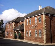
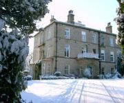
There are several Unesco world heritage sites nearby. The closest heritage site in United Kingdom is Pontcysyllte Aqueduct and Canal in a distance of 59 mi (or 95 km), South. Also, if you like the game of golf, there are several options within driving distance. Need some hints on where to stay? We compiled a list of available hotels close to the map centre further down the page.
Being here already, you might want to pay a visit to some of the following locations: Blackburn, Burnley, Bury, Bolton and Haigh. To further explore this place, just scroll down and browse the available info.
Local weather forecast
Todays Local Weather Conditions & Forecast: 10°C / 49 °F
| Morning Temperature | 2°C / 35 °F |
| Evening Temperature | 8°C / 46 °F |
| Night Temperature | 3°C / 37 °F |
| Chance of rainfall | 0% |
| Air Humidity | 67% |
| Air Pressure | 1006 hPa |
| Wind Speed | Moderate breeze with 9 km/h (6 mph) from West |
| Cloud Conditions | Overcast clouds, covering 95% of sky |
| General Conditions | Light rain |
Sunday, 28th of April 2024
8°C (47 °F)
5°C (41 °F)
Overcast clouds, fresh breeze.
Monday, 29th of April 2024
11°C (52 °F)
9°C (49 °F)
Light rain, fresh breeze, overcast clouds.
Tuesday, 30th of April 2024
14°C (58 °F)
9°C (47 °F)
Overcast clouds, fresh breeze.
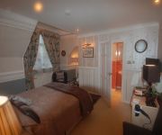
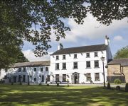
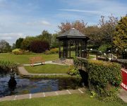
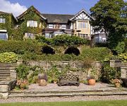
Hotels and Places to Stay
Norwood Guest House
Mercure Blackburn Dunkenhalgh Hotel and Spa
Sparth House Hotel
BEST WESTERN MYTTON FOLD HOTEL AND GOLF
Best Western Higher Trapp Country House
Foxfields Country Hotel
The Avenue Hotel at Brockhall
Astley Bank Hotel
NORTHCOTE
Videos from this area
These are videos related to the place based on their proximity to this place.
35 Albert St, Clayton Le Moors
Choice Rentals is pleased to present this 2 bed mid terraced in Clayton Le Moors. The property benefits from Gas Central Heating, Double Glazing and much more £80.00 pcw For more information...
Greyhound Pub Clayton Le Moors is the base for a Pendle road training ride on a Mountain bike.
Pendle 30 mile Mountain Bike Cycle training ride. Brilliant ride for those winter days when the hills and moors are too soggy to ride. The route takes you on quiet country lanes in beautiful...
Photo Booth Dunkenhalgh Hotel, Accrington, Accrington Photo Booth Hire,
Accrington Photo Booth Hire: http://www.boothpix.co.uk 01228 808397 Accrington Photo booth Hire, a short video from an event at the Dunkenhalgh Hotel, near Accrington. On this occasion for...
Emsley Crane Hire, Liebherr Mobile Crane, KE06 LPU
Emsley Crane Hire Liebherr Mobile Crane, KE06 LPU http://www.emsleycranehireuk.co.uk.
Accrington Sea Cadets Drill Routine
This was a display we performed at our annual presentation evening on the 15th March 2013.
Videos provided by Youtube are under the copyright of their owners.
Attractions and noteworthy things
Distances are based on the centre of the city/town and sightseeing location. This list contains brief abstracts about monuments, holiday activities, national parcs, museums, organisations and more from the area as well as interesting facts about the region itself. Where available, you'll find the corresponding homepage. Otherwise the related wikipedia article.
Hyndburn
Hyndburn is a local government district with borough status in Lancashire, England whose council is based in Accrington and the district is named after the River Hyndburn. It was formed in 1974 by the amalgamation of the Borough of Accrington, the Urban Districts of Church, Clayton-le-Moors, Great Harwood, Oswaldtwistle and Rishton, and part of the Burnley Rural District.
Oakenshaw, Lancashire
Oakenshaw is a village in Lancashire, in England. It is situated between Clayton-le-Moors and Great Harwood.
Hyndburn (UK Parliament constituency)
Hyndburn is a constituency represented in the House of Commons of the UK Parliament since 2010 by Graham Jones of the Labour Party.
107 The Bee
The Bee is a local radio station in England. It won the licence to broadcast to parts of Lancashire in December 2004, and launched on 1 October 2005. The station is owned by UKRD. The Bee operated two trial broadcasts in 2001 and 2002 to help win the licence. The station broadcasts to Blackburn with Darwen and Hyndburn on 107 FM. In addition it broadcasts to Preston, South Ribble and Chorley on 106.5 FM.
Church and Oswaldtwistle railway station
Church and Oswaldtwistle railway station serves both the Accrington suburb of Church and the small town of Oswaldtwistle. The station is 5+⁄3 miles east of Blackburn railway station on the East Lancashire Line operated by Northern Rail. Situated in the middle of Church's suburban streets, the station had fallen into disrepair but was modernised in 2005.
Accrington railway station
Accrington railway station serves the town of Accrington in Lancashire, England. It is a station on the East Lancashire Line 6+⁄4 miles east of Blackburn railway station operated by Northern Rail. It is also served by Caldervale Line express services between Blackpool North, York and Leeds.
Crown Ground
The Crown Ground, known as the Fraser Eagle Stadium for sponsorship purposes until the demise of local company Fraser Eagle in 2009 (and previously as the Interlink Express Stadium), is a multi-use stadium in Accrington, England. It is currently used mostly for football matches and is the home ground of Accrington Stanley F.C.. The stadium holds 5,057 and was built in 1968.
A678 road
The A678 is a road in Lancashire, England, which runs between the towns of Blackburn and Padiham. The road was formerly the main route between Blackburn and Burnley before it was bypassed by the M65 motorway which opened in the 1980s. It currently runs between the A6078 Blackburn Town Centre Orbital Route and the A671 in Padiham, via the small towns of Rishton and Clayton-le-Moors, having been extended at the Blackburn end when the A677 was renumbered east of Blackburn.
Accrington St Christopher's C of E High
St Christopher's C of E High is a voluntarily aided Church of England High School with academy status located north of Accrington in Lancashire, north-west England. The school was founded in 1958 and in 2005 earned Technology College status. The Sunday Times ranked it 49th in 2007 and 30th in 2006 in its "Top 50 state secondary school with no sixth form" category. The school has received an 'Outstanding' inspection report by Ofsted.
Howard & Bullough
Howard & Bullough was a firm of textile machine manufacturers in Accrington, Lancashire. They were the world's major manufacturer of power looms in the 1860s.
List of mills in Lancashire
This is a list of the cotton and other textile mills in Lancashire, England. The first mills were built in the 1760s, in Derbyshire using the Arkwright system and were powered by the water. When Stationary steam engines were introduced, they still needed water, so the mills were built along the rivers and canals. As a broad rule of thumb, spinning mills were built in the south east of the county, and weaving sheds to the north and west.
Globe Works, Accrington
The Globe Works is a former industrial works in Accrington, Lancashire that following refurbishment contains rented offices and conference rooms and is known as the Globe Centre. The centre is made up of the remainder of The Globe Works, which created machinery and looms for the cotton industry under management of the Howard & Bullough firm.


