Safety Score: 3,0 of 5.0 based on data from 9 authorites. Meaning we advice caution when travelling to United Kingdom.
Travel warnings are updated daily. Source: Travel Warning United Kingdom. Last Update: 2024-04-28 08:22:10
Touring Shawforth
Shawforth in Lancashire (England) is a town located in United Kingdom about 173 mi (or 278 km) north-west of London, the country's capital place.
Time in Shawforth is now 08:59 AM (Monday). The local timezone is named Europe / London with an UTC offset of one hour. We know of 10 airports nearby Shawforth, of which 5 are larger airports. The closest airport in United Kingdom is Manchester Airport in a distance of 23 mi (or 37 km), South. Besides the airports, there are other travel options available (check left side).
There are several Unesco world heritage sites nearby. The closest heritage site in United Kingdom is Liverpool – Maritime Mercantile City in a distance of 51 mi (or 82 km), East. Also, if you like the game of golf, there are several options within driving distance. Need some hints on where to stay? We compiled a list of available hotels close to the map centre further down the page.
Being here already, you might want to pay a visit to some of the following locations: Rochdale, Burnley, Oldham, Bury and Ashton-under-Lyne. To further explore this place, just scroll down and browse the available info.
Local weather forecast
Todays Local Weather Conditions & Forecast: 10°C / 49 °F
| Morning Temperature | 5°C / 41 °F |
| Evening Temperature | 9°C / 47 °F |
| Night Temperature | 8°C / 47 °F |
| Chance of rainfall | 4% |
| Air Humidity | 80% |
| Air Pressure | 1010 hPa |
| Wind Speed | Fresh Breeze with 16 km/h (10 mph) from North |
| Cloud Conditions | Overcast clouds, covering 99% of sky |
| General Conditions | Light rain |
Tuesday, 30th of April 2024
14°C (58 °F)
8°C (46 °F)
Light rain, fresh breeze, broken clouds.
Wednesday, 1st of May 2024
15°C (59 °F)
10°C (50 °F)
Light rain, gentle breeze, overcast clouds.
Thursday, 2nd of May 2024
11°C (53 °F)
9°C (48 °F)
Overcast clouds, light breeze.
Hotels and Places to Stay
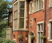
Moss Lodge
Best Western Broadfield Park
Lindores B&B
Rochdale
Videos from this area
These are videos related to the place based on their proximity to this place.
Waterfall next to Bacup road, between Todmorden and Bacup.
Just a quick vid of a waterfall up Bacup road. It's always fascinated me an I have often wondered what was the purpose of it? and why is it in a tunnel? and what was the structure on top of...
Ragley Bikes at Lee Quarry
Made by Maia Media - http://www.maiamedia.co.uk for Ragley Bikes - http://www.ragleybikes.com/
Lee Quarry Rossendale Bacup Mountain Bike - Red Route - 2nd to last section - Part 1
Watch the second to last section of the red route for Lee Quarry on a 2010 Giant Anthem X2. 4th April 2010.
Bacup Duck Pond
Bacup duck pond after some very heavy rain. Possibly the fullest I have ever seen it.
Downhill Mountain Biking In The Quarry GoPro HD 2015 | Quarry Bomming |
Downhill MTB In Lee Quarry Bacup. Filmed on the GoPro HD HERO 3 Black. Specialised Big Hit 2 FSR It was pretty windy so going fast wasn't an option:( Get Social!- Instagram-olivermarr Snapchat-o...
Weight Loss Surgery in France
http://gastricbandfrance.co.uk You too could lose weight just like the people highlighted in ou Video. Why not check out our website at http://gastricbandfrance.co.uk or call our Hotline at...
Landslide in britannia rossendale.
A landslide on the footpath that follows new line from britannia down in to bacup.
Britannia Coconut Dancers - Garland Dance
The coconutters of Bacup perform one of five garland dances on Irwell Terrace on Easter Saturday.
Lee Quarry Rawtenstall downhill to Car park
Ride down the hill from the gate to the car park, at Lee Quarry in Rawtenstall near Bacup, Lancashire. One of 3 videos we took on the day.
Lee Quarry Rossendale - Green Route section - Mountain Biking
An easy downhill section from near the entrance to Lee Quarry, down towads the main gate.
Videos provided by Youtube are under the copyright of their owners.
Attractions and noteworthy things
Distances are based on the centre of the city/town and sightseeing location. This list contains brief abstracts about monuments, holiday activities, national parcs, museums, organisations and more from the area as well as interesting facts about the region itself. Where available, you'll find the corresponding homepage. Otherwise the related wikipedia article.
Bacup
Bacup is a town within the Rossendale borough of Lancashire, England. It is located amongst the South Pennines, along Lancashire's eastern boundary with West Yorkshire. The town sits within a rural setting in the Forest of Rossendale, amongst the steep-sided upper-Irwell Valley, through which the River Irwell passes. It is 3.5 miles east of Rawtenstall, 6.4 miles north of Rochdale, and 21 miles east of Preston.
Sharneyford
Sharneyford is a hamlet in Lancashire, on the A681 road between Bacup and Todmorden. It is home to one of the smallest schools in Britain, Sharneyford Primary School. Sharneyford Mill, located north of the school, was once the highest in England, at around 1,250 feet above sea level; it has now been demolished.
Whitworth railway station
Whitworth railway station served the town of Whitworth in Rossendale, Lancashire, England, from 1870 until closure in 1947.
Facit railway station
Facit railway station served Facit near Whitworth in Rossendale, Lancashire, England, from 1870 until closure to passengers in 1947 and freight in 1963.
Shawforth railway station
Shawforth railway station served Shawforth near Bacup in Rossendale, Lancashire, England, from 1881 until closure in 1947.
Healey, Greater Manchester
Healey is a place in the Metropolitan Borough of Rochdale, Greater Manchester, England. It covers Shawclough, Syke and Nook Farm, as well as the rest of the land known as Healey on the right hand side of Whitworth Road after Gale Street up to Healey Corner.
Watergrove Reservoir
Watergrove Reservoir is a reservoir close to Wardle in the Metropolitan Borough of Rochdale, within Greater Manchester, England. Rochdale Corporation chose Watergrove as a suitable site to build a large reservoir largely to a prolonged drought in the 1930s, resulting in water regularly being bought from Oldham.
Christ Church, Bacup
Christ Church, Bacup, is located in Beech Street, off Todmorden Road, Bacup, Lancashire, England. It is an Anglican parish church in the deanery of Rossendale, the archdeaconry of Bolton and the diocese of Manchester. The church is designated by English Heritage as a Grade II listed building.


