Safety Score: 3,0 of 5.0 based on data from 9 authorites. Meaning we advice caution when travelling to United Kingdom.
Travel warnings are updated daily. Source: Travel Warning United Kingdom. Last Update: 2024-04-19 08:03:45
Discover Smithy Bridge
Smithy Bridge in Rochdale (England) is a town in United Kingdom about 169 mi (or 272 km) north-west of London, the country's capital city.
Current time in Smithy Bridge is now 08:35 PM (Friday). The local timezone is named Europe / London with an UTC offset of one hour. We know of 10 airports near Smithy Bridge, of which 5 are larger airports. The closest airport in United Kingdom is Manchester Airport in a distance of 20 mi (or 33 km), South. Besides the airports, there are other travel options available (check left side).
There are several Unesco world heritage sites nearby. The closest heritage site in United Kingdom is Liverpool – Maritime Mercantile City in a distance of 48 mi (or 77 km), East. Also, if you like playing golf, there are a few options in driving distance. Looking for a place to stay? we compiled a list of available hotels close to the map centre further down the page.
When in this area, you might want to pay a visit to some of the following locations: Rochdale, Oldham, Mossley, Ashton-under-Lyne and Bury. To further explore this place, just scroll down and browse the available info.
Local weather forecast
Todays Local Weather Conditions & Forecast: 10°C / 51 °F
| Morning Temperature | 7°C / 45 °F |
| Evening Temperature | 7°C / 45 °F |
| Night Temperature | 3°C / 38 °F |
| Chance of rainfall | 1% |
| Air Humidity | 71% |
| Air Pressure | 1018 hPa |
| Wind Speed | Fresh Breeze with 13 km/h (8 mph) from East |
| Cloud Conditions | Broken clouds, covering 63% of sky |
| General Conditions | Light rain |
Saturday, 20th of April 2024
10°C (50 °F)
5°C (40 °F)
Broken clouds, light breeze.
Sunday, 21st of April 2024
6°C (44 °F)
5°C (41 °F)
Overcast clouds, gentle breeze.
Monday, 22nd of April 2024
5°C (42 °F)
7°C (45 °F)
Light rain, light breeze, overcast clouds.
Hotels and Places to Stay
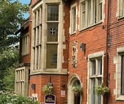
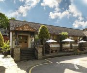
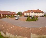
Moss Lodge
Mercure Manchester Norton Grange Hotel and Spa
Best Western Broadfield Park
The Royal Toby Hotel
Lindores B&B
Rochdale
Oldham Central
Videos from this area
These are videos related to the place based on their proximity to this place.
Rochdale MTB Ride It Feb 7th 2015
Another cracking off road sportive up in the dales of Rochdale. Had to do the medium route as the maximum route had been closed off due to snow and ice. Having trundled through some rock hard...
Eclipse 2015, Littleborough
Time lapse of the solar eclipse taken on the hills above Summit, Littleborough.
Littleborough Rushbearing Festival 2012 | Persephone
Persephone performing at the 2012 Littleborough Rushbearing Festival.
Canon HG 10 Test
Testing my Canon HG10. Hollingworth Lake near Littleborough. It's a lovely place to visit when the weather is good.
Richard Bathrooms, Rochdale - 21
small bathroom renovation project for Damian and Julie. http://www.richardbathrooms.co.uk.
Oliver! Crossgates Primary School Christmas Pantomime 1990
Crossgates Primary School, Milnrow, Rochdale. Christmas Pantomime - Oliver! 1990.
Videos provided by Youtube are under the copyright of their owners.
Attractions and noteworthy things
Distances are based on the centre of the city/town and sightseeing location. This list contains brief abstracts about monuments, holiday activities, national parcs, museums, organisations and more from the area as well as interesting facts about the region itself. Where available, you'll find the corresponding homepage. Otherwise the related wikipedia article.
Littleborough, Greater Manchester
Littleborough is a town within the Metropolitan Borough of Rochdale, in Greater Manchester, England. It is located in the upper Roch Valley by the foothills of the South Pennines, 3 miles northeast of Rochdale and 12.6 miles north-northeast of Manchester; Milnrow and the M62 motorway are to the south, and the rural uplands of Blackstone Edge are to the east. In 2001, Littleborough and its suburbs of Calderbrook, Shore, and Smithy Bridge, had a population of 13,807.
Hollingworth Lake
Hollingworth Lake is a 130-acre reservoir in the Hollingworth area of Littleborough — part of the Metropolitan Borough of Rochdale, in Greater Manchester, England. The lake was originally built as the main water source for the Rochdale Canal, but developed as a tourist resort from the 1860s, and became known as the Weighver's Seaport. Hotels were built around it, at least two of which had outdoor dancing stages with gas lighting.
Littleborough railway station
Littleborough railway station serves the small town of Littleborough in the Metropolitan Borough of Rochdale, Greater Manchester, England. It lies on the Caldervale Line 13¾ miles (22 km) north of Manchester Victoria towards Halifax, Bradford Interchange and Leeds. This is the last station on the Caldervale Line in the Greater Manchester area.
Smithy Bridge railway station
Smithy Bridge railway station serves the village of Smithy Bridge and Hollingworth Lake near Rochdale in Greater Manchester, England. The station is on the Caldervale Line 12+⁄4 miles north of Manchester Victoria on the way to Leeds.
Littleborough and Saddleworth (UK Parliament constituency)
Littleborough and Saddleworth was a parliamentary constituency in Greater Manchester, England. It returned one Member of Parliament to the House of Commons of the Parliament of the United Kingdom. The constituency was created for the 1983 general election, and abolished for the 1997 general election.
Smithy Bridge
Smithy Bridge is a suburb of Littleborough within the Metropolitan Borough of Rochdale, in Greater Manchester, England. Hollingworth Lake Country Park is close by. Smithy Bridge was formerly a part of Butterworth. {{#invoke: Navbox | navbox }} {{#invoke:Coordinates|coord}}{{#coordinates:53|38|N|2|07|W|region:GB_type:city_source:GNS-enwiki|| |primary |name= }}
Rochdale Way
The Rochdale Way is a circular 45 mile walking route around the borough of Rochdale in Greater Manchester, which takes in the best scenery and interesting buildings of the area.
St John the Baptist's Church, Smallbridge
St John the Baptist's Church, Smallbridge, is located in Halifax Road, Smallbridge, Rochdale, Greater Manchester, England. It is an active Anglican parish church in the benefice of Wardle and Smallbridge, the deanery of Rochdale, the archdeaconry of Rochdale, and the diocese of Manchester. The church has been designated by English Heritage as a Grade II listed building. It was a Commissioners' church, having received a grant towards its construction from the Church Building Commission.


