Safety Score: 3,0 of 5.0 based on data from 9 authorites. Meaning we advice caution when travelling to United Kingdom.
Travel warnings are updated daily. Source: Travel Warning United Kingdom. Last Update: 2024-04-25 08:17:04
Explore Mottram St. Andrew
Mottram St. Andrew in Cheshire East (England) is a city in United Kingdom about 151 mi (or 244 km) north-west of London, the country's capital.
Local time in Mottram St. Andrew is now 11:37 PM (Thursday). The local timezone is named Europe / London with an UTC offset of one hour. We know of 8 airports in the vicinity of Mottram St. Andrew, of which 5 are larger airports. The closest airport in United Kingdom is Manchester Woodford Airport in a distance of 3 mi (or 4 km), North-East. Besides the airports, there are other travel options available (check left side).
There are several Unesco world heritage sites nearby. The closest heritage site in United Kingdom is Pontcysyllte Aqueduct and Canal in a distance of 38 mi (or 61 km), South-West. Also, if you like golfing, there are multiple options in driving distance. We found 1 points of interest in the vicinity of this place. If you need a place to sleep, we compiled a list of available hotels close to the map centre further down the page.
Depending on your travel schedule, you might want to pay a visit to some of the following locations: Prestbury, Adlington, Bollington, Siddington and Pott Shrigley. To further explore this place, just scroll down and browse the available info.
Local weather forecast
Todays Local Weather Conditions & Forecast: 8°C / 46 °F
| Morning Temperature | 5°C / 40 °F |
| Evening Temperature | 7°C / 44 °F |
| Night Temperature | 4°C / 39 °F |
| Chance of rainfall | 3% |
| Air Humidity | 78% |
| Air Pressure | 1002 hPa |
| Wind Speed | Gentle Breeze with 7 km/h (4 mph) from East |
| Cloud Conditions | Broken clouds, covering 80% of sky |
| General Conditions | Light rain |
Friday, 26th of April 2024
8°C (46 °F)
4°C (39 °F)
Light rain, gentle breeze, broken clouds.
Saturday, 27th of April 2024
10°C (50 °F)
6°C (42 °F)
Overcast clouds, gentle breeze.
Sunday, 28th of April 2024
6°C (43 °F)
5°C (41 °F)
Moderate rain, moderate breeze, overcast clouds.
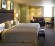
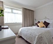
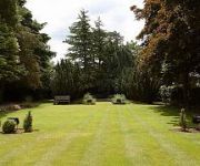
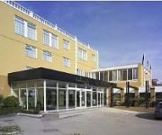
Hotels and Places to Stay
MOTTRAM HALL - QHOTELS
HALLMARK MANCHESTER
ALDERLEY EDGE HOTEL
PLUS MANCHESTER AIRPORT WILMSL
Hallmark Manchester Airport
Alderley Edge Hotel
The Bridge Hotel
Alma Lodge Hotel & Restaurant
VILLAGE MANCHESTER CHEADLE
The Wilmslow Lodge
Videos from this area
These are videos related to the place based on their proximity to this place.
A538 - Prestbury to Macclesfield (Part 1) - Front View
The A538 links the towns of Altrincham, Wilmslow and Macclesfield and the affluent village of Prestbury, and also has a junction with the M56. West of the M56, the road is an urban road running...
Prestbury, The Golden Elm - Rob Nuttall
http://www.oliver-wood.co.uk - My good old mate Rob Nuttall gives a mini guided tour of his work in St Peters Churchyard, Prestbury, with a bit of a topical message at the end. Very rough...
A538 - Wilmslow to Prestbury (Part 2) - Front View
The A538 links the towns of Altrincham, Wilmslow and Macclesfield and the affluent village of Prestbury, and also has a junction with the M56. West of the M56, the road is an urban road running...
B5087 Prestbury Road, Macclesfield - Westbound Front View
The B5087 runs from Macclesfield to Alderley Edge village, a distance of just over 5 miles (8.5km). The western half of the route runs along the top of "The Edge", a large red sandstone escarpment,...
Prestbury Night Trains
Prestbury night freight (3am) low rez experiments. Two Trafford Park to Southampton container trains pass through Prestbury railway (train) station in the early hours of Thursday 3rd April.
Natural Stone Floor Cleaning, Polishing or Restoration Prestbury (NuLifeFloorcare.co.uk)
http://nulifefloorcare.co.uk/services/marble-stone/ Here's Mike presenting natural stone floor cleaning, polishing and restoration in Prestbury from Nu-Life Floorcare. If you're looking for...
Prime Express Travel - Oldham
Oldham first bangladeshi travel, flight to bangladesh, biman airlines tickets, sylhet travel, flight to bangladesh, hajj flight, travel tickets, oldham bangladeshi travel agent,
Prestbury - St. Peter's Church 4
A short video clip taken in the graveyard of St. Peter's Church in Prestbury, Cheshire - http://www.achurchnearyou.com/venue.php?V=12808.
Color Repairing in The Village - 1-866-708-4777
Oriental Rugs-Color Correction The Village Rug Color Restoration The Village Carpet Color Solutions The Village Carpet Color Restoration The Village restores...
Videos provided by Youtube are under the copyright of their owners.
Attractions and noteworthy things
Distances are based on the centre of the city/town and sightseeing location. This list contains brief abstracts about monuments, holiday activities, national parcs, museums, organisations and more from the area as well as interesting facts about the region itself. Where available, you'll find the corresponding homepage. Otherwise the related wikipedia article.
Hare Hill
Hare Hill Hall is a country house and a garden in the parish of Over Alderley, Cheshire, England. The house and grounds is privately owned, and the separate nearby garden is in the care of the National Trust.
Geology of Alderley Edge
Alderley Edge in Cheshire is one of the classic locations for the study of Triassic sandstones in the United Kingdom. Numerous scientists from the early 19th century up to the present day have studied the area and it is a popular field site for universities around the UK. As time progresses, new theories are developed and new hypotheses are tested as to the origin of the sandstones.
Over Alderley
Over Alderley is a civil parish in the Borough of Cheshire East and the ceremonial county of Cheshire, England. It has a population of 335. It includes the hamlets of Adders Moss, Adshead Green, Broadheath, Finlow Hill, Harebarrow, Harehill, Shaw Cross, Vardentown and Whirley.
Dean Row Chapel, Wilmslow
Dean Row Chapel is a Unitarian place of worship near Manchester, England. It is located 2 miles east of the town of Wilmslow, Cheshire, near the junction of the A5102 and B5358 roads. The structure is designated by English Heritage as a Grade II* listed building. The congregation is a member of the General Assembly of Unitarian and Free Christian Churches, the umbrella organisation for British Unitarians.
Legh Hall
Legh Hall stands to the east of the village of Mottram St Andrew, Cheshire, England. It was built in the middle of the 18th century for William Brocklehurst of Macclesfield. The house was built to replace Legh Old Hall. Additions were made in the late 19th century, with alterations in the 20th century. The house is constructed in red brick with yellow headers. It is roofed with Welsh slate. Its architectural style is Georgian. The house is in 2½ storeys, and has a symmetrical five-bay front.
Legh Old Hall
Legh Old Hall, now known as Legh Hall Cottage, stands to the east of the village of Mottram St Andrew, Cheshire, England. It was built in the later part of the 16th century, with rebuilding in the 17th century. Alterations were made during the 20th century. It is constructed in coursed buff sandstone rubble, and has a Kerridge stone-slate roof. The house has an H-plan, and there is evidence that it was originally timber-framed. It is in two storeys, with a four bay front.
Normans Hall
Normans Hall is a Tudor house which stands to the southwest of the village of Prestbury, Cheshire, England. It is an L-shaped house, the south range dating from the 16th century. Additions were made in the 17th century, and repairs were carried out in the early 18th century. The east range was built in 1921 for H. B. Crook, and was designed by Henry Boddington. The south range is partly timber-framed, and partly brick, standing on a stone plinth.
Willot Hall
Willot Hall is a country house in the parish of Prestbury, some 4.5 km to the east of Wilmslow, Cheshire, England. It originated as a medieval hall house in the later part of the 15th century. This was encased in stone in the 17th century. Later in the century a service wing was added. The house was restored and extended between 1933 and 1939, moving the entrance and reopening the great hall to the roof.


