Safety Score: 3,0 of 5.0 based on data from 9 authorites. Meaning we advice caution when travelling to United Kingdom.
Travel warnings are updated daily. Source: Travel Warning United Kingdom. Last Update: 2024-04-25 08:17:04
Explore Walmersley
Walmersley in Borough of Bury (England) is a city in United Kingdom about 172 mi (or 277 km) north-west of London, the country's capital.
Local time in Walmersley is now 06:53 PM (Thursday). The local timezone is named Europe / London with an UTC offset of one hour. We know of 10 airports in the vicinity of Walmersley, of which 5 are larger airports. The closest airport in United Kingdom is Manchester Airport in a distance of 18 mi (or 30 km), South. Besides the airports, there are other travel options available (check left side).
There are several Unesco world heritage sites nearby. The closest heritage site in United Kingdom is Pontcysyllte Aqueduct and Canal in a distance of 52 mi (or 83 km), South-West. Also, if you like golfing, there are multiple options in driving distance. If you need a place to sleep, we compiled a list of available hotels close to the map centre further down the page.
Depending on your travel schedule, you might want to pay a visit to some of the following locations: Bury, Salford, Rochdale, Bolton and Manchester. To further explore this place, just scroll down and browse the available info.
Local weather forecast
Todays Local Weather Conditions & Forecast: 8°C / 46 °F
| Morning Temperature | 5°C / 42 °F |
| Evening Temperature | 7°C / 44 °F |
| Night Temperature | 3°C / 37 °F |
| Chance of rainfall | 2% |
| Air Humidity | 71% |
| Air Pressure | 1003 hPa |
| Wind Speed | Gentle Breeze with 7 km/h (4 mph) from South-East |
| Cloud Conditions | Overcast clouds, covering 100% of sky |
| General Conditions | Light rain |
Friday, 26th of April 2024
8°C (47 °F)
3°C (38 °F)
Light rain, gentle breeze, broken clouds.
Saturday, 27th of April 2024
10°C (50 °F)
5°C (41 °F)
Overcast clouds, gentle breeze.
Sunday, 28th of April 2024
5°C (41 °F)
5°C (42 °F)
Moderate rain, moderate breeze, overcast clouds.
Hotels and Places to Stay
Manchester Sanctuary
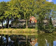
Red Hall
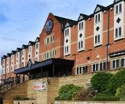
Village Hotel Manchester Bury
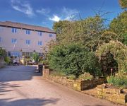
Best Western Bolholt Country Park
Best Western Old Mill and Leisure Club
Birch Hotel
TRAVELODGE BURY
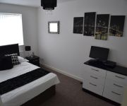
Charnley Mews Boutique Guest House
TRAVELODGE MANCHESTER BIRCH M62 EASTBOUN
TRAVELODGE MANCHESTER BIRCH M62 WESTBOUN
Videos from this area
These are videos related to the place based on their proximity to this place.
Youth Highlights: Bury u18s v Oldham Athletic
Watch extended highlights of Bury Youth Team's 5-1 win over Oldham Athletic in the North West Youth Alliance league on 11th April 2015.
Bury FC: Carrington Press Conference
Chairman Stewart Day and Manager David Flitcroft face the press at Carrington.
Bury FC: Behind the Scenes - Southend (Abandoned)
The latest behind the scenes video from Alexandros Cuschieri...
Bury FC: Behind the Scenes - Training at Carrington
Watch a special addition of 'Behind the Scenes' filmed by Alexandros Cuschieri at our Carrington Training Facilities.
Videos provided by Youtube are under the copyright of their owners.
Attractions and noteworthy things
Distances are based on the centre of the city/town and sightseeing location. This list contains brief abstracts about monuments, holiday activities, national parcs, museums, organisations and more from the area as well as interesting facts about the region itself. Where available, you'll find the corresponding homepage. Otherwise the related wikipedia article.
M66 motorway
The M66 is a motorway in Lancashire and Greater Manchester, England. It is 8 miles long and provides part of the route between the M62 and M60 motorways and the M65, with the rest being provided by the A56.
Bury North (UK Parliament constituency)
Bury North is a borough constituency in Greater Manchester, represented in the House of Commons of the Parliament of the United Kingdom. It elects one Member of Parliament (MP) by the first past the post system of election. It was first contested in 1983.
Summerseat railway station
Summerseat railway station is a preserved railway station that serves the village of Summerseat in Greater Manchester, England. It is part of the Heritage East Lancashire Railway (which runs for 12 miles from Heywood-Rawtenstall).
Burrs Country Park
Burrs Country Park covers a 36 hectare site located on the banks of the River Irwell, 1.5km (1 ml) north west of Bury, Greater Manchester. It was acquired by Bury Metroplolitan Borough Council in 1986 and transformed from a derelict industrial site into a modern country park. Access to the park which is open all year round is via Woodhill Road.
Castlesteads, Greater Manchester
Castlesteads is an Iron Age promontory fort, situated on the east bank of the River Irwell on a natural promontory in Bury, Greater Manchester. It is listed as a Scheduled Ancient Monument. Excavated pottery indicates the site was occupied between 200BC and 250AD.
Church of St Mary the Virgin, Bury
The Parish Church of St Mary the Virgin is located in the town centre of Bury, Greater Manchester, England. It has been designated by English Heritage as a Grade II listed building.
Ramsbottom Urban District
Ramsbottom Urban District was, from 1894 to 1974, a local government district of the administrative county of Lancashire, England. Its area was coterminate with Ramsbottom, spanning an area of the Rossendale Valley north of the County Borough of Bury.
St Paul's Church, Bury
St Paul's Church, Bury, is located in Church Street, Bury, Greater Manchester, England. A former Anglican parish church, it is now redundant and, following fire damage, has been converted into residential use. The former church is designated by English Heritage as a Grade II listed building.


