Safety Score: 3,0 of 5.0 based on data from 9 authorites. Meaning we advice caution when travelling to United Kingdom.
Travel warnings are updated daily. Source: Travel Warning United Kingdom. Last Update: 2024-04-27 08:23:39
Delve into Ticknall
Ticknall in Derbyshire (England) with it's 642 habitants is a city located in United Kingdom about 107 mi (or 172 km) north-west of London, the country's capital town.
Current time in Ticknall is now 07:00 PM (Saturday). The local timezone is named Europe / London with an UTC offset of one hour. We know of 10 airports closer to Ticknall, of which 5 are larger airports. The closest airport in United Kingdom is East Midlands Airport in a distance of 6 mi (or 10 km), East. Besides the airports, there are other travel options available (check left side).
There are several Unesco world heritage sites nearby. The closest heritage site in United Kingdom is Derwent Valley Mills in a distance of 43 mi (or 69 km), East. Also, if you like playing golf, there are some options within driving distance. In need of a room? We compiled a list of available hotels close to the map centre further down the page.
Since you are here already, you might want to pay a visit to some of the following locations: Derby, Netherseal, Shirley, Yeldersley and Rodsley. To further explore this place, just scroll down and browse the available info.
Local weather forecast
Todays Local Weather Conditions & Forecast: 9°C / 49 °F
| Morning Temperature | 3°C / 37 °F |
| Evening Temperature | 7°C / 45 °F |
| Night Temperature | 5°C / 41 °F |
| Chance of rainfall | 0% |
| Air Humidity | 68% |
| Air Pressure | 1004 hPa |
| Wind Speed | Moderate breeze with 11 km/h (7 mph) from South-West |
| Cloud Conditions | Broken clouds, covering 52% of sky |
| General Conditions | Light rain |
Sunday, 28th of April 2024
3°C (38 °F)
3°C (38 °F)
Moderate rain, moderate breeze, overcast clouds.
Monday, 29th of April 2024
13°C (55 °F)
10°C (49 °F)
Light rain, fresh breeze, broken clouds.
Tuesday, 30th of April 2024
14°C (58 °F)
10°C (50 °F)
Light rain, fresh breeze, overcast clouds.
Hotels and Places to Stay
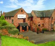
The Mill Wheel
Smithy Studio Bed and Breakfast
The Boot
Queens Head Hotel
Ashby De La Zouch
Videos from this area
These are videos related to the place based on their proximity to this place.
Willington Dovecote & Stables Car Show 2013
This video contains some (slightly overprocessed) photos of the Willington Dovecote and Stables evening car show which took place in August 2013. Unfortunately, the camera used for these shots...
Minecraft: BLACK CAT
On Friday the thirteenth a black cat decides to cross my path. More videos? check out my channel http://www.youtube.com/user/MultiAssassin120?feature=mhee.
Derby's Street Lighting PFI - Swarkestone Road, Chellaston
Commencing a little after the A50 roundabout, we travel in the direction of Derby Road. At the time of filming, the new street lighting columns were installe...
Kings Newton and Melbourne - Derbyshire by car
Andy's Driving videos around Derbyshire, UK : Are you an ex-pat of Derbyshire, feeling homesick? Or perhaps you just want a clear way of giving someone directions to a location in Derbyshire...
Boats using Swarkeston Lock in time-lapse video
This is a quick time-lapse film I shot in April 2007 at Swarkeston Lock on the Trent and Mersey Canal in Derbyshire. Watch as two narrow boats use the locks. The real time that elapses between...
Swarkestone Causway and bridge with GoPro
A slow drive over the Historic Swarkestone Causeway and bridge. Swarkestone Causeway is an ancient route that carries the A514 across the river Trent between the villages of Swarkestone and...
Swarkestone Lock - DJI Phantom GoPro Hero 3+ Silver
This video is from 3 flights around Swarkestone Lock and Lowes Lane, South Derbyshire. Shot on the GoPro Hero 3+ Silver, 1080p 60 fps.
swark.mp4
Part of my rideout today, From Breedon on the Hill, through Melbourne and onto Swarkestone Bridge.
Videos provided by Youtube are under the copyright of their owners.
Attractions and noteworthy things
Distances are based on the centre of the city/town and sightseeing location. This list contains brief abstracts about monuments, holiday activities, national parcs, museums, organisations and more from the area as well as interesting facts about the region itself. Where available, you'll find the corresponding homepage. Otherwise the related wikipedia article.
Foremarke Hall
Foremarke Hall is a Georgian-Palladian country house and manor house. Completed in 1762, the Hall is located at the manor of Foremark, near the hamlets of Ingleby, Ticknall, Milton, and the village of Repton in South Derbyshire, England. It is the current home of the Repton Preparatory School. Before becoming the Preparatory School, Foremarke Hall was the ancestral home of the Burdett family of Bramcote. It is a Grade 1 listed building.
Foremark Reservoir
Foremark Reservoir is a reservoir in South Derbyshire owned by Severn Trent which is also a 230-acre nature reserve open to the public for walking, fishing, bird watching and horse riding. It is supplied from water from the River Dove and it was constructed in the 1970s. The reservoir is accessible from the road between Milton and Ticknall. It is north of Ashby-de-la-Zouch and close to Ingleby, Swadlincote and Willington. It is part of the National Forest.
Staunton Harold Reservoir
Staunton Harold Reservoir is a large reservoir under the management of Severn Trent Water, located between Melbourne and Ticknall in Derbyshire, England. Most of the water is within Derbyshire but a small part of the southern shore is over the border in Leicestershire. The reservoir was built in 1964 at the behest of the River Dove Water Board, meant to serve Leicester and the towns of northern Leicestershire.
Calke Priory
Staunton Harold Hall
Staunton Harold Hall is a large grade I listed country house situated within the 2,000-acre Staunton Harold Park in Leicestershire. The hall is a Georgian style house largely rebuilt in 1763 for Washington Shirley, 5th Earl Ferrers It is a two storey brick building with stone dressing in the form of a square enclosing a quadrangle. The house is situated in the 2,000-acre Staunton Harold Park in which the 17th century Grade I listed Chapel of the Holy Trinity (Staunton Harold church) also stands.


