Safety Score: 3,0 of 5.0 based on data from 9 authorites. Meaning we advice caution when travelling to United Kingdom.
Travel warnings are updated daily. Source: Travel Warning United Kingdom. Last Update: 2024-04-25 08:17:04
Discover Littleover
Littleover in Derby (England) is a town in United Kingdom about 113 mi (or 182 km) north-west of London, the country's capital city.
Current time in Littleover is now 12:30 PM (Thursday). The local timezone is named Europe / London with an UTC offset of one hour. We know of 9 airports near Littleover, of which 5 are larger airports. The closest airport in United Kingdom is East Midlands Airport in a distance of 9 mi (or 15 km), South-East. Besides the airports, there are other travel options available (check left side).
There are several Unesco world heritage sites nearby. The closest heritage site in United Kingdom is Liverpool – Maritime Mercantile City in a distance of 40 mi (or 65 km), North-East. Also, if you like playing golf, there are a few options in driving distance. Looking for a place to stay? we compiled a list of available hotels close to the map centre further down the page.
When in this area, you might want to pay a visit to some of the following locations: Derby, Yeldersley, Shirley, Bradley and Rodsley. To further explore this place, just scroll down and browse the available info.
Local weather forecast
Todays Local Weather Conditions & Forecast: 9°C / 47 °F
| Morning Temperature | 3°C / 38 °F |
| Evening Temperature | 7°C / 45 °F |
| Night Temperature | 4°C / 40 °F |
| Chance of rainfall | 2% |
| Air Humidity | 73% |
| Air Pressure | 1003 hPa |
| Wind Speed | Moderate breeze with 10 km/h (6 mph) from East |
| Cloud Conditions | Broken clouds, covering 84% of sky |
| General Conditions | Light rain |
Friday, 26th of April 2024
9°C (49 °F)
3°C (38 °F)
Overcast clouds, gentle breeze.
Saturday, 27th of April 2024
7°C (44 °F)
6°C (43 °F)
Moderate rain, moderate breeze, overcast clouds.
Sunday, 28th of April 2024
11°C (52 °F)
9°C (48 °F)
Moderate rain, fresh breeze, overcast clouds.
Hotels and Places to Stay
Mercure Burton upon Trent Newton Park Hotel
Luxe Serviced Apartments
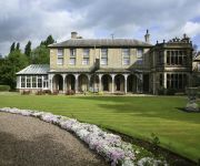
Breadsall Priory Marriott Hotel & Country Club
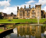
Hallmark Derby Mickleover Mickleover Court
Best Western The Stuart Hotel-Derby
pentahotel Derby
Holiday Inn Express DERBY - PRIDE PARK
The Unicorn Inn
The Boot
TRAVELODGE DERBY PRIDE PARK
Videos from this area
These are videos related to the place based on their proximity to this place.
DERBY BUSES JANUARY 2011
a trailer for www.pmpfilms.com the world's largest range of transport hobby films, see website for shop, list, links, blog etc.
Derby's Street Lighting PFI - Mackworth Estate (Night)
Commencing on Radbourne Lane, we travel along Ashbourne Road, Princes Charles Avenue, Brentford Drive, Beckenham Way, Enfield Road, Greenwich Drive North, Knightsbridge, Brackensdale ...
Derby streets by Car September 2006
Andy's Driving videos around Derby, Derbyshire, UK : Are you an ex-pat of Derby, feeling homesick? Or perhaps you just want a clear way of giving someone directions to a location in Derby...
Derby night driving, long exposure time lapse photography
Follow me on Twitter : https://twitter.com/AndySavage1969 If you liked this one then check out my more recent one at 1080p using this very same footage : http://youtu.be/I4jfMupWZyA This...
Derby's Street Lighting PFI - Chain Lane, Mickleover (Day)
Commencing at Uttoxeter Road, we pass along the Mickleover stretch of Chain Lane. At the time of filming, the outgoing lighting was surviving on borrowed time, as commissioning of the new lighting...
Stockbrook area. Derby streets by car in HD. September 2013
This is a realtime car journey. Points of interest : 00:00 we start at the traffic lights on Ford Street where it meets Friar Gate 00:08 Stafford Street (inner ring road) 00:17 On the left...
The River Trent Floods, November, 2012
Not as bad as the people elsewhere in the UK and the rest of the Country, just glad I do not live in the parts of Willington, Twyford, Barrow and Swarkstone, Derbyshire.
Derby's Street Lighting PFI - Mackworth Estate (Day)
Commencing on Radbourne Lane, we travel along Ashbourne Road, Princes Charles Avenue, Brentford Drive, Beckenham Way, Enfield Road, Greenwich Drive North, Knightsbridge, Brackensdale ...
Ian Tydeman - Staff Nurse at Royal Derby Hospital NHS Foundation Trust
My name is Ian and I have been a staff nurse for the last 10 years, all of which has been in the Trust I trained in. For the last 9 years I have worked in critical care, either on Intensive...
Derby streets by Car pt 13, Cavendish, Normanton by Derby
Andy's Driving videos around Derby, Derbyshire, UK : Are you an ex-pat of Derby, feeling homesick? Or perhaps you just want a clear way of giving someone directions to a location in Derby...
Videos provided by Youtube are under the copyright of their owners.
Attractions and noteworthy things
Distances are based on the centre of the city/town and sightseeing location. This list contains brief abstracts about monuments, holiday activities, national parcs, museums, organisations and more from the area as well as interesting facts about the region itself. Where available, you'll find the corresponding homepage. Otherwise the related wikipedia article.
University of Nottingham Medical School at Derby
The University of Nottingham Medical School at Derby was opened in September 2003 by Dr John Reid, then Secretary of State for Health. It is part of the University of Nottingham and is located in the nearby city of Derby in the East Midlands of England. It offers a four-year Graduate Entry Medical (GEM) course (initially for 90 students) as well as a 3 year Undergraduate Medical Science with Therapeutics degree (available as a 4 year foundation degree) as well.
Heatherton Village
Heatherton Village is a residential housing development located at the southern tip of Littleover, Derby, England. It comprises modern housing, several public amenity parks, shops, a school and a nursery. In 2005/6 the area welcomed more construction, with the arrival of blocks of flats, adjacent to Rykneld Road and rumours of "Heatherton 2", behind the church and medical centre have now been confirmed as true.
Royal Derby Hospital
Royal Derby Hospital, (formerly Derby City General Hospital) is one of two teaching hospitals in the city of Derby, the other being the London Road Community Hospital. It is the second largest hospital in the East Midlands, and is one of the largest hospitals in the UK. The two hospitals are part of a single NHS Foundation Trust. The hospital has completed a massive rebuild, doubling the size of the buildings.
Derby High School, Derby
Derby High School is an independent day school for girls aged 3 to 18 and boys up to age 11 in the suburb of Littleover in Derby, England. It is a member of the Girls' Schools Association and an affiliate member of the Woodard Corporation. The school's main premises are at Hillsway, Littleover, and include sports facilities on site. A new building opened in late 2008, containing a Sixth Form Centre.
Derbyshire Children's Hospital
Derbyshire Children's Hospital is a children's hospital in Derby in the United Kingdom. The hospital is located in a modern building on the Royal Derby Hospital (formerly Derby City General Hospital) site, opened in 1996. It was the only entirely new children's hospital built in the UK in the twentieth century. Prior to this, the hospital was located in a Victorian building on North Street in Derby, which has since been converted into flats.
Derby Academy (School of Dance)
Derby Academy is the oldest private dance school in Derby city centre, United Kingdom, and was founded in 1978 by its current principal, Eve Leveaux. Ms Leveaux has spent the last 30 years building the school which now has over 150 pupils working towards grades and standards primarily in the Cecchetti form of ballet. The school occupies 261m² across 2 levels and includes 2 purpose-built dance studios complete with audio and lighting facilities for performances to audiences of 100 seats.
Firs Estate School, Derby
Firs Estate School is a primary and infants school in Raven Street in the Stockbrook Street area of Derby, England, that has existed for many years in an original, probably Victorian building. The Firs Estate belonged originally to Canon Edward Abney along with a Regency house in which he lived on Burton Road. Abney's son, sir William Abney sold the estate; most of which went for housing in St Luke’s Parish Derby.
Derby Pride Academy
Derby Pride Academy is an Alternative Provision Free School that opened in September 2012. The school is a joint venture between Derby Moor Community Sports College and Derby County Football Club as part of the Derby Pride Trust.


