Safety Score: 3,0 of 5.0 based on data from 9 authorites. Meaning we advice caution when travelling to United Kingdom.
Travel warnings are updated daily. Source: Travel Warning United Kingdom. Last Update: 2024-04-27 08:23:39
Explore Hartshorne
Hartshorne in Derbyshire (England) is located in United Kingdom about 106 mi (or 171 km) north-west of London, the country's capital.
Local time in Hartshorne is now 06:44 AM (Sunday). The local timezone is named Europe / London with an UTC offset of one hour. We know of 10 airports in the wider vicinity of Hartshorne, of which 5 are larger airports. The closest airport in United Kingdom is East Midlands Airport in a distance of 9 mi (or 14 km), East. Besides the airports, there are other travel options available (check left side).
There are several Unesco world heritage sites nearby. The closest heritage site in United Kingdom is Derwent Valley Mills in a distance of 45 mi (or 73 km), East. Also, if you like golfing, there are multiple options in driving distance. If you need a place to sleep, we compiled a list of available hotels close to the map centre further down the page.
Depending on your travel schedule, you might want to pay a visit to some of the following locations: Netherseal, Derby, Shirley, Yeldersley and Rodsley. To further explore this place, just scroll down and browse the available info.
Local weather forecast
Todays Local Weather Conditions & Forecast: 3°C / 38 °F
| Morning Temperature | 5°C / 41 °F |
| Evening Temperature | 7°C / 45 °F |
| Night Temperature | 3°C / 38 °F |
| Chance of rainfall | 21% |
| Air Humidity | 97% |
| Air Pressure | 1003 hPa |
| Wind Speed | Moderate breeze with 13 km/h (8 mph) from South |
| Cloud Conditions | Overcast clouds, covering 100% of sky |
| General Conditions | Moderate rain |
Monday, 29th of April 2024
13°C (55 °F)
10°C (49 °F)
Light rain, fresh breeze, broken clouds.
Tuesday, 30th of April 2024
14°C (58 °F)
10°C (50 °F)
Light rain, fresh breeze, overcast clouds.
Wednesday, 1st of May 2024
16°C (60 °F)
11°C (51 °F)
Light rain, gentle breeze, overcast clouds.
Hotels and Places to Stay
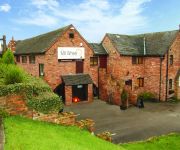
The Mill Wheel
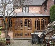
Smithy Studio Bed and Breakfast
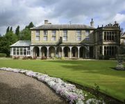
Mercure Burton upon Trent Newton Park Hotel
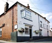
The Boot
The Unicorn Inn
Champneys Springs
Queens Head Hotel
Burton On Trent East
Ashby De La Zouch
Videos from this area
These are videos related to the place based on their proximity to this place.
Swainswood Leisure Park Testimonials
Real client feedback and reviews on their holidays at http://www.swainswoodleisurepark.co.uk Luxury lodges with spa and hot tubs on site in the heart of Derbyshire countryside. Lots to do...
Clean Room - Bosch Common Rail Injector Build
Building a Bosch common rail injector in our purpose built climate controlled room.
CRI-PC 4 Line - Delphi Common Rail Injector Testing
Swad Diesel testing 4 Delphi common rail Mondeo TDCi injectors.
A Drive from Castle Gresley to Church Gresley
On way to Kite Flying, but its going to rain, but who care's, its going to be a nice day anyway.
Videos provided by Youtube are under the copyright of their owners.
Attractions and noteworthy things
Distances are based on the centre of the city/town and sightseeing location. This list contains brief abstracts about monuments, holiday activities, national parcs, museums, organisations and more from the area as well as interesting facts about the region itself. Where available, you'll find the corresponding homepage. Otherwise the related wikipedia article.
Bretby Hall
Bretby Hall is a country house at Bretby, Derbyshire, England, north of Swadlincote and east of Burton upon Trent on the border with Staffordshire. It is a Grade II* listed building. The name Bretby means "dwelling place of Britons". The first Bretby Hall was built in 1630 after Thomas Stanhope bought the manor of Bretby from the family of Stephen de Segrave, to whom it had been granted by Ranulph de Blondeville, 4th Earl of Chester.
South Derbyshire
South Derbyshire is a local government district in Derbyshire, England. It contains a third of the National Forest, and the council offices are in Swadlincote. The district was formed on 1 April 1974 as a merger of the Swadlincote urban district along with Repton Rural District and part of South East Derbyshire Rural District.
A511 road
The A511 road is a 21-mile stretch of mainly single-carriageway road which runs northwest from Markfield in Leicestershire, England to Foston in South Derbyshire. It links the towns of Coalville, Ashby-de-la-Zouch and Burton upon Trent. It has a junction with the dual-carriageway A42 at Ashby, and with the non-trunk A514 road east of Swadlincote. The A511 passes under the dual-carriageway A38 at Burton, but has no direct junction with that major route.
South Derbyshire (UK Parliament constituency)
South Derbyshire is a a constituency represented in the House of Commons of the UK Parliament since 2010 by Heather Wheeler, a Conservative.
Foremark Reservoir
Foremark Reservoir is a reservoir in South Derbyshire owned by Severn Trent which is also a 230-acre nature reserve open to the public for walking, fishing, bird watching and horse riding. It is supplied from water from the River Dove and it was constructed in the 1970s. The reservoir is accessible from the road between Milton and Ticknall. It is north of Ashby-de-la-Zouch and close to Ingleby, Swadlincote and Willington. It is part of the National Forest.
Blackfordby
Blackfordby is a small village about 2 miles to the northwest of Ashby-de-la-Zouch in England. On some early maps, such as one dated 1587, the village is shown as "Blaugherby", hence the local name of "Blofferby". The village is dominated by the Church of St. Margaret of Antioch, erected in 1858 on the site of an earlier Anglican Chapel which was attached to the Church of St. Helen at nearby Ashby-de-la-Zouch.
Leicestershire and South Derbyshire Coalfield
The Leicestershire and South Derbyshire Coalfield in the English Midlands is one of the smaller British coalfields. The two areas are sometimes separately referred to as the South Derbyshire Coalfield and the Leicestershire Coalfield. All of the worked coal seams are contained within the Lower and Middle Coal Measures which are of Upper Carboniferous age.
Midway, Derbyshire
Midway is a suburb of Swadlincote, South Derbyshire and is north of the centre of the town. Nearby villages include Newhall, Church Gresley and Hartshorne, which is further east.


