Safety Score: 3,0 of 5.0 based on data from 9 authorites. Meaning we advice caution when travelling to United Kingdom.
Travel warnings are updated daily. Source: Travel Warning United Kingdom. Last Update: 2024-05-03 08:06:06
Delve into Moira
Moira in Leicestershire (England) with it's 2,458 habitants is a city located in United Kingdom about 104 mi (or 167 km) north-west of London, the country's capital town.
Current time in Moira is now 08:01 AM (Saturday). The local timezone is named Europe / London with an UTC offset of one hour. We know of 10 airports closer to Moira, of which 5 are larger airports. The closest airport in United Kingdom is East Midlands Airport in a distance of 11 mi (or 17 km), North-East. Besides the airports, there are other travel options available (check left side).
There are several Unesco world heritage sites nearby. The closest heritage site in United Kingdom is Derwent Valley Mills in a distance of 47 mi (or 76 km), North-East. Also, if you like playing golf, there are some options within driving distance. In need of a room? We compiled a list of available hotels close to the map centre further down the page.
Since you are here already, you might want to pay a visit to some of the following locations: Netherseal, Derby, Shirley, Rodsley and Yeldersley. To further explore this place, just scroll down and browse the available info.
Local weather forecast
Todays Local Weather Conditions & Forecast: 15°C / 58 °F
| Morning Temperature | 8°C / 47 °F |
| Evening Temperature | 13°C / 56 °F |
| Night Temperature | 8°C / 47 °F |
| Chance of rainfall | 0% |
| Air Humidity | 59% |
| Air Pressure | 1011 hPa |
| Wind Speed | Gentle Breeze with 8 km/h (5 mph) from North-East |
| Cloud Conditions | Scattered clouds, covering 29% of sky |
| General Conditions | Light rain |
Sunday, 5th of May 2024
15°C (60 °F)
9°C (48 °F)
Light rain, gentle breeze, overcast clouds.
Monday, 6th of May 2024
14°C (58 °F)
8°C (46 °F)
Light rain, gentle breeze, overcast clouds.
Tuesday, 7th of May 2024
16°C (60 °F)
11°C (51 °F)
Light rain, light breeze, few clouds.
Hotels and Places to Stay
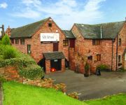
The Mill Wheel
Smithy Studio Bed and Breakfast
Champneys Springs
Best Western Appleby Park
Queens Head Hotel
Burton On Trent East
Videos from this area
These are videos related to the place based on their proximity to this place.
Ashby Woulds - NEW Luxury Lodges Holiday Homes
Luxury lodge holiday homes for sale or holiday hire. http://www.ashbywouldslodges.co.uk Set in Heart of Midlands and National Forest with countryside views, canal walk, fishing, beauty therapist,...
Swainswood LUXURY Lodges and SPA
Exclusive luxury leisure homes in the heart of the National Forest near beautiful village of Overseal, Derbyshire http://www.swainswoodleisurepark.co.uk Close to the UK's top 85 attractions...
Swainswood Leisure Park Testimonials
Real client feedback and reviews on their holidays at http://www.swainswoodleisurepark.co.uk Luxury lodges with spa and hot tubs on site in the heart of Derbyshire countryside. Lots to do...
Clean Room - Bosch Common Rail Injector Build
Building a Bosch common rail injector in our purpose built climate controlled room.
Videos provided by Youtube are under the copyright of their owners.
Attractions and noteworthy things
Distances are based on the centre of the city/town and sightseeing location. This list contains brief abstracts about monuments, holiday activities, national parcs, museums, organisations and more from the area as well as interesting facts about the region itself. Where available, you'll find the corresponding homepage. Otherwise the related wikipedia article.
Donisthorpe
Donisthorpe is a village in the East Midlands of England, administered as part of the Leicestershire district of North West Leicestershire. The historic county boundary between Leicestershire and Derbyshire is the River Mease, which runs through the village, with the village centre being on the southern (Derbyshire side), forming part of an exclave of Derbyshire. In 1086, Donisthorpe was part of the land given to Nigel of Stafford by William the Conqueror.
Ashby Woulds
Ashby Woulds is a civil parish in Leicestershire, England. It is in the North West Leicestershire district, to the west of Ashby de la Zouch. The main settlements in the parish are Norris Hill and Moira. Until 1974 the parish was an urban district of Leicestershire. {{#invoke:Coordinates|coord}}{{#coordinates:52.74897|N|1.534996|W||||| |primary |name= }}
Oakthorpe, Donisthorpe and Acresford
Oakthorpe, Donisthorpe and Acresford is a civil parish in the North West Leicestershire district of Leicestershire, England. According to the 2001 census it had a population of 2336. It includes Oakthorpe and Donisthorpe.
Moira Furnace
furnace stack at the front and the bridgehouse building at the rear, originally there would have been a casting shed in front of the furnace where the iron 'pigs' were produced]] Moira Furnace is a nineteenth-century iron-making blast furnace located in Moira, Leicestershire on the banks of the Ashby-de-la-Zouch Canal. Built by the Earl of Moira in 1804 the building has been preserved by North West Leicestershire District Council as a museum featuring lime kilns and craft workshops.
Blackfordby
Blackfordby is a small village about 2 miles to the northwest of Ashby-de-la-Zouch in England. On some early maps, such as one dated 1587, the village is shown as "Blaugherby", hence the local name of "Blofferby". The village is dominated by the Church of St. Margaret of Antioch, erected in 1858 on the site of an earlier Anglican Chapel which was attached to the Church of St. Helen at nearby Ashby-de-la-Zouch.
Donisthorpe Woodland Park
Donisthorpe Woodland Park is located on Church Street, Donisthorpe in North West Leicestershire. {{#invoke:Coordinates|coord}}{{#coordinates:52|43|31.03|N|1|31|47.76|W|region:GB |primary |name= }} Donisthorpe Woodland Park is a 36-hectare former colliery site in The National Forest. There are 20 hectares of mixed woodland and 3 km of stone-surfaced paths, which are suitable for all users.
Ashby Woulds Heritage Trail
The Ashby Woulds Heritage Trail is 6 km long and was formerly a railway line in The National Forest. There are links to Donisthorpe woodland park, Moira Furnace and Conkers (the main visitor centre for The National Forest). {{#invoke:Coordinates|coord}}{{#coordinates:52|44|0.06|N|1|32|41.13|W|region:GB |primary |name= }}
Leicestershire and South Derbyshire Coalfield
The Leicestershire and South Derbyshire Coalfield in the English Midlands is one of the smaller British coalfields. The two areas are sometimes separately referred to as the South Derbyshire Coalfield and the Leicestershire Coalfield. All of the worked coal seams are contained within the Lower and Middle Coal Measures which are of Upper Carboniferous age.


