Safety Score: 3,0 of 5.0 based on data from 9 authorites. Meaning we advice caution when travelling to United Kingdom.
Travel warnings are updated daily. Source: Travel Warning United Kingdom. Last Update: 2024-04-26 08:02:42
Delve into Mossblown
Mossblown in South Ayrshire (Scotland) with it's 2,090 habitants is located in United Kingdom about 329 mi (or 530 km) north-west of London, the country's capital town.
Current time in Mossblown is now 07:28 PM (Friday). The local timezone is named Europe / London with an UTC offset of one hour. We know of 10 airports close to Mossblown, of which 5 are larger airports. The closest airport in United Kingdom is Glasgow Prestwick Airport in a distance of 3 mi (or 4 km), North-West. Besides the airports, there are other travel options available (check left side).
Also, if you like playing golf, there are some options within driving distance. We encountered 2 points of interest near this location. If you need a hotel, we compiled a list of available hotels close to the map centre further down the page.
While being here, you might want to pay a visit to some of the following locations: Ayr, Kilmarnock, Irvine, Paisley and Giffnock. To further explore this place, just scroll down and browse the available info.
Local weather forecast
Todays Local Weather Conditions & Forecast: 9°C / 48 °F
| Morning Temperature | 2°C / 36 °F |
| Evening Temperature | 8°C / 47 °F |
| Night Temperature | 4°C / 40 °F |
| Chance of rainfall | 0% |
| Air Humidity | 55% |
| Air Pressure | 1006 hPa |
| Wind Speed | Gentle Breeze with 7 km/h (4 mph) from South-East |
| Cloud Conditions | Broken clouds, covering 50% of sky |
| General Conditions | Light rain |
Saturday, 27th of April 2024
11°C (52 °F)
5°C (41 °F)
Light rain, light breeze, few clouds.
Sunday, 28th of April 2024
10°C (49 °F)
6°C (42 °F)
Scattered clouds, gentle breeze.
Monday, 29th of April 2024
10°C (50 °F)
9°C (47 °F)
Light rain, moderate breeze, overcast clouds.
Hotels and Places to Stay
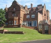
Enterkine House Hotel
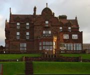
Adamton Country House Hotel
Adamton House
AYR
Ayr A77/Racecourse
Videos from this area
These are videos related to the place based on their proximity to this place.
Case 1494 Tractor and front loader
Taken from an old camcorder- taken in 2003 I think - A Case 1494 tractor owned by J McNae of Tarbolton- an "obstacle course" for spectators to try out their driving skills- until it ran out...
Mossblown, Hard Times 1943
Hard times, hardy people. More info on Ayrshire Mines here: http://www.scottishmining.co.uk/229.html.
Ice Skating on a frozen Martnaham Loch, near Ayr, Scotland
January 2010. Skating on a snow covered, frozen Martnaham Loch, near Ayr, Scotland for the first time in 50 years. The only other tracks in the snow/ice were made by wildlife and sheep.
ANTONOV 225 TAXI AND TAKEOFF PRESTWICK AIRPORT
Antonov 225 leaving Prestwick, the vertical surfaces can be seen blowing about in the strong wind when it's running the engines up.
Videos provided by Youtube are under the copyright of their owners.
Attractions and noteworthy things
Distances are based on the centre of the city/town and sightseeing location. This list contains brief abstracts about monuments, holiday activities, national parcs, museums, organisations and more from the area as well as interesting facts about the region itself. Where available, you'll find the corresponding homepage. Otherwise the related wikipedia article.
Ayrshire
Ayrshire is a registration county, and former administrative county in south-west Scotland, United Kingdom, located on the shores of the Firth of Clyde. Its principal towns include Ayr, Kilmarnock and Irvine. The population of Ayrshire is approximately 366800. The town of Troon on the coast has hosted the The Open Championship twice in the last seven years and eight times in total. Approximately 200,000 visitors came to Troon during the 2004 Open.
1948 KLM Constellation air disaster
A KLM Lockheed L-049 Constellation airliner (named Nijmegen and registered PH-TEN) crashed into high ground near Glasgow Prestwick Airport, Scotland, on 20 October 1948; all 40 aboard died. A subsequent inquiry found that the accident was likely caused by the crew's reliance on a combination of erroneous charts and incomplete weather forecasts, causing the crew to become distracted and disoriented in the inclement conditions.
Fail Monastery
Fail Monstery, occasionally known as Failford Abbey, had a dedication to 'Saint Mary', and was located at Fail (NS 42129 28654) on the bank of the Water of Fail, Parish of Tarbolton near the town of Tarbolton, South Ayrshire. Most of the remaining monastery ruins were removed in 1952.
New Pebble Park
New Pebble Park is a football stadium in Annbank in Scotland. It is the home ground of Annbank United Football Club. There are 3 covered stances on the far site as you enter. On the near site is the club house,food stand and changing rooms. The stadium has small floodlights which are not used often. The pitch is surrounded by a whitewashed wall.
Ness Waterfall
Ness Waterfall is a waterfall of Scotland.
Fail Loch
Fail Loch was situated in a low lying area near the old monastery of Fail in the Parish of Tarbolton, South Ayrshire, Scotland. The old Lochlea Loch lies nearby and its waters still feed into Fail Loch via the Mill Burn.
Lochend Loch, Coylton
Lochend Loch, once nearly 3 acres in surface area, is now only a small freshwater loch remnant in the South Ayrshire Council Areas, lying on the hill above Joppa, between Gallowhill and Lochend Farm, 0.5 km from Coylton, in the parish of Coylton and 3 miles from Ayr. The loch once had a small island within it.
Sundrum Castle
Sundrum Castle is located 1.5 kilometres north of Coylton, South Ayrshire, Scotland, by the Water of Coyle. The original castle was built in the 14th century by Sir Robert Wallace, Sheriff of Ayr. This was incorporated into the present mansion, built by the Hamiltons of Sundrum in 1792. The castle is now a category B listed building.


