Safety Score: 3,0 of 5.0 based on data from 9 authorites. Meaning we advice caution when travelling to United Kingdom.
Travel warnings are updated daily. Source: Travel Warning United Kingdom. Last Update: 2024-05-04 08:22:41
Discover Wargrave
Wargrave in Wokingham (England) with it's 4,209 citizens is a city in United Kingdom about 32 mi (or 51 km) west of London, the country's capital city.
Local time in Wargrave is now 03:44 AM (Sunday). The local timezone is named Europe / London with an UTC offset of one hour. We know of 11 airports in the vicinity of Wargrave, of which 5 are larger airports. The closest airport in United Kingdom is Blackbushe Airport in a distance of 12 mi (or 20 km), South. Besides the airports, there are other travel options available (check left side).
There are several Unesco world heritage sites nearby. The closest heritage site in United Kingdom is Blenheim Palace in a distance of 26 mi (or 41 km), North. Also, if you like golfing, there are a few options in driving distance. We discovered 1 points of interest in the vicinity of this place. Looking for a place to stay? we compiled a list of available hotels close to the map centre further down the page.
When in this area, you might want to pay a visit to some of the following locations: Twyford, Sonning, Woodley, Remenham and Hurley. To further explore this place, just scroll down and browse the available info.
Local weather forecast
Todays Local Weather Conditions & Forecast: 12°C / 54 °F
| Morning Temperature | 8°C / 46 °F |
| Evening Temperature | 13°C / 56 °F |
| Night Temperature | 9°C / 48 °F |
| Chance of rainfall | 0% |
| Air Humidity | 85% |
| Air Pressure | 1009 hPa |
| Wind Speed | Gentle Breeze with 7 km/h (4 mph) from North-West |
| Cloud Conditions | Overcast clouds, covering 91% of sky |
| General Conditions | Light rain |
Monday, 6th of May 2024
12°C (54 °F)
11°C (51 °F)
Light rain, light breeze, overcast clouds.
Tuesday, 7th of May 2024
16°C (61 °F)
12°C (53 °F)
Light rain, gentle breeze, broken clouds.
Wednesday, 8th of May 2024
16°C (60 °F)
12°C (54 °F)
Light rain, gentle breeze, scattered clouds.
Hotels and Places to Stay
Olde Bell Inn
Hurley House Hotel
JCT.10 Holiday Inn READING - M4
Best Western Plus Reading Moat House
The Great House at Sonning
Phyllis Court Club
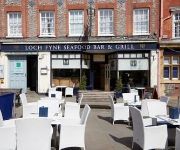
Loch Fyne Restaurant and Hotel Henley-on-Thames
HOTEL DU VIN HENLEY ON THAMES
Coppid Beech
Cantley House
Videos from this area
These are videos related to the place based on their proximity to this place.
Wargrave Park - by Millgate Homes
We know from experience that creating character homes and defining excellence is a very precise and deliberate undertaking, but as a niche developer building only 50 new properties a year,...
59,201 Village of Chantry passes through Twyford Station on the 26-03-09
59201 Village of Chantry passes through Twyford Station on the 26-03-09 with the 6A13 13:30 Whatley-West Drayton Stone train.
Wargrave Boat Club Mini Kayak Course 2009
The finale of the debut mini kayak course on the Thames in Berkshire UK in June 2009. Imagine about 30 8-10 year olds being packed into three Canadian canoes by instructors determined to make...
PHS Pillock
PHS Totalcare van driver overtakes on a double white line on a narrow traffic light controlled bridge on the A321 Wargrave Road on 11th March 2015. FD13 EHE FD13EHE.
Steam engine 60019 Bittern [4464] @ Twyford 5/7/12. Cathedrals Express Oxford-Lewes.
Steam engine 60019 Bittern [4464] stops/starts at Twyford station on 5/7/12. Bittern refills with water using a fire engine. Cathedrals Express trip en route from Oxford to Lewes. Organized...
Steam Train: 35028 Clan Line, Cathedrals Express to Cardiff, 20 Aug 12, at Twyford
This video shows preserved ex-Southern Region locomotive no 35028 "Clan Line" pulling the Cathedrals Express by Steam Dreams from London to Cardiff on the morning of 20th August 2012.
Deltic 55022 at Ruscombe
Class 55 Deltic 55022/D9000 "Royal Scots Grey" passing Ruscombe between Maidenhead and Twyford on the Great Western Main Line at speed. This was a GBRf staff excursion from Peterborough to.
Earl of Mount Edgcumbe on The Bristolian
Seond day running...! GWR Castle Class 4-6-0 5043 "Earl of Mount Edgcumbe" opens up as it passes Ruscombe between Maidenhead and Twyford on its way to Bristol on "The Bristolian" charter.
47,739 & 47,727 pass through Twyford Station on 26-03-09
47739 Robin of Templecombe and 47727 Rebecca pass through Twyford on the 26-03-09 with the 6Z48 13:05 Burton on Trent-Dollands Moor steel train.
Videos provided by Youtube are under the copyright of their owners.
Attractions and noteworthy things
Distances are based on the centre of the city/town and sightseeing location. This list contains brief abstracts about monuments, holiday activities, national parcs, museums, organisations and more from the area as well as interesting facts about the region itself. Where available, you'll find the corresponding homepage. Otherwise the related wikipedia article.
Shiplake Lock
Shiplake Lock is a lock and weir situated on the River Thames in England near the village of Shiplake, Oxfordshire. It is just above the points where the River Loddon joins the Thames and Shiplake Railway Bridge crosses the river. The first pound lock was built by the Thames Navigation Commission in 1773. The weir is some distance upstream of the lock between the lock island and Berkshire bank.
Shiplake Railway Bridge
Shiplake Railway Bridge carries the Henley Branch Line to Henley-on-Thames, England across the River Thames, connecting Shiplake in Oxfordshire with Wargrave in Berkshire. It crosses the river just downstream of Shiplake Lock on the reach above Marsh Lock.
Crazies Hill
Crazies Hill is a hamlet in the English county of Berkshire. It adjoins the hamlet of Cockpole Green. For local government purposes, the village is within the civil parish of Wargrave, which in turn is within the unitary authority of Wokingham. The Village Hall was originally built to serve also as a Mission Church and still contains the paraphernalia of an altar etc. behind folding doors. Crazies Hill Church of England Primary School is located in the village.
Handbuck Eyot
Handbuck Eyot or Handbuck Ait is an island in the River Thames in England near the villages of Shiplake, Oxfordshire and Wargrave, Berkshire. It is on the reach above Marsh Lock. The island is wooded and inaccessible except by boat, but has been included in the property of the large houses on the Shiplake bank.
St Patrick's Stream
St Patrick's Stream or Patrick Stream is a backwater of the River Thames in England, which flows into the River Loddon near Wargrave, Berkshire. It leaves the Thames on the reach above Shiplake Lock near Buck Ait, downstream of Sonning. It is believed that the stream was originally a branch of the River Loddon that flowed into the Thames. However when Shiplake Lock was built, the water level was raised to such an extent that it became an outfall.
Poplar Eyot
Poplar Eyot or Poplar Ait is an island in the River Thames in England near the villages of Shiplake, Oxfordshire and Wargrave, Berkshire. It is on the reach above Marsh Lock. The island is wooded and inaccessible except by boat. It is in the middle of a chain lying off the large houses on the Shiplake bank.
The Piggott School
'The Piggott School' is a Church of England academy secondary school in Wargrave in Berkshire, England. The school has approximately 1,516 pupils and around 185 teaching staff. The school specialises in Modern Languages and Humanities. It has been awarded International school status by the British Council. The most recent inspection from ofsted achieved a rating of 'Outstanding' in 28 categories and 3 ratings of 'Good'.
Unnamed Eyot
The Unnamed Eyot is an island in the River Thames in Berkshire, England, near the villages of Shiplake, Oxfordshire and Wargrave, Berkshire. It is on the reach above Marsh Lock. The island is wooded and about 200m long by 50m at its widest point. It is closer to the Wargrave bank, and accessible by a footbridge from the property on that side. The Ordnance Survey shows no name for the island.


!['Steam engine 60019 Bittern [4464] @ Twyford 5/7/12. Cathedrals Express Oxford-Lewes.' preview picture of video 'Steam engine 60019 Bittern [4464] @ Twyford 5/7/12. Cathedrals Express Oxford-Lewes.'](https://img.youtube.com/vi/R2ZghWwR4ec/mqdefault.jpg)


