Safety Score: 3,0 of 5.0 based on data from 9 authorites. Meaning we advice caution when travelling to United Kingdom.
Travel warnings are updated daily. Source: Travel Warning United Kingdom. Last Update: 2024-04-23 08:18:23
Discover Medmenham
Medmenham in Buckinghamshire (England) is a place in United Kingdom about 31 mi (or 50 km) west of London, the country's capital city.
Current time in Medmenham is now 07:04 AM (Wednesday). The local timezone is named Europe / London with an UTC offset of one hour. We know of 12 airports near Medmenham, of which 5 are larger airports. The closest airport in United Kingdom is RAF Benson in a distance of 12 mi (or 19 km), West. Besides the airports, there are other travel options available (check left side).
There are several Unesco world heritage sites nearby. The closest heritage site in United Kingdom is Blenheim Palace in a distance of 22 mi (or 35 km), North-East. Also, if you like playing golf, there are a few options in driving distance. We encountered 2 points of interest in the vicinity of this place. If you need a hotel, we compiled a list of available hotels close to the map centre further down the page.
While being here, you might want to pay a visit to some of the following locations: Hurley, Remenham, Wargrave, Bisham and Twyford. To further explore this place, just scroll down and browse the available info.
Local weather forecast
Todays Local Weather Conditions & Forecast: 10°C / 50 °F
| Morning Temperature | 5°C / 40 °F |
| Evening Temperature | 8°C / 46 °F |
| Night Temperature | 4°C / 39 °F |
| Chance of rainfall | 0% |
| Air Humidity | 54% |
| Air Pressure | 1017 hPa |
| Wind Speed | Gentle Breeze with 8 km/h (5 mph) from South |
| Cloud Conditions | Overcast clouds, covering 89% of sky |
| General Conditions | Overcast clouds |
Thursday, 25th of April 2024
11°C (51 °F)
8°C (46 °F)
Light rain, gentle breeze, overcast clouds.
Friday, 26th of April 2024
10°C (49 °F)
8°C (46 °F)
Light rain, gentle breeze, overcast clouds.
Saturday, 27th of April 2024
14°C (57 °F)
9°C (48 °F)
Light rain, fresh breeze, overcast clouds.
Hotels and Places to Stay
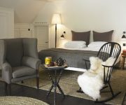
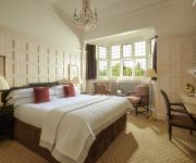
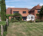
Macdonald Compleat Angler
Hurley House Hotel
Olde Bell Inn
Danesfield House Hotel & Spa
Bull Inn
The Great House at Sonning
Malvern House
Pinkneys Court Mews
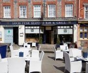
Loch Fyne Restaurant and Hotel Henley-on-Thames
HOTEL DU VIN HENLEY ON THAMES
Videos from this area
These are videos related to the place based on their proximity to this place.
PHS Pillock
PHS Totalcare van driver overtakes on a double white line on a narrow traffic light controlled bridge on the A321 Wargrave Road on 11th March 2015. FD13 EHE FD13EHE.
A walk along the River Thames at Hurley
A stroll along the banks of the River Thames in Hurley Berkshire & some pictures from Hurley village. If you enjoyed this video, please give it a thumbs up and perhaps subscribe to my channel...
Foam Roller - SMR
Ross takes you through SMR technique using a foam roller. A great way to relax and recover after exercise. For more information please visit http://www.apsfitness.co.uk/
DofE Silver Rescue Training - 10 July 2013
With our DofE Silver Award just around the corner, we participated in a much-needed 'refresher' of our canoe rescue skills -- just in case of disaster on the Norfolk Broads.
Bike riding in Hurley campsite
Phil Riding his motor bike. thinking he is Boon (just a rhinestone cowboy)
FPV wing testing
I put an old Parkzone T-28 motor on a slope soaring wing to try to create another fpv plane. I threw it in the garden to start with a 3s 1300mah lipo and realized it was really tail heavy,...
Handlebar Mount Test
Veho Muvi HD10 960p - In waterproof housing Handlebar mount - Minoura Le Korde Camera Mount 1 - Raw footage 2 - Stabilised using Mercalli 3 - Raw footage 4 - Stabilised using Mercalli.
Videos provided by Youtube are under the copyright of their owners.
Attractions and noteworthy things
Distances are based on the centre of the city/town and sightseeing location. This list contains brief abstracts about monuments, holiday activities, national parcs, museums, organisations and more from the area as well as interesting facts about the region itself. Where available, you'll find the corresponding homepage. Otherwise the related wikipedia article.
Danesfield House
Danesfield House in Medmenham, near Marlow, Buckinghamshire, England, in the Chiltern Hills is a former country house now used as a hotel and spa. The house stands on a plateau which shelves steeply down to the River Thames to the south.
RAF Medmenham
RAF Medmenham was a Royal Air Force station based at Danesfield House near Medmenham, in Buckinghamshire, England. Activities there specialized in photographic intelligence, and it was once the home of the RAF Intelligence Branch. RAF Medmenham, a sister organisation to Bletchley Park, was the interpretation centre for one of the largest photographic reconnaissance operations ever undertaken.
Hambleden Mill
Hambleden Mill is an historic watermill on the River Thames at Mill End, near the village of Hambleden in Buckinghamshire, England. It is next to Hambleden Lock and has now been converted into flats. It was Grade II listed in 1955. The Mill was mentioned in the Domesday Book when it had a rent of £1/year. Before 1235 the mill was granted to Keynsham Abbey. Alison Uttley described it as "The most beautiful place in the whole length of the long Thames valley."
Magpie Island
Magpie Island is an island in the River Thames in England near the villages of Aston, Berkshire and Medmenham, Buckinghamshire. It is situated on the reach above Hurley Lock. Navigation is believed to have passed originally down the present backwater which was then cluttered with eel bucks. In the eighteenth century the island was part of the Culham Court estate.
Frog Mill Ait
Frog Mill Ait is an island in the River Thames in England between the villages of Medmenham, Buckinghamshire and Hurley, Berkshire. It is situated on the reach above Hurley Lock. The island is named after a mill on the bank here. Frog Mill Ait and the adjacent Black Boy Island presented a problem to navigation because the towpath was on the other side of the island from the main navigation channel.
Black Boy Island
Black Boy Island is an island in the River Thames in England between the villages of Medmenham, Buckinghamshire and Hurley, Berkshire. It is situated on the reach above Hurley Lock. The island is said to be named after Charles II who was so dark as a child that his mother called him "Black Boy". Black Boy Island and the adjacent Frog Mill Ait presented a problem to navigation because the towpath was on the other side of the island from the main navigation channel.
Hurley Priory
Hurley Priory is a former Benedictine priory in the village of Hurley on the banks of the River Thames in the English county of Berkshire.
RAF Henley-on-Thames
RAF Henley-on-Thames is a former World War II grass-strip airfield in Berkshire, England, located near Henley-on-Thames. It was also known by a variety of other names: Cockpole Green, Upper Culham Farm, Crazies Hill, or Crazies Hill Farm.


