Safety Score: 3,0 of 5.0 based on data from 9 authorites. Meaning we advice caution when travelling to United Kingdom.
Travel warnings are updated daily. Source: Travel Warning United Kingdom. Last Update: 2024-05-09 08:23:21
Delve into Belton
Belton in Norfolk (England) is located in United Kingdom about 105 mi (or 170 km) north-east of London, the country's capital town.
Current time in Belton is now 04:49 AM (Friday). The local timezone is named Europe / London with an UTC offset of one hour. We know of 11 airports close to Belton, of which 5 are larger airports. The closest airport in United Kingdom is Norwich International Airport in a distance of 17 mi (or 28 km), North-West. Besides the airports, there are other travel options available (check left side).
There are several Unesco world heritage sites nearby. The closest heritage site in United Kingdom is Canterbury Cathedral, St Augustine's Abbey, and St Martin's Church in a distance of 92 mi (or 149 km), South. Also, if you like playing golf, there are some options within driving distance. If you need a hotel, we compiled a list of available hotels close to the map centre further down the page.
While being here, you might want to pay a visit to some of the following locations: Wrentham, Brundall, Surlingham, Hellington and Rockland Saint Mary. To further explore this place, just scroll down and browse the available info.
Local weather forecast
Todays Local Weather Conditions & Forecast: 15°C / 59 °F
| Morning Temperature | 11°C / 52 °F |
| Evening Temperature | 14°C / 57 °F |
| Night Temperature | 11°C / 52 °F |
| Chance of rainfall | 0% |
| Air Humidity | 75% |
| Air Pressure | 1025 hPa |
| Wind Speed | Gentle Breeze with 6 km/h (3 mph) from West |
| Cloud Conditions | Overcast clouds, covering 100% of sky |
| General Conditions | Overcast clouds |
Saturday, 11th of May 2024
14°C (58 °F)
11°C (52 °F)
Overcast clouds, gentle breeze.
Sunday, 12th of May 2024
16°C (60 °F)
13°C (56 °F)
Overcast clouds, gentle breeze.
Monday, 13th of May 2024
13°C (55 °F)
11°C (53 °F)
Light rain, fresh breeze, overcast clouds.
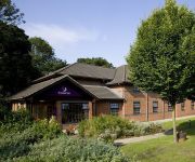
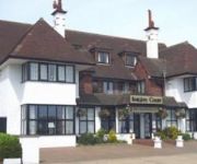
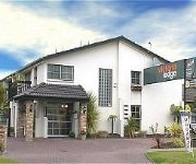
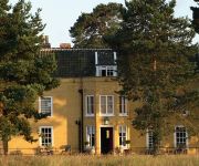
Hotels and Places to Stay
Barnard House
Imperial Hotel
Tudor House
TRAVELODGE GREAT YARMOUTH
Lowestoft
Knights Court Hotel
Burlington Palm Hotel
The Sea Princess
Waveney Inn
Fritton Arms
Videos from this area
These are videos related to the place based on their proximity to this place.
Derma roller on stretch marks 1st time
This is the first day I got my roller and I thought I'd share my journey with you!
1995 Falconry centre Valkenier
Valkerij is oorspronkelijk de kunst van het vangen en africhten van valken ten behoeve van de jacht. Tegenwoordig wordt het gezien als het africhten van roofvogels ten behoeve van de jacht,...
Berney Arms pub, Norfolk Broads
The Berney Arms pub on the Norfolk Broads - September 2012. Quite a strange place - an urban back-street pub in the middle of nowhere. Reasonable beer selection, basic pub grub - burgers and...
eXplore - Burgh Castle, Norfolk
WATCH IN SUPER HD / FULL HD eXplore - Burgh Castle, Norfolk The Broads National Park Equipment used: DJI Phantom 2, mini iOSD, H3-3D Gimbal, ImmersionRC 25w TX, Black Perl Diversity 7" ...
Entering Breydon Water from the River Yare
Returning from Norwich, passing the Berney Arms Pub and entering Breydon Water. At this point, there are no further stops until crossing Breydon Water and going through the channel at Great ...
Videos provided by Youtube are under the copyright of their owners.
Attractions and noteworthy things
Distances are based on the centre of the city/town and sightseeing location. This list contains brief abstracts about monuments, holiday activities, national parcs, museums, organisations and more from the area as well as interesting facts about the region itself. Where available, you'll find the corresponding homepage. Otherwise the related wikipedia article.
Berney Arms
Berney Arms is a place on the north bank of the River Yare, close to Breydon Water in the English county of Norfolk. It is part of the civil parish of Reedham, is administered by the district of Broadland and lies within The Broads National Park. It comprises a railway station, a windpump, a public house and a farm, but no longer has any inhabited houses. Berney Arms can be reached only by train, by boat or on foot; there is no road access.
River Yare
The River Yare is a river in the English county of Norfolk. In its lower reaches it is one of the principal navigable waterways of The Broads and connects with the rest of the network. The river rises south of Dereham close to the village of Shipdham. From there it flows in a generally eastward direction passing Barnham Broom and is joined by the River Tiffey before reaching Bawburgh.
Berney Arms railway station
Berney Arms railway station is a halt serving the remote settlement of Berney Arms in the Halvergate Marshes, in the English county of Norfolk. The station, which is 3.5 miles from the nearest road, is the most remote station in Norfolk. It is accessible only by rail, by boat, or on foot. Trains stop at Berney Arms only on request, and only during daylight hours as there is no lighting at the station, which is unstaffed. The station was adopted in 2010 as part of the 'Station Adoption Scheme'.
Lockgate Mill
Lockgate Mill also referred to locally and historically as Freethorpe Mill, 'Banham's Black Mill' and 'Duffel's Mill' is a windpump located on the Halvergate Marshes in the detached parish of Freethorpe within the Norfolk Broads National Park, United Kingdom. It can be found at grid reference TG480072 and is approximately two miles west of Great Yarmouth, and 3 miles east of Berney Arms on the northern edge of Breydon Water. The structure is a Grade II listed building.
Belton and Burgh railway station
Belton & Burgh was a station in the Norfolk village of Belton on the outskirts of Great Yarmouth but also served the village of Burgh Castle about 3.5 km away. It once saw trains on the main line from Yarmouth South Town to London, but was closed in 1959 as part of a major re-evaluation of the British Railways network. It was on a connecting branch between Great Yarmouth and Beccles. The site of the station can still be located.
Ashby, Suffolk
Ashby is a small hamlet located to the north east of Suffolk very close to the border with Norfolk. It is close to the village of Herringfleet on the B1074 road. The closest town is Lowestoft.
Lound Windmill
Lound Mill is a tower mill at Lound, Suffolk, England which has been converted to residential accommodation.
Fritton Lake
Fritton Lake is a lake in the English county of Norfolk. It is a popular local tourist attraction located south-west of Great Yarmouth and north-west of Lowestoft on the Norfolk–Suffolk border. A secret training facility was located at Fritton Lake during the Second World War. American made Sherman tanks were turned into amphibious vehicles by attaching a special collapsible screen made of rubber.


