Safety Score: 3,0 of 5.0 based on data from 9 authorites. Meaning we advice caution when travelling to United Kingdom.
Travel warnings are updated daily. Source: Travel Warning United Kingdom. Last Update: 2024-05-20 08:01:38
Touring Oulton
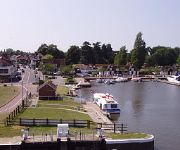
Oulton in Suffolk (England) is a town located in United Kingdom about 104 mi (or 167 km) north-east of London, the country's capital place.
Time in Oulton is now 07:09 AM (Tuesday). The local timezone is named Europe / London with an UTC offset of one hour. We know of 11 airports nearby Oulton, of which 5 are larger airports. The closest airport in United Kingdom is Norwich International Airport in a distance of 23 mi (or 37 km), North-West. Besides the airports, there are other travel options available (check left side).
There are several Unesco world heritage sites nearby. The closest heritage site in United Kingdom is Canterbury Cathedral, St Augustine's Abbey, and St Martin's Church in a distance of 88 mi (or 141 km), South. Also, if you like the game of golf, there is an option about 18 mi (or 28 km). away. Need some hints on where to stay? We compiled a list of available hotels close to the map centre further down the page.
Being here already, you might want to pay a visit to some of the following locations: Wrentham, Brundall, Hellington, Surlingham and Rockland Saint Mary. To further explore this place, just scroll down and browse the available info.
Local weather forecast
Todays Local Weather Conditions & Forecast: 15°C / 60 °F
| Morning Temperature | 11°C / 52 °F |
| Evening Temperature | 14°C / 57 °F |
| Night Temperature | 13°C / 55 °F |
| Chance of rainfall | 0% |
| Air Humidity | 87% |
| Air Pressure | 1009 hPa |
| Wind Speed | Moderate breeze with 9 km/h (6 mph) from South |
| Cloud Conditions | Overcast clouds, covering 99% of sky |
| General Conditions | Light rain |
Wednesday, 22nd of May 2024
17°C (63 °F)
12°C (54 °F)
Light rain, moderate breeze, overcast clouds.
Thursday, 23rd of May 2024
15°C (60 °F)
11°C (52 °F)
Scattered clouds, moderate breeze.
Friday, 24th of May 2024
12°C (54 °F)
10°C (50 °F)
Light rain, gentle breeze, overcast clouds.
Hotels and Places to Stay
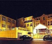
BEST WESTERN THE HATFIELD HTL
Lowestoft
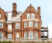
The Hotel Victoria
Chiltern House Boutique Bed & Breakfast
Wherry
Ivy House Country Hotel
Waveney Inn
TRAVELODGE GREAT YARMOUTH
TRAVELODGE LOWESTOFT
Videos from this area
These are videos related to the place based on their proximity to this place.
Lowestoft Town 1 Worcester City 1 Vanarama Conference North
Lowestoft Town 1 Worcester City 1 Vanarama Conference North Saturday 4th April 2015.
Beach Detecting Lowestoft Pakefield - Live Bomb Removal - Garrett Ace 150
My first detecting video brought up some live ordinance that the police had to come and take away. This was filmed on Pakefield Beach in Lowestoft with the Garrett Ace 150. This is also the...
Storm Surge Waves - Lowestoft Sea Front 6 December 2013
Storm Surge Waves - Lowestoft Sea Front 6 December 2013 This was the scene 12 hours after the worst storm surge seen in the UK for 60 years. David Ellis - Roller Coasters, Thrill Rides and...
Lowestoft Local Links
A short film highlighting some elements of the multi-award winning school, community and business programmes of Lowestoft Local Links.
Lowestoft Pancake Race 2015
The Graphiboyz and GraphiGirlz were out in force this afternoon! In their first venture into the race the team got through to the Semi-Finals. We're already in preparation for next years race...whe...
Nuffield Health Lowestoft
Introducing the New Nuffield Health & Wellbeing club, Lowestoft in partnership with East Point Academy. 100 founder memberships will be available upon launch.
HM Coastguard - Lowestoft.. Sirens
This is the HM Coastguard at Lowestoft Carnival "Suffolk" messing about with the blues & twos lol.
South Lowestoft Methodist Church Spring Holiday Flower Festival.wmv
Our beautiful Flower Festival - The Journey of Life was held on Spring Bank Holiday weekend.
Videos provided by Youtube are under the copyright of their owners.
Attractions and noteworthy things
Distances are based on the centre of the city/town and sightseeing location. This list contains brief abstracts about monuments, holiday activities, national parcs, museums, organisations and more from the area as well as interesting facts about the region itself. Where available, you'll find the corresponding homepage. Otherwise the related wikipedia article.
Lowestoft railway station
Lowestoft, formerly known as Lowestoft Central, is a staffed railway station serving the town of Lowestoft in Suffolk. It is the terminus of the Wherry Line from Norwich and the East Suffolk Line from Ipswich. It is the easternmost station on the National Rail network. The station is owned by Network Rail and served by Greater Anglia. Services are operated by diesel multiple units of Classes 153, 156 or 170.
Lowestoft Town F.C
Lowestoft Town F.C. is an English football club based in Lowestoft, Suffolk. The club are currently members of the Isthmian League Premier Division and play at Crown Meadow.
Lowestoft North railway station
Lowestoft North railway station was in Lowestoft, England. It closed in 1970. The station was located just to the east of the A12, opposite the Denes High School; a site which is now occupied by Beeching Drive.
Gunton, Suffolk
Gunton is a suburb of Lowestoft in the English county of Suffolk. Gunton was a small coastal village but over the years has been suburbanised. Gunton has an estimated population of 6,640. The main A12 or Yarmouth road runs through the area.
Port of Lowestoft
The Port of Lowestoft is a harbour in Lowestoft in the English county of Suffolk owned by Associated British Ports. It is the most easterly harbour in the United Kingdom and has direct sea access to the North Sea. The harbour is made up of two sections divided by a bascule bridge. The inner harbour is formed by Lake Lothing whilst the outer harbour is constructed from breakwaters.
Lowestoft Corporation Tramways
Lowestoft Corporation Tramways was the operator of the electric tramway system that served Lowestoft from 22 July 1903 until 8 May 1931.
Lowestoft College
Lowestoft College is a Further Education college in Lowestoft, Suffolk. It is affiliated to University Campus Suffolk through which it offers a range of Higher Education degree courses. The College works with two school partnerships, North Suffolk and Lowestoft, delivering vocational training in Lowestoft and also at Halesworth in the North Suffolk Skills Centre. Adult community outreach provision is delivered in the Somerleyton, Beccles, Southwold and Leiston areas.
St. Margaret's Church, Lowestoft
Saint Margaret's Church is the parish church of Lowestoft in the English county of Suffolk. It is dedicated to St Margaret of Antioch and is notable for its large illuminated blue spire which can be seen across the town. The church is located on a hilltop on the north-western edge of the town centre and was used as a navigation landmark. The church is within the deanery of Lothingland and archdeaconry of Norfolk. It falls within the Diocese of Norwich which extends into north Suffolk.


