Safety Score: 3,0 of 5.0 based on data from 9 authorites. Meaning we advice caution when travelling to United Kingdom.
Travel warnings are updated daily. Source: Travel Warning United Kingdom. Last Update: 2024-05-01 08:01:32
Delve into Pakefield
Pakefield in Suffolk (England) is located in United Kingdom about 103 mi (or 165 km) north-east of London, the country's capital town.
Current time in Pakefield is now 03:20 AM (Thursday). The local timezone is named Europe / London with an UTC offset of one hour. We know of 11 airports close to Pakefield, of which 5 are larger airports. The closest airport in United Kingdom is Norwich International Airport in a distance of 24 mi (or 39 km), North-West. Besides the airports, there are other travel options available (check left side).
There are several Unesco world heritage sites nearby. The closest heritage site in United Kingdom is Canterbury Cathedral, St Augustine's Abbey, and St Martin's Church in a distance of 86 mi (or 138 km), South. Also, if you like playing golf, there is an option about 19 mi (or 31 km). away. If you need a hotel, we compiled a list of available hotels close to the map centre further down the page.
While being here, you might want to pay a visit to some of the following locations: Wrentham, Brundall, Hellington, Surlingham and Rockland Saint Mary. To further explore this place, just scroll down and browse the available info.
Local weather forecast
Todays Local Weather Conditions & Forecast: 13°C / 55 °F
| Morning Temperature | 11°C / 51 °F |
| Evening Temperature | 12°C / 53 °F |
| Night Temperature | 10°C / 50 °F |
| Chance of rainfall | 0% |
| Air Humidity | 88% |
| Air Pressure | 1001 hPa |
| Wind Speed | Moderate breeze with 10 km/h (6 mph) from South-West |
| Cloud Conditions | Overcast clouds, covering 86% of sky |
| General Conditions | Light rain |
Friday, 3rd of May 2024
9°C (49 °F)
9°C (48 °F)
Moderate rain, fresh breeze, overcast clouds.
Saturday, 4th of May 2024
14°C (57 °F)
9°C (49 °F)
Scattered clouds, moderate breeze.
Sunday, 5th of May 2024
14°C (57 °F)
11°C (51 °F)
Broken clouds, gentle breeze.
Hotels and Places to Stay
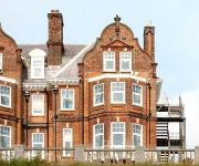
Chiltern House Boutique Bed & Breakfast
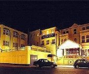
The Hotel Victoria
BEST WESTERN THE HATFIELD HTL
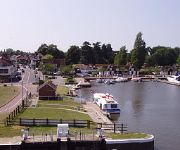
Wherry
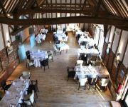
Ivy House Country Hotel
Lowestoft
Waveney Inn
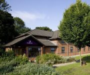
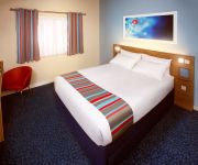
TRAVELODGE LOWESTOFT
Videos from this area
These are videos related to the place based on their proximity to this place.
Lowestoft Fun Palace
Tour of the Fun Palace amusement arcade located on Claremont Pier in Lowestoft. Produced as part of my article 'Summer Break 2007' available at www.retrogamers.org.
Nuffield Health Lowestoft
Introducing the New Nuffield Health & Wellbeing club, Lowestoft in partnership with East Point Academy. 100 founder memberships will be available upon launch.
HM Coastguard - Lowestoft.. Sirens
This is the HM Coastguard at Lowestoft Carnival "Suffolk" messing about with the blues & twos lol.
South Lowestoft Methodist Church Spring Holiday Flower Festival.wmv
Our beautiful Flower Festival - The Journey of Life was held on Spring Bank Holiday weekend.
Honda Lowestoft Flooded
Southwold coast guards attended Lowestoft as the tidal surge flooded parts of the town. Honda Lings either didn't take the warnings seriously or perhaps they had no idea it would be so bad?...
lowestoft air show, quick clip of B17 Sally b, 23rd 2012 what a great sound
Sally b B17 flying fortress at lowestoft air show, uk, 23/06/2012.
Lowestoft Bridge
Returning north from France we decided to call into Lowestoft mainly due to a strong wind warning for the following 2 days. We arrived at 0215 and passed through the bridge not long after and...
Lowestoft chinese kempo... Freestyle self defence
Sam brown, lowestoft, chinese kempo, kung fu, self defence.
Lowestoft Bascule Bridge, 16th February 2014
Lowestoft Bascule Bridge being raised for small boat, 16th February 2014. Video by Rob W.
Videos provided by Youtube are under the copyright of their owners.
Attractions and noteworthy things
Distances are based on the centre of the city/town and sightseeing location. This list contains brief abstracts about monuments, holiday activities, national parcs, museums, organisations and more from the area as well as interesting facts about the region itself. Where available, you'll find the corresponding homepage. Otherwise the related wikipedia article.
Lowestoft railway station
Lowestoft, formerly known as Lowestoft Central, is a staffed railway station serving the town of Lowestoft in Suffolk. It is the terminus of the Wherry Line from Norwich and the East Suffolk Line from Ipswich. It is the easternmost station on the National Rail network. The station is owned by Network Rail and served by Greater Anglia. Services are operated by diesel multiple units of Classes 153, 156 or 170.
Oulton Broad South railway station
Oulton Broad South is one of two railway stations serving Oulton Broad, a suburb of Lowestoft in Suffolk, England. The station is located on the Ipswich-Lowestoft East Suffolk Line. After leaving Lowestoft and splitting from the Norwich line, it crosses Mutford Bridge with a view of Lake Lothing to the east and Oulton Broad lake to the west. The station is served by Greater Anglia, who operate services between Ipswich and Lowestoft. Through trains to London were withdrawn in 2010.
Lothingland Rural District
Lothingland was a rural district in East Suffolk, England, named after the ancient half-hundred of Lothingland which was merged with Mutford half-hundred in 1763 to form Mutford and Lothingland. The rural district was formed in 1934 by the merger of most of Mutford and Lothingland Rural District along with part of Blythling Rural District, both of which were being abolished. It covered a coastal area between Great Yarmouth and Lowestoft.
Kirkley & Pakefield F.C
Kirkley & Pakefield F.C. is an English football club based in the Lowestoft suburb of Kirkley, Suffolk. The club are currently members of the Eastern Counties League Premier Division and play at Walmer Road.
Port of Lowestoft
The Port of Lowestoft is a harbour in Lowestoft in the English county of Suffolk owned by Associated British Ports. It is the most easterly harbour in the United Kingdom and has direct sea access to the North Sea. The harbour is made up of two sections divided by a bascule bridge. The inner harbour is formed by Lake Lothing whilst the outer harbour is constructed from breakwaters.
Lowestoft Corporation Tramways
Lowestoft Corporation Tramways was the operator of the electric tramway system that served Lowestoft from 22 July 1903 until 8 May 1931.
Mincarlo (trawler)
Mincarlo is the last surviving sidewinder fishing trawler of the Lowestoft fishing fleet. She is also the last surviving fishing vessel built in Lowestoft, with an engine made in the town.
Claremont Pier
The Claremont Pier is a traditional seaside pier in Lowestoft in the English county of Suffolk.


