Safety Score: 3,0 of 5.0 based on data from 9 authorites. Meaning we advice caution when travelling to United Kingdom.
Travel warnings are updated daily. Source: Travel Warning United Kingdom. Last Update: 2024-05-10 08:04:54
Delve into Runham
Runham in Norfolk (England) is a town located in United Kingdom about 107 mi (or 173 km) north-east of London, the country's capital town.
Time in Runham is now 11:56 AM (Friday). The local timezone is named Europe / London with an UTC offset of one hour. We know of 11 airports closer to Runham, of which 5 are larger airports. The closest airport in United Kingdom is Norwich International Airport in a distance of 16 mi (or 26 km), West. Besides the airports, there are other travel options available (check left side).
There are several Unesco world heritage sites nearby. The closest heritage site in United Kingdom is Canterbury Cathedral, St Augustine's Abbey, and St Martin's Church in a distance of 95 mi (or 154 km), South. Also, if you like the game of golf, there are some options within driving distance. In need of a room? We compiled a list of available hotels close to the map centre further down the page.
Since you are here already, you might want to pay a visit to some of the following locations: Brundall, Surlingham, Wrentham, Hellington and Rockland Saint Mary. To further explore this place, just scroll down and browse the available info.
Local weather forecast
Todays Local Weather Conditions & Forecast: 15°C / 59 °F
| Morning Temperature | 11°C / 52 °F |
| Evening Temperature | 14°C / 57 °F |
| Night Temperature | 11°C / 52 °F |
| Chance of rainfall | 0% |
| Air Humidity | 75% |
| Air Pressure | 1025 hPa |
| Wind Speed | Gentle Breeze with 6 km/h (3 mph) from West |
| Cloud Conditions | Overcast clouds, covering 100% of sky |
| General Conditions | Overcast clouds |
Saturday, 11th of May 2024
14°C (58 °F)
11°C (52 °F)
Overcast clouds, gentle breeze.
Sunday, 12th of May 2024
16°C (60 °F)
13°C (56 °F)
Overcast clouds, gentle breeze.
Monday, 13th of May 2024
13°C (55 °F)
11°C (53 °F)
Light rain, fresh breeze, overcast clouds.
Hotels and Places to Stay
Barnard House
Tudor House
Fritton Arms
TRAVELODGE GREAT YARMOUTH
Horse and Groom Hotel
Taunton Guest House
Andover House Hotel & Restaurant
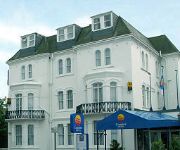
Comfort Hotel Great Yarmouth
Cliff Hotel
Great Yarmouth
Videos from this area
These are videos related to the place based on their proximity to this place.
Derma roller on stretch marks 1st time
This is the first day I got my roller and I thought I'd share my journey with you!
Norfolk Broads boating holiday
Visit http://www.waterwaysholidays.com/ or call 01252 796400 for boat holidays on the Norfolk Broads. This gives you a feel for the picturesque views and experience of boating on the Norfolk...
Living On A Boat - A Year On The Broads - Part 17
Living on a boat is a sailing adventure which started on the Norfolk broads. - The aim is to take this sailing boat, or yacht as I prefer to call it and take it from the Norfolk Broads to...
REED THATCHING circa 1948
REED THATCHING Norfolk Broads, UK. Circa 1948 The thatcher mows some suitable reeds, loads them onto his boat and rows it home. Later, using the dried and prepared reeds, he works on the...
1976 - The Broads and Brittany
The Norfolk Broads; Gilfrid, Jill, Andrew, Robert and Penny Day Brittanny; Gilfrid, Jill, Andrew, Robert and Penny Day.
Large radio controlled yacht sailing In lowestoft harbour area
This is my radio controlled yacht that I have just bought and this was its first trip out. The length is 12.70mm the beam is 380mm the height above the waterline is 19.30mm and the total height...
Videos provided by Youtube are under the copyright of their owners.
Attractions and noteworthy things
Distances are based on the centre of the city/town and sightseeing location. This list contains brief abstracts about monuments, holiday activities, national parcs, museums, organisations and more from the area as well as interesting facts about the region itself. Where available, you'll find the corresponding homepage. Otherwise the related wikipedia article.
Berney Arms
Berney Arms is a place on the north bank of the River Yare, close to Breydon Water in the English county of Norfolk. It is part of the civil parish of Reedham, is administered by the district of Broadland and lies within The Broads National Park. It comprises a railway station, a windpump, a public house and a farm, but no longer has any inhabited houses. Berney Arms can be reached only by train, by boat or on foot; there is no road access.
River Yare
The River Yare is a river in the English county of Norfolk. In its lower reaches it is one of the principal navigable waterways of The Broads and connects with the rest of the network. The river rises south of Dereham close to the village of Shipdham. From there it flows in a generally eastward direction passing Barnham Broom and is joined by the River Tiffey before reaching Bawburgh.
Berney Arms railway station
Berney Arms railway station is a halt serving the remote settlement of Berney Arms in the Halvergate Marshes, in the English county of Norfolk. The station, which is 3.5 miles from the nearest road, is the most remote station in Norfolk. It is accessible only by rail, by boat, or on foot. Trains stop at Berney Arms only on request, and only during daylight hours as there is no lighting at the station, which is unstaffed. The station was adopted in 2010 as part of the 'Station Adoption Scheme'.
Nowhere, Norfolk
According to 19th-century directories, Nowhere or No-Where is a marshy area by the River Bure where the villagers of Acle, Norfolk had salt-pans to produce salt for food preservation, etc. Originally an extra-parochial liberty it was formally incorporated into Acle parish in 1862 and the name no longer appears in maps and gazetteers. In 1861 there were four inhabited houses and 16 people.
Lockgate Mill
Lockgate Mill also referred to locally and historically as Freethorpe Mill, 'Banham's Black Mill' and 'Duffel's Mill' is a windpump located on the Halvergate Marshes in the detached parish of Freethorpe within the Norfolk Broads National Park, United Kingdom. It can be found at grid reference TG480072 and is approximately two miles west of Great Yarmouth, and 3 miles east of Berney Arms on the northern edge of Breydon Water. The structure is a Grade II listed building.
Thrigby Windmill
Thrigby Post Windmill is located in the civil parish of Mautby in the English county of Norfolk. The mill is on the south side of Mill Lane 1,125 yards east of the village of Thrigby. The post mill is north of The River Bure, Breydon Water and the Halvergate Marshes.


