Safety Score: 3,0 of 5.0 based on data from 9 authorites. Meaning we advice caution when travelling to United Kingdom.
Travel warnings are updated daily. Source: Travel Warning United Kingdom. Last Update: 2024-05-04 08:22:41
Explore Mustard Hyrn
Mustard Hyrn in Norfolk (England) is a city in United Kingdom about 111 mi (or 178 km) north-east of London, the country's capital.
Local time in Mustard Hyrn is now 12:12 AM (Sunday). The local timezone is named Europe / London with an UTC offset of one hour. We know of 11 airports in the vicinity of Mustard Hyrn, of which 5 are larger airports. The closest airport in United Kingdom is Norwich International Airport in a distance of 14 mi (or 22 km), West. Besides the airports, there are other travel options available (check left side).
There are several Unesco world heritage sites nearby. The closest heritage site in United Kingdom is Canterbury Cathedral, St Augustine's Abbey, and St Martin's Church in a distance of 101 mi (or 163 km), South. Also, if you like golfing, there is an option about 3 mi (or 4 km). away. If you need a place to sleep, we compiled a list of available hotels close to the map centre further down the page.
Depending on your travel schedule, you might want to pay a visit to some of the following locations: East Ruston, Brundall, Surlingham, Hellington and Rockland Saint Mary. To further explore this place, just scroll down and browse the available info.
Local weather forecast
Todays Local Weather Conditions & Forecast: 16°C / 60 °F
| Morning Temperature | 7°C / 44 °F |
| Evening Temperature | 11°C / 52 °F |
| Night Temperature | 9°C / 49 °F |
| Chance of rainfall | 0% |
| Air Humidity | 69% |
| Air Pressure | 1012 hPa |
| Wind Speed | Moderate breeze with 10 km/h (6 mph) from North-East |
| Cloud Conditions | Overcast clouds, covering 87% of sky |
| General Conditions | Overcast clouds |
Sunday, 5th of May 2024
14°C (58 °F)
9°C (49 °F)
Overcast clouds, moderate breeze.
Monday, 6th of May 2024
12°C (54 °F)
10°C (51 °F)
Overcast clouds, gentle breeze.
Tuesday, 7th of May 2024
12°C (54 °F)
8°C (47 °F)
Scattered clouds, gentle breeze.
Hotels and Places to Stay
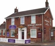
Horse and Groom Hotel
TRAVELODGE GREAT YARMOUTH ACLE
Videos from this area
These are videos related to the place based on their proximity to this place.
Seal Beach
Travel website 'Jules Told Me' gets close to hundreds of seals at Horsey beach in Norfolk, UK. More great stories at julestoldme.com.
Enchanting Horsey at dusk.
theo harpik, http://youtu.be/cV0u8qT2vuk This small village of Horsey is situated within the area of the Norfolk Broads, this video shows Horsey All Saints Church at dusk, note the adjacent...
Commie Paul's last Bitternes Afloat Easter Cruise
A snapshot of the Bitternes Afloat Christian Cruise on the Norfolk Broads 2011 in celebration of the work done by Paul Clifford on behalf of the cruise during 12 years as Commodore.
Providence Place - Holiday Cottage for Hire - Norfolk Broads
www.NorfolkCottageHolidays.com - Detached, holiday cottage on the Norfolk Broads, UK. Just 3 miles from sandy beaches.
Marsh Harrier, Norfolk Broads
This video is part of my Norfolk Broads Blog at http://exploringthebroads.com/ Between Martham Broad and West Somerton we see this Marsh Harrier, who seems to be enjoying the first warm rays...
Going Wild In Watercolour With Jake Winkle Trailer Official Trailer
Trailer for full length DVD available from www.townhousefilms.co.uk.
Roysia Homes' Sample property video tour1
www.roysiahomes.co.uk Roysia Homes is an online fixed-fee estate agents. We sell property in E Norfolk, Norwich and SE Suffolk. We have a creative marketing strategy. We create full HD video...
Videos provided by Youtube are under the copyright of their owners.
Attractions and noteworthy things
Distances are based on the centre of the city/town and sightseeing location. This list contains brief abstracts about monuments, holiday activities, national parcs, museums, organisations and more from the area as well as interesting facts about the region itself. Where available, you'll find the corresponding homepage. Otherwise the related wikipedia article.
The Broads
The Broads are a network of mostly navigable rivers and lakes in the English counties of Norfolk and Suffolk. The Broads, and some surrounding land, were constituted as a special area with a level of protection similar to a National Park by The Norfolk and Suffolk Broads Act of 1988. The Broads Authority, a Special Statutory Authority responsible for managing the area, became operational in 1989.
Martham Broad
Martham Broad is a broad (or lake) and National Nature Reserve on the River Thurne in the English county of Norfolk. The broad is located within The Broads National Park about 2 km north of the village of Martham. The nature reserve is maintained by English Nature and is part of the Upper Thurne Broads and Marshes SSSI. It is owned and managed by Norfolk Wildlife Trust. It comprises 590,000 m² of open water, reed and saw-sedge fen, and it is a shallow, brackish lake.
Cess, Norfolk
Cess is a hamlet on the River Thurne in the southwestern part of the village of Martham, in Norfolk, England, within The Broads a member of the National Parks.
Martham railway station
Martham railway station was a station in Martham, Norfolk. It was on the line between Melton Constable and Great Yarmouth. It closed in 1959.
Stubb Drainage Windmill
Stubb Drainage Windmill is 1.9 miles east of Hickling in the English county of Norfolk. The Windmill is a Grade II listed building and was given this status on the 30th September 1987. The estimate is that there were once about 200 wind powered drainage windmills in the Broadlands. Stubb Drainage windmill is listed as one that is at risk of decay by Norfolk County Council. The structure is a Grade II listed building.
Potter Heigham Bridge Halt railway station
Potter Heigham Bridge Halt was a railway station on the Midland and Great Northern Joint Railway which was opened to serve the boating traffic on the River Thurne. It was more conveniently situated to the Norfolk village of Potter Heigham than Potter Heigham station itself.
Heigham Holmes
Heigham Holmes is a National Nature Reserve located within the Norfolk Broads in the English county of Norfolk. The reserve is, in effect, an island, being surrounded by the river channels, drainage ditches and wetland areas of the Broads. It is only accessible by an unusual floating swing bridge across the River Thurne from the village of Martham. The reserve is owned by the National Trust and is within the Broads National Park and the civil parish of Potter Heigham.
Emma Turner (photographer)
Emma Louise Turner FLS (1866-14 August 1940) was an ornithologist and pioneering bird photographer whose 1911 picture of a nestling Bittern in Norfolk was the first evidence of their return to the United Kingdom as a breeding bird after local extinction since the late 1800s. She was described as being " …small in stature but very wiry, quite capable with a punt or rowing boat". She took up photography after meeting Richard Kearton.


