Safety Score: 3,0 of 5.0 based on data from 9 authorites. Meaning we advice caution when travelling to United Kingdom.
Travel warnings are updated daily. Source: Travel Warning United Kingdom. Last Update: 2024-04-29 08:03:39
Discover Hall Common
Hall Common in Norfolk (England) is a town in United Kingdom about 109 mi (or 175 km) north-east of London, the country's capital city.
Current time in Hall Common is now 10:19 AM (Monday). The local timezone is named Europe / London with an UTC offset of one hour. We know of 11 airports near Hall Common, of which 5 are larger airports. The closest airport in United Kingdom is Norwich International Airport in a distance of 11 mi (or 17 km), West. Besides the airports, there are other travel options available (check left side).
There are several Unesco world heritage sites nearby. The closest heritage site in United Kingdom is Canterbury Cathedral, St Augustine's Abbey, and St Martin's Church in a distance of 100 mi (or 161 km), South. Also, if you like playing golf, there is an option about 1 mi (or 1 km). away. Looking for a place to stay? we compiled a list of available hotels close to the map centre further down the page.
When in this area, you might want to pay a visit to some of the following locations: East Ruston, Brundall, Surlingham, Rockland Saint Mary and Hellington. To further explore this place, just scroll down and browse the available info.
Local weather forecast
Todays Local Weather Conditions & Forecast: 13°C / 55 °F
| Morning Temperature | 4°C / 40 °F |
| Evening Temperature | 13°C / 55 °F |
| Night Temperature | 8°C / 46 °F |
| Chance of rainfall | 0% |
| Air Humidity | 64% |
| Air Pressure | 1016 hPa |
| Wind Speed | Fresh Breeze with 14 km/h (8 mph) from North |
| Cloud Conditions | Broken clouds, covering 65% of sky |
| General Conditions | Broken clouds |
Tuesday, 30th of April 2024
12°C (53 °F)
11°C (52 °F)
Light rain, fresh breeze, overcast clouds.
Wednesday, 1st of May 2024
14°C (56 °F)
11°C (51 °F)
Light rain, gentle breeze, overcast clouds.
Thursday, 2nd of May 2024
13°C (55 °F)
10°C (51 °F)
Light rain, moderate breeze, overcast clouds.
Hotels and Places to Stay
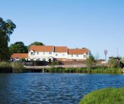
Wayford Bridge Hotel
TRAVELODGE GREAT YARMOUTH ACLE
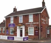
Horse and Groom Hotel
Videos from this area
These are videos related to the place based on their proximity to this place.
Horning Sailing Club river cruisers class
Start line of downriver race from St Benets Abbey to Thurne Lion. Very light winds.
Sailing at Thurne Norfolk Broads
River Cruiser Annie during Tri- icycle Snowflakes Sailing Club downriver race.
ST BENET'S ABBEY PARANORMAL INVESTIGATION (8th April 2011 update)
The OUT THERE PARANORMAL TEAM investigate the ruins of St Benet's Abbey in Norfolk where they come into contact with an extremely 'rude' spirit of a monk...
Battlefield 2: Love
Made this little beta quite a while back and uploaded on a different account of mine, but made a new one, and wanted it to be included. Well here it is; a Battlefield 2 funnies..
Norfolk Broads: from Ranworth Staith towards Potter Heigham
Shows the journey from Malthouse Broad via river Bure and river Thurne towards Potter Heigham. Video has Lat Long information, recorded at 1 FPS.
Sailing on the river Bure, Acle Bridge Norfolk Broads
Sailing boat Excalibur boat leaving mooring, head to wind on mainsail, unfurling jib and then a gybe!
Scania P230 at Speed.
Scania P230 on country roads near the village of Ludham in Norfolk. the road got a bit bumpy at times but we got the job done.
Videos provided by Youtube are under the copyright of their owners.
Attractions and noteworthy things
Distances are based on the centre of the city/town and sightseeing location. This list contains brief abstracts about monuments, holiday activities, national parcs, museums, organisations and more from the area as well as interesting facts about the region itself. Where available, you'll find the corresponding homepage. Otherwise the related wikipedia article.
St Benet's Abbey
St Benet's Abbey is a ruined abbey of the Order of Saint Benedict situated on the River Bure within The Broads in Norfolk England. It is also known as St Benet's at Holme or Hulme.
How Hill
How Hill lies on the River Ant within The Broads National Park in Norfolk, England. The large Edwardian building houses the Norfolk Broads Study Centre, an independent charitable organisation which runs residential environmental courses for groups of schoolchildren. The How Hill Nature Reserve is administered by the Broads Authority.
Crome's Broad
Crome's Broad is situated to the east of the River Ant, north of How Hill, within The Broads National Park in Norfolk, England. It is named after John Crome, the founder of the Norwich school of painters.
Ludham – Potter Heigham National Nature Reserve
Ludham–Potter Heigham Marshes NNR is a National Nature Reserve established and owned by English Nature in Norfolk, England. Located within The Broads National Park, it is an internationally important wetland site. The area was declared an NNR in 1987, covers an area of 86 hectares and consists of grass marshes on the north side of the River Thurne between Ludham and Potter Heigham.
Ludham Bridge
Ludham Bridge is a hamlet on the River Ant on the Norfolk Broads in Norfolk, England.
River Thurne
The River Thurne is a river in Norfolk, England in The Broads. Just six miles (10 km) long it rises two miles (3 km) from the coast near Martham Broad and is navigable from West Somerton. It flows southwest and is linked by Candle Dyke and Heigham Sound to both Horsey Mere and Hickling Broad. It continues southwest and flows through Potter Heigham (passing under its medieval bridge) and enters the River Bure just south of Thurne dyke, near St. Benet's Abbey.
Boardman's Windmill
Boardman’s Drainage Windmill is located at How Hill in the English county of Norfolk It is on the east bank of the River Ant close to the large Edwardian building houses the Norfolk Broads Study Centre . The Drainage mill is 1½ miles west of the village of Ludham. The structure is a grade II* listed building.
Clayrack Drainage Mill
Clayrack Drainage Windmill is located at How Hill in the English county of Norfolk . It is on the east bank of the River Ant close to How Hill House, a large Edwardian building which houses the Norfolk Broads Study Centre . The Drainage mill is 1¾ miles west of the village of Ludham.


