Safety Score: 3,0 of 5.0 based on data from 9 authorites. Meaning we advice caution when travelling to United Kingdom.
Travel warnings are updated daily. Source: Travel Warning United Kingdom. Last Update: 2024-04-26 08:02:42
Touring Moortown
The district Moortown of Leeds in Leeds (England) is a subburb located in United Kingdom about 172 mi north of London, the country's capital place.
Need some hints on where to stay? We compiled a list of available hotels close to the map centre further down the page.
Being here already, you might want to pay a visit to some of the following locations: Shadwell, Scarcroft, Thorner, Pool and Collingham. To further explore this place, just scroll down and browse the available info.
Local weather forecast
Todays Local Weather Conditions & Forecast: 5°C / 42 °F
| Morning Temperature | 2°C / 36 °F |
| Evening Temperature | 6°C / 43 °F |
| Night Temperature | 2°C / 36 °F |
| Chance of rainfall | 3% |
| Air Humidity | 87% |
| Air Pressure | 1005 hPa |
| Wind Speed | Gentle Breeze with 6 km/h (4 mph) from South-West |
| Cloud Conditions | Overcast clouds, covering 91% of sky |
| General Conditions | Light rain |
Saturday, 27th of April 2024
9°C (48 °F)
3°C (38 °F)
Light rain, gentle breeze, overcast clouds.
Sunday, 28th of April 2024
7°C (45 °F)
5°C (41 °F)
Moderate rain, gentle breeze, overcast clouds.
Monday, 29th of April 2024
13°C (55 °F)
8°C (46 °F)
Light rain, moderate breeze, scattered clouds.
Hotels and Places to Stay
Quebecs Luxury Apartments 3 Infirmary Street
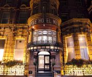
The Met Hotel PH Hotels
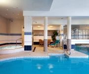
Hilton Leeds City
Quebecs
Malmaison Leeds
THE QUEENS - QHOTELS
Park Plaza Leeds
Leeds Marriott Hotel
42 The Calls
Jurys Inn Leeds
Videos from this area
These are videos related to the place based on their proximity to this place.
Garden design and construction Northbrook street Chapel allerton Leeds
I created this video with the YouTube Slideshow Creator (http://www.youtube.com/upload)
Roundhay Park
It was our first visit to this park on the last day in October. It was very busy as it was the last day of the autumn school holiday. A lovely place for young and old with a children's play...
Pano Pole - elevated high level photography, panoramas and video - on location demo.
On location with the 'PanoPole' for elevated pole photography, 360 panoramas and video. Carbon fibre pole and clamps elevates your camera to 15 feet from the ground, and remote viewing screen...
Tai Chi & Qi Gong Testimonial
Hello you beautiful people, Namaste :-) I've been asked by Shifu Jason Dean at Temple Holistic to give a testimonial on just how effective and beneficial Tai Chi and Qi Gong has been to me....
National Cross Country 2010 Part 1
Manx Harriers made their annual trip to the National Cross Country at Leeds on 27 February and David Griffiths took the film of the event but with special features on his own club.
Bonfire Night - Fireworks at Roundhay Park Leeds
http://www.roundhaypark.org.uk/roundhay-park-fireworks-2011.html.
The NLP View: Donna Blinston Discusses NLP in PTSD
PTSD, or Post Traumatic Stress Disorder, affects thousands of state and local police officers, armed service men and women and civilians of every description. PTSD is a psychiatric disorder...
The Mansion Wedding Photography // Katie and Frazer
Katie and Frazer The Mansion at Roundhay Park, Leeds. We Are Scientists - After Hours www.jamestraceyphotography.com.
Martin House Dragon Boat Race - Team Tom - Leeds 2014
Team Tom entered a team into the 2014 Martin House Dragon Boat Race on 18th May 2014 in Roundhay Park, Leeds. We were one of forty one teams who entered and thanks to everyone who ...
Roundhay parkrun #167 05/07/2014
Roundhay parkrun just before Tour de France start at Leeds. Classic parkrun course of three laps with a very sharp turns. http://www.parkrun.org.uk/roundhay/results/weeklyresults/?
Videos provided by Youtube are under the copyright of their owners.
Attractions and noteworthy things
Distances are based on the centre of the city/town and sightseeing location. This list contains brief abstracts about monuments, holiday activities, national parcs, museums, organisations and more from the area as well as interesting facts about the region itself. Where available, you'll find the corresponding homepage. Otherwise the related wikipedia article.
University of Leeds
The University of Leeds (informally Leeds University, or simply Leeds) is a British Redbrick university located in the city of Leeds, West Yorkshire, England.
Scott Hall, Leeds
Scott Hall is a suburb of north-east Leeds, West Yorkshire, England, adjacent to Chapeltown and Meanwood. It is made up largely of council housing and has an industrial past, with a number of disused factories to the west in Meanwood Valley.
Gledhow
Gledhow is a suburb of north-east Leeds, West Yorkshire, England, situated east of Chapel Allerton and west of Roundhay. A major feature of the area is Gledhow Valley, a strip of mixed deciduous woodland with a beck and lake. A bathhouse dating from 1671, the Gipton Spa, is in the woods. Running through the valley is Gledhow Valley Road, built in 1926. Gledhow Lane crosses Gledhow Valley Road and on the Eastern side is a steep road up from the valley.
Sheepscar
Sheepscar is an inner city district of Leeds in West Yorkshire England, lying to the north east of Leeds city centre. It is overlooked by the tower blocks of Little London and Lovell Park to the west, and gives way to Meanwood in the north-west, Chapeltown in the north-east and Burmantofts in the east. Clay Pit Lane, effectively an urban motorway, runs through Sheepscar to the south, while Scott Hall Road makes up the eastern border.
St James's University Hospital
St. James's University Hospital is in Leeds, West Yorkshire, England. It is popularly known as Jimmy's and is one of the United Kingdom's most famous hospitals. Its fame derives in part from its extensive television coverage in the documentary series also titled "Jimmy's", screened by Yorkshire Television (YTV) between 1987 and 1994 with a theme tune performed by Snake Davis.
Leeds College of Art
Leeds College of Art is a specialist arts further and higher education institution, based in the city of Leeds, West Yorkshire, England, with a main campus opposite the University of Leeds. It was founded in 1846 as the Leeds School of Art. From 1968 to 1993 it was known as Jacob Kramer College - having lost part of its provision to Leeds Polytechnic. It was known as Leeds College of Art and Design until 2009.
Leeds North East (UK Parliament constituency)
Leeds North East is a constituency which has been represented in the House of Commons of the UK Parliament since 1997 by Fabian Hamilton of the Labour Party.
Thackray Museum
The Thackray Museum in Leeds, West Yorkshire, England, is a museum of the history of medicine adjacent to St James's Hospital. Since it opened in 1997 it has won "Museum of the Year" and other awards. The building is a Grade II listed building, the former Leeds Union Workhouse, built in 1858 to accommodate 784 paupers. By the end of the 19th century, the buildings had become largely used for medical care of the poor, rather than workhouse and training.
Roundhay Park
Roundhay Park in Leeds, West Yorkshire, England, is one of the biggest city parks in Europe. It has over 700 acres of parkland, lakes, woodland and gardens which are owned by Leeds City Council. The park is one of the most popular attractions in Leeds, nearly a million people visit each year. It is situated on the north-east edge of the city, bordered by the suburb of Roundhay to the west and Oakwood to the south.
Miles Hill
Miles Hill is a district in Leeds. It is about 1.5 miles north of Leeds city centre, West Yorkshire, England and is situated between Meanwood and Chapel Allerton next to Beck Hill. As the name suggests, it is a hilltop, looking south over Leeds down the A61 Scott Hall Road. The main part is the Miles Hill estate of 1920's council houses, brick built semi-detached and terraces.
Cranmer Bank
Cranmer Bank is a council estate situated in Moor Allerton, Leeds, West Yorkshire, England. The estate is often referred to as Black Moor, however these are two separate areas of Moor Allerton. The estate has a parade of shops including a Post Office The Tynwald area separates Cranmer Bank from Black Moor, while Alwoodley lies further up King Lane.
Yorkshire Amateur A.F.C
Yorkshire Amateur A.F.C. are a football club based in Leeds, West Yorkshire, England. They were formed in 1918, and two years later became founding members of the Yorkshire Football League. For the 2012–13 season, Yorkshire Amateur are members of the Northern Counties East League Division One.
Eccup reservoir
Eccup reservoir is a reservoir in Alwoodley, a suburb of Leeds, West Yorkshire, England. It was first constructed in 1843, and later expanded. The open water area is 91 hectares, making it largest area of water in West Yorkshire. The reservoir is owned by Yorkshire Water. The reservoir and the surrounding woodlands are both Sites of Special Scientific Interest. The reservoir is now home to a growing population of red kites.
Carr Manor
Carr Manor is a Victorian grade II listed house in Meanwood, Leeds, England, designed by Edward Schroeder Prior and built for Thomas Clifford Allbutt M.D. (1836–1925). In 1881 it replaced Carr Manor House, though retaining the 1796 stable block. The former gardener's and housekeeper's cottages, the former stables (now garage) and the wall, gate piers and gates are also grade II listed. It was Richard Norman Shaw’s custom to give setting up commissions to his former pupils.
Potternewton
Potternewton is a suburb and parish of north-east Leeds, West Yorkshire, England, situated between Chapeltown and Chapel Allerton, mainly in the LS7 postcode and partly in LS8. It is between Scott Hall Road on the West and Roundhay Road on the East, with Harehills Lane on the North. The main thoroughfare is Chapeltown Road, and it is often taken to be part of a larger area referred to as Chapeltown. On some maps Potternewton included the Chapeltown and Scott Hall areas and partly Harehills.
Leeds Thomas Danby
Leeds Thomas Danby (formerly Thomas Danby College) was a further education college in Leeds, West Yorkshire, England offering courses for 16-18 year-olds and adults. The college was named after the first Mayor of Leeds, Captain Thomas Danby of Farnley. On 1 April 2009, Leeds Thomas Danby merged with Park Lane College and the Leeds College of Technology to form the new Leeds City College. The Leeds Thomas Danby site is now known as the Thomas Danby Campus of the new college.
St Aidan's Church, Leeds
St Aidan's Church in Harehills, Leeds, West Yorkshire is a Church of England parish church built in 1894. It is a large Victorian basilica-type red-brick building which is Grade II* listed. A church hall is adjacent. The architects were Johnson and Crawford Hick of Newcastle. The church was consecrated by John Pulleine, Bishop of Richmond, on 13 October 1894. The first vicar was Samuel Mumford Taylor who later became Bishop of Kingston-upon-Thames.
Spencer Place
Spencer Place is a road that runs approximately North-South between Harehills and Chapeltown in the city of Leeds, West Yorkshire, England. At the north end it intersects with Harehills Lane, at the corner of Potternewton Park. At the south end it forms a junction with Roundhay Road. It is home to the Leeds Jamia Mosque and Chapeltown Health Centre. It was the heart of one of Leeds' main red light districts and was associated with prostitution, gun crime and drug crime.
Moor Allerton
Moor Allerton is an area of Leeds, West Yorkshire, England. The area is situated in North Leeds, near to King Lane and the Leeds Outer Ring Road. The area is mainly made up of post war council housing and has a good reputation. This combined with relatively low house prices has made the area popular with first time buyers. In the 1990s much of the area's Shopping Centre was rebuilt.
East Leeds Family Learning Centre
East Leeds Family Learning Centre was a large Adult Education Centre in Seacroft, Leeds, England. The buildings were originally used as a secondary school, Foxwood School. The school is notable for its use for filming The Beiderbecke Trilogy between 1984 and 1988. Demolition of the buildings began in December 2009 and was completed early in 2010.
Moortown Golf Club
Moortown Golf Club is a golf club located in Alwoodley, near Leeds, England. It was founded in 1909, and the championship golf course was designed by Dr Alister MacKenzie. Moortown hosted the Ryder Cup in 1929. About two thousand spectators saw America gain a narrow lead before the Great Britain team won singles on the final day and thus the competition by a score of 7–5 points.
Sugarwell Court
Sugarwell Court is a hall of residence of Leeds Metropolitan University located off Meanwood Road in the Meanwood area of Leeds, West Yorkshire, England. There are currently 7 blocks based on site, which are alphabetically placed around the campus, called Airedale, Bishopdale, Coverdale, Deepdale, Eskdale, Farndale and Glaisdale. In total the hall accommodates 388 people. Eskdale has facilities for disabled students.
All Souls, Blackman Lane
All Souls' Church, Blackman Lane, in Leeds, West Yorkshire, England is a large Victorian Church of England parish church.
Leeds Gamma Knife Centre
Leeds Gamma Knife Centre is based in the Institute of Oncology at St. James’s University Hospital in Leeds, West Yorkshire, England. The National Health Service (NHS) hospital known to millions of TV viewers as ‘Jimmy’s, St. James's Institute of Oncology (Bexley Wing) is the largest cancer research hospital in Europe. There are only five centres in the UK which specialise in the treatment of brain disease by a Gamma Knife.
Victoria Ground, Leeds
The Victoria Ground (also known as the Royal Park) was a cricket ground in Leeds, Yorkshire. The first recorded match on the ground was in 1846, when pre-county club Yorkshire played an All-England Eleven. The ground also hosted a single first-class match in 1858 when the United North of England Eleven played the United South of England Eleven. The final recorded match on the ground saw Leeds play the United North of England Eleven in 1878.


