Safety Score: 3,0 of 5.0 based on data from 9 authorites. Meaning we advice caution when travelling to United Kingdom.
Travel warnings are updated daily. Source: Travel Warning United Kingdom. Last Update: 2024-04-25 08:17:04
Discover Beeston
The district Beeston of Leeds in Leeds (England) is a district in United Kingdom about 167 mi north of London, the country's capital city.
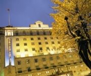
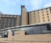
Looking for a place to stay? we compiled a list of available hotels close to the map centre further down the page.
When in this area, you might want to pay a visit to some of the following locations: Morley, Gildersome, Drighlington, Wakefield and Shadwell. To further explore this place, just scroll down and browse the available info.
Local weather forecast
Todays Local Weather Conditions & Forecast: 6°C / 44 °F
| Morning Temperature | 6°C / 42 °F |
| Evening Temperature | 8°C / 46 °F |
| Night Temperature | 4°C / 39 °F |
| Chance of rainfall | 1% |
| Air Humidity | 71% |
| Air Pressure | 1003 hPa |
| Wind Speed | Gentle Breeze with 7 km/h (4 mph) from South |
| Cloud Conditions | Broken clouds, covering 52% of sky |
| General Conditions | Light rain |
Friday, 26th of April 2024
8°C (47 °F)
3°C (38 °F)
Light rain, light breeze, overcast clouds.
Saturday, 27th of April 2024
9°C (49 °F)
5°C (42 °F)
Overcast clouds, gentle breeze.
Sunday, 28th of April 2024
7°C (44 °F)
5°C (42 °F)
Moderate rain, gentle breeze, overcast clouds.
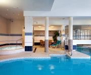
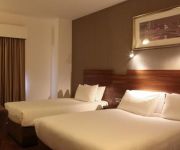
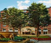
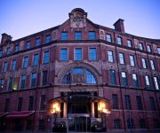
Hotels and Places to Stay
Quebecs Luxury Apartments 3 Infirmary Street
Hilton Leeds City
42 The Calls
Jurys Inn Leeds
VILLAGE LEEDS SOUTH
Leeds Marriott Hotel
Malmaison Leeds
Park Plaza Leeds
THE QUEENS - QHOTELS
Clayton Leeds
Videos from this area
These are videos related to the place based on their proximity to this place.
Leeds United 2-2 Galatasaray
Bundan tan 12 yıl önce 20 Nisan 2000'de .Galatasaray'ımızın İngiltere'de oynanan karşılaşmada Leeds United futbol takımıyla 2-2 berabere kalıp UEFA Kupası'nda finaline yükseldiğimiz...
Leeds United - Manchester United (Sep 20, 2011)
Another matchday experience seen through the eyes of an Amsterdam United fan (Leeds, Elland Road) Follow me on Twitter: https://twitter.com/pi_alfa Due to copyright restrictions I'm unable...
Leeds United - QPR 1973/74
December 1st, 1973. Leeds were indeed superior this season, but in early December QPR had climbed from 14th to 7th place with a nice run. A snowy Elland Road with QPR playing in their all red...
Video Request For althegamefreak Aphasia Village Part 1
This is the first part of kingsley's adventure for althegamefreak.
Video Request For althegamefreak Aphasia Village Part 3
3rd part of the video request for althegamefreak.
Video Request For althegamefreak Aphasia Village Part 2
Here's another part of the video request for althegamefreak.
Video Request For althegamefreak PoorLuck Village Part 3
3rd part of the video request for althegamefreak.
Video Request For althegamefreak PoorLuck Village Part 5
Final part of the video request for althegamefreak.
Video Request For althegamefreak PoorLuck Village Part 2
2nd part of the video request for althegamefreak.
Videos provided by Youtube are under the copyright of their owners.
Attractions and noteworthy things
Distances are based on the centre of the city/town and sightseeing location. This list contains brief abstracts about monuments, holiday activities, national parcs, museums, organisations and more from the area as well as interesting facts about the region itself. Where available, you'll find the corresponding homepage. Otherwise the related wikipedia article.
Elland Road
Elland Road is a football stadium in Leeds, West Yorkshire. It is the home of Leeds United A.F.C. since the club's foundation in 1919 and it was previously occupied by Leeds City. The stadium is the 12th largest football stadium in England, and the second largest outside the Premier League. The ground has hosted FA Cup semi-final matches as a neutral venue, and England international fixtures, having been selected as one of eight Euro 96 venues.
The Wendy House
The Wendy House is a goth and alternative nightclub based in Leeds, England. It generally occurs on the 3rd Saturday of every month from 9.00pm to 2.30am at Leeds University Union. The night was started in May 1998 by three graduates of the University of Leeds, who wanted the north of England to have something comparable with events at London venues such as The Slimelight and The Electric Ballroom. Originally the night was held in the (now defunct) Harvey Milk Bar of Leeds University Union.
City Evangelical Church, Leeds
City Evangelical Church is an independent evangelical church in Leeds, West Yorkshire, England. The church is affiliated to the Fellowship of Independent Evangelical Churches.
Stratford Street Mosque
Stratford Street Mosque (officially the Omar Mosque or Masjid-e-Umar) is a mosque in Beeston, Leeds, England. Three people responsible for the 7 July 2005 London bombings were regulars at Friday prayers at the mosque. The mosque is close to the home of Tanweer, who caused the Aldgate explosion. Stratford Street mosque is just a two streets away from his Colwyn Road home.
M621 motorway
The M621 is a short loop of motorway in England that takes traffic into central Leeds between the M1 and M62 motorways.
Leeds University Union
Leeds University Union (LUU) is the representative body for the students at the University of Leeds, England. LUU is a charity for over 32,000 students. LUU is led by students, although many of the decisions are made by staff. There are shops, bars and clubs in the Union building. Some of the money spent is used to support students in the form of funding for clubs and societies and a range of services including an advice centre, volunteering projects and academic support.
Middleton Railway
The Middleton Railway is the world's oldest continuously working public railway. It was founded in 1758 and is now a heritage railway run by volunteers from The Middleton Railway Trust Ltd. since 1960. The railway operates passenger services at weekends and on public holidays over approximately 1 mile of track between its headquarters at Moor Road, Hunslet, Leeds, West Yorkshire, England and Park Halt on the outskirts of Middleton Park.
White Rose Centre
The White Rose Centre is a shopping centre in the Beeston area of the City of Leeds, West Yorkshire, England. It spans two floors and is linked to the M621 motorway. It takes its name from the White Rose of York, the traditional symbol of Yorkshire. The Upper Level houses the Centre's 'Upper Circle' food court. There are 4,800 free car parking spaces, security arrangements and on-site Police officers.
Joseph Priestley College
Joseph Priestley College was a further education college founded in 1955 serving the communities of South Leeds, West Yorkshire, England. It was named after Joseph Priestley, the famous scientist and co-discoverer of oxygen who was born nearby. The college had three campuses, in Rothwell, Morley and Beeston. Following financial problem the college was merged with Leeds City College in August 2011.
Cottingley, Leeds
Cottingley is an urban area in the south-west of Leeds, West Yorkshire, England. Most of Cottingley is a 1960s council estate. The two tower blocks situated on a hill at the centre of the estate are Leeds's tallest flats. In the 1980s, these were in a poor condition, and had particular problems with squatters. At the end of the decade, they were refurbished and their condition was improved. Cottingley railway station serves the area.
Temple Works
Temple Works is a former flax mill in Holbeck, Leeds, West Yorkshire, England. It was designed by Joseph Bonomi the Younger and built by John Marshall between 1836 and 1840. Temple Works is the only Grade I listed building in Holbeck. Temple Works, also known as Temple Mill, was based on the Temple of Horus at Edfu in Egypt with a chimney designed in the style of an obelisk. Marshall's inspiration for the design of Temple Works was his interest in Egyptology.
Marshall's Mill
Marshall's Mill is a former flax spinning mill on Marshall Street in Holbeck, Leeds, West Yorkshire, England. Marshall's Mill was part of a complex begun in 1791-92 by English industrial pioneer John Marshall. It was a six storey mill, drawing water from the nearby Hol Beck, with machines supplanting Yorkshire's previous cottage industry of hand driven spindles. Later, together with the adjacent Egyptian-style Temple Works, the complex employed over 2,000 factory workers.
Midland Mills
Midland Mills is a former flax mill on Silver Street in Holbeck, Leeds, West Yorkshire.
Tower Works
Tower Works is a former factory notable for its three listed towers. It is located on Globe Road in Holbeck, Leeds, West Yorkshire, next to the Leeds and Liverpool Canal. The Italianate towers of the factory are a distinctive landmark on the Leeds skyline. The factory was founded by T.R. Harding to make steel pins for carding and combing in the textile industry, and the original buildings, by Thomas Shaw, were erected in 1864-6.
A647 road
The A647 is an A road in West Yorkshire, England that begins in Leeds and ends in Halifax. The road is approximately 18 miles (30 km) long. The road begins at the Armley Gyratory and goes via Armley, by-passes Stanningley and Pudsey, then onwards via Thornbury and then to the edge of Bradford city centre.
HM Prison Leeds
HM Prison Leeds is a Category B men's prison, located at Gloucester Terrace in the Armley area of Leeds in West Yorkshire, England, which opened in 1847. Leeds Prison is operated by Her Majesty's Prison Service, and is still known locally as Armley Gaol (or Armley Jail), the historical name for the prison.
Holbeck Urban Village
Holbeck Urban Village is the name given by local government and planning agencies to a mixed use urban renewal area south of Leeds railway station in Holbeck, West Yorkshire, England. The designated area, part of Holbeck, is located amongst ex-locomotive engineering and manufacturing buildings, some dating back to the 18th century on the south side of the River Aire. Among the listed buildings on the site are Marshall's Mill, Temple Works, Tower Works and the Round Foundry.
Middleton Park
Middleton Park is a public park in Middleton, Leeds, West Yorkshire, England. It covers an area of 630 acres (255 ha), nearly a square mile of which 200 acres (80.9 ha) are ancient woodland. There is also a small lake, recreational areas and a golf course. The reclaimed site of "Middleton Broom" Colliery has been incorporated into the park. By its northern boundary is the South Leeds Stadium, home of Hunslet Rugby League Club.
John Charles Centre for Sport
The John Charles Centre for Sport is a sports facility in South Leeds, West Yorkshire, England. It was previously named (and is still known locally as) the South Leeds Stadium and was renamed to honour John Charles (1931–2004), the former Leeds United, Juventus F.C. and Wales footballer. It is located to the south of Leeds city centre roughly on the border of Beeston, Belle Isle and Hunslet. The sports centre opened in 1996.
A643 road
The A643 is a main road in West Yorkshire, England. It starts at the Armley Gyratory and ends at junction 23 of the M62 Motorway and is approximately 18 miles long. The road goes through Morley, Birstall, Gomersal, Cleckheaton, Brighouse, Rastrick to the north of Huddersfield. The Leeds United AFC football stadium is named after the road part of the A643 that passes it, Elland Road. This road is so called because the A643 originally ended in town of Elland near Halifax.
Recreation Ground (Holbeck)
The Recreation Ground, Holbeck held eight first class cricket matches http://cricketarchive. com/Archive/Grounds/11/530_f. html. Yorkshire CCC played 3 county championship games at the site, including a Roses Match in 1868 and the touring Australians twice played there.
Brick Man
Brick Man was an Antony Gormley sculpture proposed for the city of Leeds, West Yorkshire, England. A male human figure standing over 100 feet (30 m) high, it would have stood on a triangle of land bounded by railway lines in the Holbeck area of the city, greeting travellers arriving at Leeds railway station. It would have cost £600,000 and been the largest sculpture in the UK at the time.
Morley Tunnel
Morley Tunnel is a railway tunnel in West Yorkshire, England, situated between Morley railway station and Batley railway station on the Huddersfield Line. From its northern end, it extends 4,320 yards, passing beneath Morley town centre, to its southern end .
St Mary the Virgin, Middleton
The Church of St Mary the Virgin, Middleton is a church in Middleton, West Yorkshire, England. It is an active Anglican parish church and part of the Armley deanery in the archdeaconry of Leeds and the diocese of Ripon and Leeds. The church and its lych gate are Grade II listed buildings.
St Cross Church, Middleton
The Church of St Cross, Middleton is a church in Middleton, Leeds, West Yorkshire, England. It is an active Anglican church and part of the Armley deanery in the archdeaconry of Leeds, Diocese of Ripon and Leeds.


