Safety Score: 3,0 of 5.0 based on data from 9 authorites. Meaning we advice caution when travelling to United Kingdom.
Travel warnings are updated daily. Source: Travel Warning United Kingdom. Last Update: 2024-04-26 08:02:42
Delve into Thorner
Thorner in Leeds (England) with it's 1,408 habitants is located in United Kingdom about 171 mi (or 276 km) north of London, the country's capital town.
Current time in Thorner is now 11:24 AM (Friday). The local timezone is named Europe / London with an UTC offset of one hour. We know of 9 airports close to Thorner, of which 5 are larger airports. The closest airport in United Kingdom is Leeds Bradford Airport in a distance of 10 mi (or 15 km), West. Besides the airports, there are other travel options available (check left side).
There are several Unesco world heritage sites nearby. The closest heritage site in United Kingdom is Liverpool – Maritime Mercantile City in a distance of 36 mi (or 58 km), South-East. Also, if you like playing golf, there are some options within driving distance. If you need a hotel, we compiled a list of available hotels close to the map centre further down the page.
While being here, you might want to pay a visit to some of the following locations: Scarcroft, Shadwell, Collingham, Wetherby and Clifford. To further explore this place, just scroll down and browse the available info.
Local weather forecast
Todays Local Weather Conditions & Forecast: 6°C / 43 °F
| Morning Temperature | 2°C / 35 °F |
| Evening Temperature | 7°C / 44 °F |
| Night Temperature | 2°C / 35 °F |
| Chance of rainfall | 2% |
| Air Humidity | 83% |
| Air Pressure | 1005 hPa |
| Wind Speed | Gentle Breeze with 7 km/h (4 mph) from South-West |
| Cloud Conditions | Overcast clouds, covering 99% of sky |
| General Conditions | Light rain |
Saturday, 27th of April 2024
9°C (49 °F)
3°C (37 °F)
Light rain, gentle breeze, overcast clouds.
Sunday, 28th of April 2024
8°C (46 °F)
5°C (41 °F)
Moderate rain, gentle breeze, overcast clouds.
Monday, 29th of April 2024
13°C (56 °F)
8°C (46 °F)
Light rain, moderate breeze, scattered clouds.
Hotels and Places to Stay
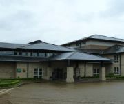
Wood Hall Hotel and Spa
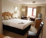
Thorpe Park Hotel & Spa
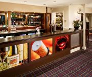
Holiday Inn LEEDS - GARFORTH
Britannia Leeds
Mercure Wetherby
Holiday Inn Express LEEDS - EAST
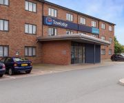
TRAVELODGE LEEDS COLTON
Leeds East
Videos from this area
These are videos related to the place based on their proximity to this place.
Collingham
Some shots of leaders kayaking on a nice Spring day at Collingham, River Wharfe. Happy Birthday Richard.
Ollie Riley - from Hair Cut to Square Cut
Ollie Riley helps himself to a square-cut four in TABS U11 victory against close rivals Collingham & Linton.
We Decided To Rudely Awaken Other Campers
Sex Rains amazing camping trip when we decide that we shouldn't be the only ones awake. And at the end i'm sure you'll wonder whos weird laugh it is.... It's Alexs.
Uncoupler
A quick video showing how to make a uncoupler, for tension lock couplers on modal railway's / railroads.
Barwick-in-Elmet
An introduction to the ancient village of Barwick-in-Elmet, near Leeds, West Yorkshire. This short video gives an idea of the character of the village and shows some of the shops and other...
Maintaining Barwick's Maypole
Every three years, on Easter Monday, the villagers of Barwick-in-Elmet near Leeds take down their 86-foot maypole. That doesn't give volunteers Kath and Carl Whitfield long to check it, make...
Near Miss - Idiot Car Driver - Barwick in Elmet VW Fox YB59GWY
This car driver came out of a side road without looking. I had to swerve to avoid crashing into him. The car is a VW Fox Reg No. YB59GWY.
TV Aerials Scarcroft
TV Aerials and Satellites Fitted in Scarcroft http://www.adi-tvaerialsscarcroft.co.uk Fitting Aerials and Satellites in Scarcroft. We are fully qualified, professional and are able to offer...
Videos provided by Youtube are under the copyright of their owners.
Attractions and noteworthy things
Distances are based on the centre of the city/town and sightseeing location. This list contains brief abstracts about monuments, holiday activities, national parcs, museums, organisations and more from the area as well as interesting facts about the region itself. Where available, you'll find the corresponding homepage. Otherwise the related wikipedia article.
Cock Beck
Cock Beck is a stream in the outlying areas of East Leeds, West Yorkshire, England, which runs from its source due to a runoff north-west of Whinmoor, skirting east of Swarcliffe and Manston (where a public house has been named 'The Cock Beck'), past Pendas Fields, Scholes, Barwick-in-Elmet, Aberford, Towton, Stutton, and Tadcaster, where it flows into the River Wharfe. It is a tributary of the River Wharfe, and also known as the River Cock or Cock River.
Elmet (UK Parliament constituency)
Elmet was a county constituency in West Yorkshire represented in the House of Commons of the Parliament of the United Kingdom. It elected one Member of Parliament (MP) by the first past the post system of election. From 1997 the MP was Colin Burgon of Labour, who did not stand in the 2010 general election.
Bardsey cum Rigton
Bardsey cum Rigton is a civil parish in the City of Leeds metropolitan borough in West Yorkshire, England. According to the 2001 census it had a population of 2,385. The parish includes the villages of Bardsey, East Rigton and Thornhurst.
Barwick-in-Elmet Castle
Barwick-in-Elmet Castle was in the village of Barwick-in-Elmet, West Yorkshire, England to the east of Leeds. Originally the site of an Iron Age hill fort, a motte and bailey castle was erected by the Norman Ilbert de Lacy on the southern end of the hill fort. Most of the bailey to the east of Hall Tower Hill has now been built on and destroyed.
Kirklees Way
The Kirklees Way is a 72 mile (115 km) waymarked footpath in Kirklees metropolitan district, West Yorkshire, England. It was opened in 1990 and includes the upper Colne Valley, Spen Valley and Holme Valley.
Wothersome
Wothersome is a civil parish in the City of Leeds metropolitan borough, West Yorkshire, England. It is south of Wetherby, north east of Leeds and west of Bramham. It has a population of 40. In 1848 it was described as having 3 farms totalling 600 acres and a population of 19 people. It was a township in Bardsey parish in the Skyrack wapentake, lower division, in the West Riding of Yorkshire. In 1871 the population of Wothersome was 24; in 1901 it was 28; it 1971 it was 26.
Battle of Seacroft Moor
The Battle of Seacroft Moor, on 30 March 1643, was a decisive loss for the Parliamentary forces during the First Civil War. It took place near Seacroft, north east of Leeds, West Yorkshire, England. The battle reportedly turned the Cock Beck, which ran through the battlefield, red with the casualties' blood for several days.
The Bingley Arms
The Bingley Arms is an old pub in Bardsey, Leeds, which was originally called The Priests Inn. It is claimed to be the oldest pub in Britain, including by the Guinness Book of Records, with a known history dating back to AD 953 and evidence suggesting it could date to AD 905. It is also said that it served as a safehouse for persecuted Catholic priests and also as a courthouse from around AD 1000, from which offenders were taken to the pillory across the road.


