Safety Score: 3,0 of 5.0 based on data from 9 authorites. Meaning we advice caution when travelling to United Kingdom.
Travel warnings are updated daily. Source: Travel Warning United Kingdom. Last Update: 2024-04-24 08:14:40
Delve into Harehills
Harehills in Leeds (England) is located in United Kingdom about 170 mi (or 273 km) north of London, the country's capital town.
Current time in Harehills is now 07:33 PM (Wednesday). The local timezone is named Europe / London with an UTC offset of one hour. We know of 9 airports close to Harehills, of which 5 are larger airports. The closest airport in United Kingdom is Leeds Bradford Airport in a distance of 7 mi (or 11 km), North-West. Besides the airports, there are other travel options available (check left side).
There are several Unesco world heritage sites nearby. The closest heritage site in United Kingdom is Liverpool – Maritime Mercantile City in a distance of 35 mi (or 56 km), South-East. Also, if you like playing golf, there are some options within driving distance. If you need a hotel, we compiled a list of available hotels close to the map centre further down the page.
While being here, you might want to pay a visit to some of the following locations: Leeds, Shadwell, Scarcroft, Thorner and Morley. To further explore this place, just scroll down and browse the available info.
Local weather forecast
Todays Local Weather Conditions & Forecast: 7°C / 45 °F
| Morning Temperature | 4°C / 40 °F |
| Evening Temperature | 7°C / 45 °F |
| Night Temperature | 5°C / 40 °F |
| Chance of rainfall | 0% |
| Air Humidity | 61% |
| Air Pressure | 1017 hPa |
| Wind Speed | Gentle Breeze with 8 km/h (5 mph) from South |
| Cloud Conditions | Broken clouds, covering 75% of sky |
| General Conditions | Broken clouds |
Thursday, 25th of April 2024
7°C (45 °F)
3°C (37 °F)
Light rain, gentle breeze, overcast clouds.
Friday, 26th of April 2024
10°C (49 °F)
4°C (38 °F)
Light rain, gentle breeze, scattered clouds.
Saturday, 27th of April 2024
11°C (51 °F)
6°C (43 °F)
Broken clouds, gentle breeze.
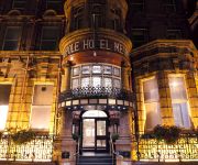
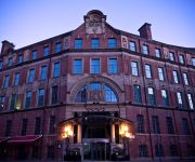
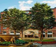
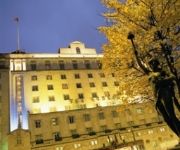
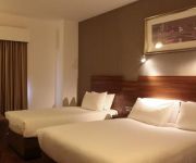
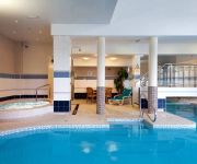
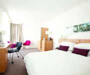
Hotels and Places to Stay
Quebecs Luxury Apartments 3 Infirmary Street
The Met Hotel PH Hotels
42 The Calls
Malmaison Leeds
Leeds Marriott Hotel
THE QUEENS - QHOTELS
Jurys Inn Leeds
Leeds Radisson Blu Hotel
Hilton Leeds City
DoubleTree by Hilton Hotel Leeds City Centre
Videos from this area
These are videos related to the place based on their proximity to this place.
Crossfit Leeds - 13.5
Thursday night at the Box and the big guns ore out to take on the final WOD of the 2013 Open.
Leeds Nagar Kirtan 2014
Leeds Nagar Kirtan 2014 From The Sikh Temple to Gurudwara Shri Guru Hargobind Singh Ji to Gurdwara Guru Kalgidhar Sahib, to Ramgharia Board to Millennium Square.
Car Locksmith Leeds | Call: 07966 986 939
Car Locksmith Leeds. If you need a Car Locksmith based in Leeds or an Auto Locksmith Leeds specialist stay on this page. Here you will find specialist expert Car Locksmith Leeds and Emergency...
2 bedroom brand new fully furnished apartment to rent in Leeds city centre £695AVI.AVI
http://flatsinleeds.com/rentals/Leeds/City%20Centre/477/property.aspx?From=SearchResults Cypress Point, City Centre, Leeds LS2 7LB - Apartment / Flat Trendy and totally brand new fully...
GREAT VALUE ONE BED APARTMENT TO LET IN LEEDS CITY CENTRE
Studio / crashpad that sits on the border of the ever expanding city centre and suburbia. Hallway leading to an open plan lounge with sofa and dining table overlooking the contemporary roof...
Echo Central 2 properties to rent in Leeds 2 bedrooms
STUNNING 7th floor apartment in this fantastic development. This 2 bedroom property enjoys great views from it's large balcony and has a very light and spacious feel to it. The large open plan...
Minecraft Lets Play (The City of Testifica 2] Episode 1
cool map with Reece ------------------------------------------------[download]------------------------------------------------ http://www.minecraftmaps.com/adventure-maps/the-city-of-testifica-2/v...
Dead Island Riptide Walkthrough Part 16 [All Blueprints/Side Quests & Collectibles]
Dead Island Riptide Walkthrough Part 16 no commentary Dead Island Riptide Gameplay Walkthrough Part 1 NO COMMENTARY let's play "Dead Island Riptide walkthrough part 1" no commentary ...
Videos provided by Youtube are under the copyright of their owners.
Attractions and noteworthy things
Distances are based on the centre of the city/town and sightseeing location. This list contains brief abstracts about monuments, holiday activities, national parcs, museums, organisations and more from the area as well as interesting facts about the region itself. Where available, you'll find the corresponding homepage. Otherwise the related wikipedia article.
Gledhow
Gledhow is a suburb of north-east Leeds, West Yorkshire, England, situated east of Chapel Allerton and west of Roundhay. A major feature of the area is Gledhow Valley, a strip of mixed deciduous woodland with a beck and lake. A bathhouse dating from 1671, the Gipton Spa, is in the woods. Running through the valley is Gledhow Valley Road, built in 1926. Gledhow Lane crosses Gledhow Valley Road and on the Eastern side is a steep road up from the valley.
Sheepscar
Sheepscar is an inner city district of Leeds in West Yorkshire England, lying to the north east of Leeds city centre. It is overlooked by the tower blocks of Little London and Lovell Park to the west, and gives way to Meanwood in the north-west, Chapeltown in the north-east and Burmantofts in the east. Clay Pit Lane, effectively an urban motorway, runs through Sheepscar to the south, while Scott Hall Road makes up the eastern border.
St James's University Hospital
St. James's University Hospital is in Leeds, West Yorkshire, England. It is popularly known as Jimmy's and is one of the United Kingdom's most famous hospitals. Its fame derives in part from its extensive television coverage in the documentary series also titled "Jimmy's", screened by Yorkshire Television (YTV) between 1987 and 1994 with a theme tune performed by Snake Davis.
Thackray Museum
The Thackray Museum in Leeds, West Yorkshire, England, is a museum of the history of medicine adjacent to St James's Hospital. Since it opened in 1997 it has won "Museum of the Year" and other awards. The building is a Grade II listed building, the former Leeds Union Workhouse, built in 1858 to accommodate 784 paupers. By the end of the 19th century, the buildings had become largely used for medical care of the poor, rather than workhouse and training.
Yorkshire Amateur A.F.C
Yorkshire Amateur A.F.C. are a football club based in Leeds, West Yorkshire, England. They were formed in 1918, and two years later became founding members of the Yorkshire Football League. For the 2012–13 season, Yorkshire Amateur are members of the Northern Counties East League Division One.
Potternewton
Potternewton is a suburb and parish of north-east Leeds, West Yorkshire, England, situated between Chapeltown and Chapel Allerton, mainly in the LS7 postcode and partly in LS8. It is between Scott Hall Road on the West and Roundhay Road on the East, with Harehills Lane on the North. The main thoroughfare is Chapeltown Road, and it is often taken to be part of a larger area referred to as Chapeltown. On some maps Potternewton included the Chapeltown and Scott Hall areas and partly Harehills.
Leeds Thomas Danby
Leeds Thomas Danby (formerly Thomas Danby College) was a further education college in Leeds, West Yorkshire, England offering courses for 16-18 year-olds and adults. The college was named after the first Mayor of Leeds, Captain Thomas Danby of Farnley. On 1 April 2009, Leeds Thomas Danby merged with Park Lane College and the Leeds College of Technology to form the new Leeds City College. The Leeds Thomas Danby site is now known as the Thomas Danby Campus of the new college.
St Aidan's Church, Leeds
St Aidan's Church in Harehills, Leeds, West Yorkshire is a Church of England parish church built in 1894. It is a large Victorian basilica-type red-brick building which is Grade II* listed. A church hall is adjacent. The architects were Johnson and Crawford Hick of Newcastle. The church was consecrated by John Pulleine, Bishop of Richmond, on 13 October 1894. The first vicar was Samuel Mumford Taylor who later became Bishop of Kingston-upon-Thames.
Mabgate
Mabgate is an inner city area of Leeds, West Yorkshire, England. The name Mabgate comes from Mable-gate, Mable being a middle English reference to 'loose women'. This is perhaps somewhat apt as for many years Mabgate has been one of the city's red light districts, although less so then Spencer Place in Chapeltown and in recent years Water Lane in Holbeck. The area defined as Mabgate is a small area, mainly made up of derelict and unused industrial units.
Lincoln Green
Lincoln Green is an area of Leeds, West Yorkshire, England. The area is mainly residential with a small local shopping centre. The area also has a public house, The Harp, and a working men's club, The North Leeds WMC. Most housing in Lincoln Green is council-owned high-rise flats; these are in a significantly worse condition then those in other areas of the city. Lincoln Green is one of the most deprived areas of the city.
Spencer Place
Spencer Place is a road that runs approximately North-South between Harehills and Chapeltown in the city of Leeds, West Yorkshire, England. At the north end it intersects with Harehills Lane, at the corner of Potternewton Park. At the south end it forms a junction with Roundhay Road. It is home to the Leeds Jamia Mosque and Chapeltown Health Centre. It was the heart of one of Leeds' main red light districts and was associated with prostitution, gun crime and drug crime.
Leeds Gamma Knife Centre
Leeds Gamma Knife Centre is based in the Institute of Oncology at St. James’s University Hospital in Leeds, West Yorkshire, England. The National Health Service (NHS) hospital known to millions of TV viewers as ‘Jimmy’s, St. James's Institute of Oncology (Bexley Wing) is the largest cancer research hospital in Europe. There are only five centres in the UK which specialise in the treatment of brain disease by a Gamma Knife.






!['Minecraft Lets Play (The City of Testifica 2] Episode 1' preview picture of video 'Minecraft Lets Play (The City of Testifica 2] Episode 1'](https://img.youtube.com/vi/lU8omHswPnA/mqdefault.jpg)
!['Dead Island Riptide Walkthrough Part 16 [All Blueprints/Side Quests & Collectibles]' preview picture of video 'Dead Island Riptide Walkthrough Part 16 [All Blueprints/Side Quests & Collectibles]'](https://img.youtube.com/vi/oAqvYh9gL0g/mqdefault.jpg)
