Safety Score: 3,0 of 5.0 based on data from 9 authorites. Meaning we advice caution when travelling to United Kingdom.
Travel warnings are updated daily. Source: Travel Warning United Kingdom. Last Update: 2024-04-26 08:02:42
Discover Swillington
Swillington in Leeds (England) with it's 3,088 citizens is a place in United Kingdom about 165 mi (or 266 km) north of London, the country's capital city.
Current time in Swillington is now 08:39 AM (Saturday). The local timezone is named Europe / London with an UTC offset of one hour. We know of 9 airports near Swillington, of which 5 are larger airports. The closest airport in United Kingdom is Leeds Bradford Airport in a distance of 12 mi (or 19 km), North-West. Besides the airports, there are other travel options available (check left side).
There are several Unesco world heritage sites nearby. The closest heritage site in United Kingdom is Liverpool – Maritime Mercantile City in a distance of 30 mi (or 49 km), South-East. Also, if you like playing golf, there are a few options in driving distance. If you need a hotel, we compiled a list of available hotels close to the map centre further down the page.
While being here, you might want to pay a visit to some of the following locations: Normanton, Ledston, Thorner, Aberford and Sharlston. To further explore this place, just scroll down and browse the available info.
Local weather forecast
Todays Local Weather Conditions & Forecast: 9°C / 48 °F
| Morning Temperature | 2°C / 36 °F |
| Evening Temperature | 8°C / 46 °F |
| Night Temperature | 6°C / 43 °F |
| Chance of rainfall | 0% |
| Air Humidity | 66% |
| Air Pressure | 1007 hPa |
| Wind Speed | Moderate breeze with 10 km/h (6 mph) from South-West |
| Cloud Conditions | Overcast clouds, covering 87% of sky |
| General Conditions | Light rain |
Sunday, 28th of April 2024
5°C (41 °F)
4°C (40 °F)
Moderate rain, moderate breeze, overcast clouds.
Monday, 29th of April 2024
13°C (56 °F)
8°C (47 °F)
Scattered clouds, moderate breeze.
Tuesday, 30th of April 2024
17°C (62 °F)
10°C (50 °F)
Light rain, moderate breeze, scattered clouds.
Hotels and Places to Stay
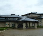
Holiday Inn LEEDS - GARFORTH
Thorpe Park Hotel & Spa
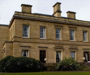
OULTON HALL - QHOTELS
The Grange
Holiday Inn Express LEEDS - EAST
Britannia Leeds
York House Hotel
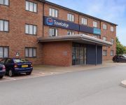
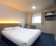
TRAVELODGE LEEDS COLTON
TRAVELODGE WAKEFIELD
Leeds East
Videos from this area
These are videos related to the place based on their proximity to this place.
Searching for Glow Worms at Townclose Hills
One of the new sites we are managing in partnership with Leeds City Council, Townclose Hills is a SSSI, known for its magnesium limestone flora. It is also the home of glow worms. Glow worms...
Allerton Bywater Colliery Railways
Google Earth satellite image of Allerton Bywater/ Great Preston (West Yorkshire) with 1953 OS map superimposed on top.
Wonder Stuff - Circle Square - Garforth Festival 2014
Wonder Stuff - Circle Square - Garforth Festival 2014.
Greenpeace at Garforth Arts Festival 2013
Recorded on 6th July 2013. "See You Later" by Pitx (feat. Fireproof Babies, Bmccosar) http://ccmixter.org/files/Pitx/17154 is licensed under a Creative Commons license: http://creativecommons.org/...
Working Model Draglines Of Big Bob & Oddball
Here are two 50:1 scale working models of Ransome Rapier W2000 Walking Dragline known as "Big Bob" & also Bucyrus Erie 1150 Walking Dragline known as Oddball both built by Neville Wilkinson.
Videos provided by Youtube are under the copyright of their owners.
Attractions and noteworthy things
Distances are based on the centre of the city/town and sightseeing location. This list contains brief abstracts about monuments, holiday activities, national parcs, museums, organisations and more from the area as well as interesting facts about the region itself. Where available, you'll find the corresponding homepage. Otherwise the related wikipedia article.
Oulton, West Yorkshire
Oulton is a village in the City of Leeds metropolitan borough, West Yorkshire, England, between Leeds and Wakefield. It is at the junction of the A639 and A642 roads. Though now adjoining the village of Woodlesford, it was once quite separate. It was once part of the urban district of Rothwell. Oulton Hall was built in 1850 and is now a hotel and conference centre. Oulton's most famous son is Richard Bentley who became Master of Trinity College, Cambridge.
Pendas Fields
Pendas Fields is a private, suburban housing estate in Leeds, West Yorkshire, England. It is considered part of Cross Gates, as is Manston. Swarcliffe is close, and Cock Beck runs nearby.
Great Preston
Great Preston is a small village in the City of Leeds metropolitan borough, West Yorkshire, England. It is situated 8 miles (13 km) south east of Leeds city centre, near to the town of Garforth and the villages of Kippax, Swillington and Little Preston. The village is in the LS26 Leeds postcode area, and forms part of the civil parish of Great and Little Preston, which has a population of 1,449. Great Preston has one pub, a local cricket and football team, a post office and a village hall.
St. Mary's Church, Swillington
St. Mary's Church is located on Church Lane next to Swillington Primary School, on Wakefield Road, Swillington, West Yorkshire, England. There has been a church at this location for at least 900 years. The Domesday Book of 1086 notes that 'a church is there' but no other records of that building remain. The church on the site today is a Grade II* listed building, over 600 years old, built around 1360. It is in need of repairs, especially the nave roof, estimated to cost around £250,000.
Woodlesford
Woodlesford is a village in the metropolitan county of West Yorkshire, England, six miles south-east of Leeds city centre. It is in the City of Leeds metropolitan borough. Woodlesford was formerly part of the Rothwell Urban District The name is first attested between 1188 and 1202, in the form Widlesford, with other medieval forms including Wryd(e)lesford(e). These other forms are closer to the likely origin: Old English *wrīdels 'thicket' + ford 'ford'.
Mickletown
Mickletown is a district within the village of Methley, south of Leeds, West Yorkshire, England, Methley, sits within the delta of two rivers. The southern boundary is the River Calder and it's northern boundary River Aire. It is in the City of Leeds metropolitan borough. The Leeds Country Way and the Trans Pennine Trail both pass Mickletown.
West Riding County Football Association
The West Riding County Football Association is the governing body of football in the area covered by the administrative county of the West Riding of Yorkshire.
Austhorpe Hall
Austhorpe Hall is a house built in 1694 at Austhorpe, Leeds, West Yorkshire, England. It is a grade II* listed building. The house is of red brick with stone quoins, seven bays and three storeys, with a triangular pediment over the door. Pevsner describes it as "A remarkably early case of acceptance of the classical idiom".


