Safety Score: 3,0 of 5.0 based on data from 9 authorites. Meaning we advice caution when travelling to United Kingdom.
Travel warnings are updated daily. Source: Travel Warning United Kingdom. Last Update: 2024-04-28 08:22:10
Discover Methley
Methley in Leeds (England) with it's 1,184 citizens is a town in United Kingdom about 162 mi (or 261 km) north of London, the country's capital city.
Current time in Methley is now 09:52 PM (Sunday). The local timezone is named Europe / London with an UTC offset of one hour. We know of 9 airports near Methley, of which 5 are larger airports. The closest airport in United Kingdom is Leeds Bradford Airport in a distance of 14 mi (or 23 km), North-West. Besides the airports, there are other travel options available (check left side).
There are several Unesco world heritage sites nearby. The closest heritage site in United Kingdom is Liverpool – Maritime Mercantile City in a distance of 28 mi (or 44 km), South-East. Also, if you like playing golf, there are a few options in driving distance. Looking for a place to stay? we compiled a list of available hotels close to the map centre further down the page.
When in this area, you might want to pay a visit to some of the following locations: Normanton, Sharlston, Ledston, Featherstone and Crofton. To further explore this place, just scroll down and browse the available info.
Local weather forecast
Todays Local Weather Conditions & Forecast: 6°C / 43 °F
| Morning Temperature | 5°C / 42 °F |
| Evening Temperature | 8°C / 47 °F |
| Night Temperature | 5°C / 41 °F |
| Chance of rainfall | 22% |
| Air Humidity | 94% |
| Air Pressure | 1002 hPa |
| Wind Speed | Moderate breeze with 10 km/h (6 mph) from South-East |
| Cloud Conditions | Overcast clouds, covering 100% of sky |
| General Conditions | Heavy intensity rain |
Monday, 29th of April 2024
13°C (56 °F)
11°C (52 °F)
Light rain, moderate breeze, broken clouds.
Tuesday, 30th of April 2024
16°C (62 °F)
10°C (50 °F)
Light rain, moderate breeze, scattered clouds.
Wednesday, 1st of May 2024
17°C (63 °F)
12°C (54 °F)
Light rain, gentle breeze, broken clouds.
Hotels and Places to Stay
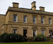
The Grange
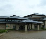
Holiday Inn LEEDS - GARFORTH
OULTON HALL - QHOTELS
Thorpe Park Hotel & Spa
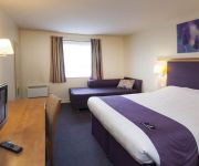
Holiday Inn Express LEEDS - EAST
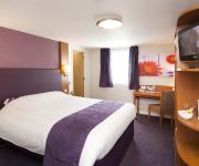
TRAVELODGE LEEDS COLTON
Castleford M62 Jct 31
M62 J32) Castleford (Xscape
Leeds East
Videos from this area
These are videos related to the place based on their proximity to this place.
YESSS Group 2015 UK
We proudly achieved 1.1billion in sales over 2013-14. How? By providing superior value and delivering world class Supplies Service and Solutions • Across 11 countries • 90 Branches in...
Wholesaler of the Year for a second time!
YESSS win a second award for 'Wholesaler of the Year', in addition to being the first electrical wholesale company in the UK to gain all three BSI industry standards. All this after just two...
YESSS Moments - Dave
On a cold and miserable winter morning Dave, an electrical contractor, is having a rough start to the day. He's been let down by his regular electrical supplier (and his kettle!) an hour...
Searching for Glow Worms at Townclose Hills
One of the new sites we are managing in partnership with Leeds City Council, Townclose Hills is a SSSI, known for its magnesium limestone flora. It is also the home of glow worms. Glow worms...
Aqua Plastics Water Feature
http://www.liquidbyaqua.co.uk http://www.aquaplastics.co.uk A view of our 1 metre high prototype panel. Originally designed for sensory rooms for the disabled, the Aqua Panel that we've...
john kennedy siging brown eyed girl in white lion
6.5.12 white lion in castleford great evenings and amazing atmosphere come and join us from 4pm mon-fri an 12pm sat-sun thanks and enjoy.
Allerton Bywater Colliery Railways
Google Earth satellite image of Allerton Bywater/ Great Preston (West Yorkshire) with 1953 OS map superimposed on top.
Videos provided by Youtube are under the copyright of their owners.
Attractions and noteworthy things
Distances are based on the centre of the city/town and sightseeing location. This list contains brief abstracts about monuments, holiday activities, national parcs, museums, organisations and more from the area as well as interesting facts about the region itself. Where available, you'll find the corresponding homepage. Otherwise the related wikipedia article.
Normanton (UK Parliament constituency)
Normanton was a county constituency represented in the House of Commons of the Parliament of the United Kingdom. It elected one Member of Parliament (MP) by the first past the post system of election.
Great Preston
Great Preston is a small village in the City of Leeds metropolitan borough, West Yorkshire, England. It is situated 8 miles (13 km) south east of Leeds city centre, near to the town of Garforth and the villages of Kippax, Swillington and Little Preston. The village is in the LS26 Leeds postcode area, and forms part of the civil parish of Great and Little Preston, which has a population of 1,449. Great Preston has one pub, a local cricket and football team, a post office and a village hall.
All Saints Church, Normanton
All Saints Church is the parish church in Normanton, West Yorkshire, England.
Mickletown
Mickletown is a district within the village of Methley, south of Leeds, West Yorkshire, England, Methley, sits within the delta of two rivers. The southern boundary is the River Calder and it's northern boundary River Aire. It is in the City of Leeds metropolitan borough. The Leeds Country Way and the Trans Pennine Trail both pass Mickletown.
Savile Park
Savile Park Cricket Ground on Lumley Street in Castleford held a list A limited overs game in May 1967 when Yorkshire CCC played Cambridgeshire in the Gillette Cup, bowling the visitors out for 43. In May 2000 the touring Zimbabwe team defeated a strong Marylebone Cricket Club side in another List A game at the venue http://cricketarchive. com/Archive/Grounds/11/385_a. html. It has also hosted many Yorkshire Second XI games and Minor Counties fixtures in addition to Castleford club cricket.
West Riding County Football Association
The West Riding County Football Association is the governing body of football in the area covered by the administrative county of the West Riding of Yorkshire.
Lower Mickletown
Lower Mickletown is a hamlet in the City of Leeds District, in the English county of West Yorkshire.
Wakefield Europort
Wakefield Europort is a rail connnected warehousing and industrial estate located to the northeast of Wakefield at junction 31 of the M62 motorway in West Yorkshire, England. It opened in 1996 in anticipation of increased international railfreight due to the construction of the Channel Tunnel. As of 2012 the site employs over 3000 persons, and has motorway, high capacity rail, and waterway (canal) transport access.


