Safety Score: 3,0 of 5.0 based on data from 9 authorites. Meaning we advice caution when travelling to United Kingdom.
Travel warnings are updated daily. Source: Travel Warning United Kingdom. Last Update: 2024-04-20 08:25:34
Touring Robin Hood
Robin Hood in Wakefield (England) is a town located in United Kingdom about 165 mi (or 265 km) north of London, the country's capital place.
Time in Robin Hood is now 09:31 AM (Saturday). The local timezone is named Europe / London with an UTC offset of one hour. We know of 9 airports nearby Robin Hood, of which 5 are larger airports. The closest airport in United Kingdom is Leeds Bradford Airport in a distance of 11 mi (or 17 km), North-West. Besides the airports, there are other travel options available (check left side).
There are several Unesco world heritage sites nearby. The closest heritage site in United Kingdom is Liverpool – Maritime Mercantile City in a distance of 31 mi (or 50 km), South-East. Also, if you like the game of golf, there are several options within driving distance. Need some hints on where to stay? We compiled a list of available hotels close to the map centre further down the page.
Being here already, you might want to pay a visit to some of the following locations: Wakefield, Leeds, Morley, Normanton and Crigglestone. To further explore this place, just scroll down and browse the available info.
Local weather forecast
Todays Local Weather Conditions & Forecast: 10°C / 50 °F
| Morning Temperature | 4°C / 39 °F |
| Evening Temperature | 8°C / 47 °F |
| Night Temperature | 5°C / 41 °F |
| Chance of rainfall | 0% |
| Air Humidity | 43% |
| Air Pressure | 1030 hPa |
| Wind Speed | Gentle Breeze with 7 km/h (5 mph) from South-West |
| Cloud Conditions | Broken clouds, covering 63% of sky |
| General Conditions | Broken clouds |
Sunday, 21st of April 2024
8°C (47 °F)
7°C (44 °F)
Overcast clouds, light breeze.
Monday, 22nd of April 2024
8°C (46 °F)
7°C (45 °F)
Light rain, light breeze, overcast clouds.
Tuesday, 23rd of April 2024
7°C (44 °F)
5°C (41 °F)
Overcast clouds, moderate breeze.
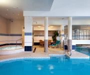
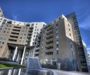
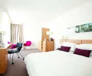
Hotels and Places to Stay
Quebecs Luxury Apartments 3 Infirmary Street
THE QUEENS - QHOTELS
Leeds Marriott Hotel
Park Plaza Leeds
Hilton Leeds City
Gateway Apartments
Leeds Radisson Blu Hotel
DoubleTree by Hilton Hotel Leeds City Centre
Jurys Inn Leeds
Clayton Leeds
Videos from this area
These are videos related to the place based on their proximity to this place.
The first Scarborough Spa Express of 2012, Outwood nr Wakefield with 46115
Royal Scot class 46115 Scots Guardsman powers the first SSE of the Summer up the incline out of Wakefield through Outwood just about on-time. I left some footage in at the start for those of...
Girls Aloud Dance Deans Birthday Lofthouse Golf Club
Wives and girlfriends put on a girls aloud dance routine for Deans birthday as a surprise.
L20LAK Belle Isle Road Nesfield View Careful Driving Near Miss
Did the driver not see me? Did they just terribly misjudge the distance? If I hadn't have braked and swerved several metres out of the cycle lane, I would have been under her wheels. Apr 1 2014 18:49.
G-Star Competition - Leeds - Boys C 1 Meter
Michael dives in the first G Star competition at the new pool in Leeds.
RESERVES Hunslet Hawks v Keighely Cougars 14th August 2009
Cougars Reserves had a nightmare evening at South Leeds Stadium when they they were outmuscled by a much larger, older and more experienced Hunslet Hawks.
Michael & Joe at the NER Leg 3 - 3M Synchro Mens Open
Michael & Joe at the NER Leg 3 - 3M Synchro Mens Open.
KQ2H 10 metre repeater being received by M0VKG at +30dB in IO93gs
10 metres is waking up... KQ2H being received in Rothwell, West Yorkshire (IO93gs) on 22.10.2011 at about 2pm. HRD shows the received signal peaking at S9+30dB at times.
Videos provided by Youtube are under the copyright of their owners.
Attractions and noteworthy things
Distances are based on the centre of the city/town and sightseeing location. This list contains brief abstracts about monuments, holiday activities, national parcs, museums, organisations and more from the area as well as interesting facts about the region itself. Where available, you'll find the corresponding homepage. Otherwise the related wikipedia article.
Rhubarb Triangle
The Rhubarb Triangle is a 9-square-mile triangle in West Yorkshire, England between Wakefield, Morley and Rothwell famous for producing early forced rhubarb. It includes Kirkhamgate, East Ardsley, Stanley, Lofthouse and Carlton. The Rhubarb Triangle was originally much bigger, covering an area between Leeds, Bradford and Wakefield. From the first decade of the 20th century to 1939 the rhubarb industry expanded and at its peak covered an area of about 30-square-mile .
West Ardsley
West Ardsley is commonly used to refer to an area on the south-west edge of the City of Leeds metropolitan borough, possessing a WF postcode in the WF3 (Wakefield) postcode area while the village telephone numbers are "0113", the Leeds prefix. Historically part of the West Riding of Yorkshire, it roughly approximates to an amalgamation of Tingley, Woodkirk, Hill Top, Upper Green and Common Side. The parish church is at Woodkirk.
Lawns, West Yorkshire
Lawns is a district of Wakefield in the English county of West Yorkshire. It is near junction 41 of the M1 motorway between Wakefield and Leeds.
Lofthouse Colliery disaster
The Lofthouse Colliery disaster was a mining accident which took place in Lofthouse, West Yorkshire, England on 21 March 1973. A new coalface was excavated too close to an abandoned, flooded 19th century mineshaft. The sudden inrush of three million gallons of water trapped seven mine workers 750 feet (228.6 metres) below ground. A six-day rescue operation was carried out but succeeded in recovering only one body.
Stourton, Leeds
Stourton is a mainly industrial area of the city of Leeds, West Yorkshire, England. The area is 2 miles (3 km) to the south east of Leeds city centre and lies between Hunslet, the M1 motorway and Cross Green in the LS10 postcode area. Until the local boundary changes in the 1970s, Stourton was a village in the Rothwell Urban District attached to the southernmost border of Leeds, and governed by the old West Riding County Council.
Woodhouse Hill Ground, Leeds
Woodhouse Hill was a stadium in the Hunslet district of Leeds which was used for cricket and rugby football.
Thwaite Mills
Thwaite Mills is an industrial museum in Leeds, West Yorkshire, England. It is a fully restored working water-powered mill built in 1823-25, harnessing the power of the River Aire, and claims to be "one of the best last remaining examples of a water-powered mill in Britain. " It is administered by Leeds City Council. The mill, the manager's house, and three associated buildings are all grade 2 listed buildings.
Leeds Valley Park
Leeds Valley is a Leeds based business park owned by Goodman Business Parks. Major tenants of the park include BAE Systems, Arla Foods and Ventura.


