Safety Score: 3,0 of 5.0 based on data from 9 authorites. Meaning we advice caution when travelling to United Kingdom.
Travel warnings are updated daily. Source: Travel Warning United Kingdom. Last Update: 2024-04-24 08:14:40
Discover Pool
Pool in Leeds (England) with it's 1,935 citizens is a city in United Kingdom about 177 mi (or 284 km) north of London, the country's capital city.
Local time in Pool is now 07:03 AM (Thursday). The local timezone is named Europe / London with an UTC offset of one hour. We know of 9 airports in the vicinity of Pool, of which 5 are larger airports. The closest airport in United Kingdom is Leeds Bradford Airport in a distance of 3 mi (or 5 km), South-West. Besides the airports, there are other travel options available (check left side).
There are several Unesco world heritage sites nearby. The closest heritage site in United Kingdom is Liverpool – Maritime Mercantile City in a distance of 42 mi (or 68 km), South-East. Also, if you like golfing, there are a few options in driving distance. Looking for a place to stay? we compiled a list of available hotels close to the map centre further down the page.
When in this area, you might want to pay a visit to some of the following locations: Otley, Leeds, Gildersome, Shadwell and Drighlington. To further explore this place, just scroll down and browse the available info.
Local weather forecast
Todays Local Weather Conditions & Forecast: 6°C / 43 °F
| Morning Temperature | 4°C / 39 °F |
| Evening Temperature | 6°C / 43 °F |
| Night Temperature | 2°C / 35 °F |
| Chance of rainfall | 1% |
| Air Humidity | 66% |
| Air Pressure | 1004 hPa |
| Wind Speed | Gentle Breeze with 8 km/h (5 mph) from East |
| Cloud Conditions | Overcast clouds, covering 88% of sky |
| General Conditions | Light rain |
Friday, 26th of April 2024
9°C (48 °F)
3°C (38 °F)
Light rain, gentle breeze, broken clouds.
Saturday, 27th of April 2024
10°C (50 °F)
5°C (42 °F)
Broken clouds, gentle breeze.
Sunday, 28th of April 2024
7°C (45 °F)
6°C (42 °F)
Moderate rain, moderate breeze, overcast clouds.
Hotels and Places to Stay
Headingley Lodge
Weetwood Hall
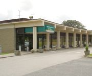
Britannia Leeds Bradford Airport
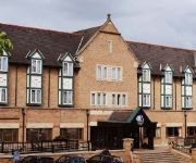
Mercure Leeds Parkway
Chevin Country Park
VILLAGE LEEDS NORTH
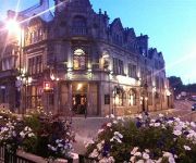
The Black Horse Hotel
The Butlers Hotel
Haley's Hotel & Restaurant
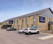
TRAVELODGE LEEDS BRADFORD AIRPORT
Videos from this area
These are videos related to the place based on their proximity to this place.
Tour De France 2014 Pool to Otley
Live coverage of the race from between Pool and Otley - the Police seemed to enjoy the race more than the competitors, and they received a lot of encouragement.
Courser Edge V2 5+, Otley Wall, Caley Roadside Boulders
Me Bouldering, very easy problem. I normally have this problem, but this was not a great day, and it took about 5 attempts! I want to make a record of my favorite problems, also I hope to...
Burning Stainburn
A short film of the black and red graded boulder trails at Stainburn, Yorkshire. Riding it on a 7 inch travel bike may have been cheating a little but as you'll see the trail still beat me...
The City Cleaners - Testimonial by Katie from Bramhope in Leeds
We have cleaned for Katie a few times, this time we cleaned the living room carpet and again she was happy with the results.
A Walk Around Golden Acre Park, Bramhope, Leeds, West Yorkshire, UK - 13th June, 2012 (720 HD)
Footage of a short walk around part of Golden Acre Park, which is situated six miles North West of Leeds City Centre, just outside the village of Bramhope. Featured in this video is a walk...
Leeds Bradford International Airport (LBA), Yeadon, West Yorkshire, UK - 24th January, 2013
Footage taken from Yeadon Cemetery on a late Winter afternoon, of aircraft taxiing, taking off and landing on Runway14 of Leeds Bradford Airport. These include the following G-BEUX Multiflight...
Walk to Breary Marsh and Paul's Pond, Cookridge, Leeds, UK - 24th June, 2012 (1080 HD)
Footage taken on a beautifully scenic 3 mile / 4.5 kilometre circular walk from Pinfold Lane in Cookridge, Leeds, West Yorkshire, UK to Breary Marsh and Paul's Pond also within Cookridge. The...
Carlton Countryside Around Leeds Bradford Airport, West Yorkshire, UK - 11th September, 2012
Footage from a walk around the countryside (most of which is technically a part of Carlton) near Leeds Bradford Airport. This footage was taken late on a Summer evening, and features a rainbow...
Take-off from Leeds Bradford Airport and Views of Snowy Yorkshire, UK - January, 2013
Footage taken from the left side of a Ryanair Boeing 737 as it takes off from Leeds Bradford Airport's Runway 32 over Yeadon and Guiseley, with views of Yeadon Tarn, Bradford, Leeds, and the...
Cookridge Countryside, Leeds, West Yorkshire, UK - 3rd November, 2012
This video features views around the West Yorkshire countryside near Cookridge, Leeds. It was taken whilst on a Geocaching walk, so many of the featured locations are near Geocaches. The video...
Videos provided by Youtube are under the copyright of their owners.
Attractions and noteworthy things
Distances are based on the centre of the city/town and sightseeing location. This list contains brief abstracts about monuments, holiday activities, national parcs, museums, organisations and more from the area as well as interesting facts about the region itself. Where available, you'll find the corresponding homepage. Otherwise the related wikipedia article.
Castley
Castley is a village and civil parish in the Harrogate district of North Yorkshire, England, It is on the River Wharfe and about 10 miles from the centre of Leeds.
Leathley
Leathley is a village and civil parish in the Harrogate district of North Yorkshire, England. It is near the border with West Yorkshire and the River Wharfe, 1 mile north east of Otley. The B6161 runs through the village, connecting Leathley with Killinghall in the North and Pool-in-Wharfedale in the south.
Leeds Country Way
The Leeds Country Way is a circular long-distance footpath of 62 miles (99 km) around Leeds, West Yorkshire, England. It is never more than 7 miles (11 km) from Leeds City Square, but is mainly rural with extensive views in the outlying areas of the Leeds metropolitan district. It follows public Rights of Way including footpaths, bridleways and minor lanes, with a few short sections along roads.
Golden Acre Park
Golden Acre Park is a public park between Adel and Bramhope, Leeds, West Yorkshire, England, administered by Leeds City Council. It is on the A660 Otley Road and covers an area of 137 acres .
Creskeld Hall
Creskeld Hall is a grade II listed Country House located in Arthington, near Bramhope, West Yorkshire, England. It belonged to the Rhodes family in 1846 and has been privately owned by the same family since the early 1900s. It is known to many people as Home Farm from the ITV soap Emmerdale, a part it has been playing for over 40 years. A flat-roofed billiard room extension was added by the owner in 1919.
Bramhope Tunnel
The Bramhope Tunnel is a railway tunnel 2.138 miles long, owned by Network Rail on a route currently operated mainly by Northern Rail. It was constructed during 1845–1849 on the Harrogate Line, carrying rural and commuter passengers between Horsforth and Weeton in West Yorkshire, England.
Breary Marsh
Breary Marsh is a nature reserve and Site of Special Scientific Interest situated adjacent to Golden Acre Park in Leeds, grid reference SE264416. As the name suggests, it includes an area of marshland, but also a wet alder valley wood. Wooden walkways are provided over marsh area. It is part of the Leeds Country Way and the north end of the Meanwood Valley Trail. The site is situated between Lawnswood and Bramhope off the A660 Otley Road.
St Mary's Church, Stainburn
St Mary's Church, Stainburn, is a redundant Anglican church in the village of Stainburn, North Yorkshire, England. It has been designated by English Heritage as a Grade I listed building, and is under the care of the Churches Conservation Trust.


