Safety Score: 3,0 of 5.0 based on data from 9 authorites. Meaning we advice caution when travelling to United Kingdom.
Travel warnings are updated daily. Source: Travel Warning United Kingdom. Last Update: 2024-04-24 08:14:40
Delve into Killingbeck
The district Killingbeck of Leeds in Leeds (England) is a district located in United Kingdom about 168 mi north of London, the country's capital town.
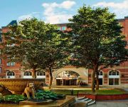
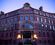
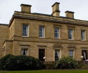
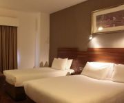
In need of a room? We compiled a list of available hotels close to the map centre further down the page.
Since you are here already, you might want to pay a visit to some of the following locations: Shadwell, Scarcroft, Thorner, Normanton and Wakefield. To further explore this place, just scroll down and browse the available info.
Local weather forecast
Todays Local Weather Conditions & Forecast: 7°C / 45 °F
| Morning Temperature | 4°C / 40 °F |
| Evening Temperature | 7°C / 45 °F |
| Night Temperature | 5°C / 40 °F |
| Chance of rainfall | 0% |
| Air Humidity | 61% |
| Air Pressure | 1017 hPa |
| Wind Speed | Gentle Breeze with 8 km/h (5 mph) from South |
| Cloud Conditions | Broken clouds, covering 75% of sky |
| General Conditions | Broken clouds |
Thursday, 25th of April 2024
7°C (45 °F)
3°C (37 °F)
Light rain, gentle breeze, overcast clouds.
Friday, 26th of April 2024
10°C (49 °F)
4°C (38 °F)
Light rain, gentle breeze, scattered clouds.
Saturday, 27th of April 2024
11°C (51 °F)
6°C (43 °F)
Broken clouds, gentle breeze.
Hotels and Places to Stay
Quebecs Luxury Apartments 3 Infirmary Street
Park Plaza Leeds
Leeds Marriott Hotel
Malmaison Leeds
OULTON HALL - QHOTELS
Leeds Radisson Blu Hotel
42 The Calls
Jurys Inn Leeds
Thorpe Park Hotel & Spa
Gateway Apartments
Videos from this area
These are videos related to the place based on their proximity to this place.
Official Party in the Park 2012 Highlights Video with One Direction, Tulisa, Professor Green
Fruition produced this official highlights video for Leeds City Council and Radio Aire's Party in the Park 2012. Our team worked on the pre-production for the show, liaising with artists and...
Temple Newsam, Leeds, National Collection of Delphiniums 2012
The National Collection of Delphiniums in Temple Newsam Gardens in Leeds, filmed on a wet and windy day - 30th June 2012 Video by Gordon West, Chairman of the Delphinium Society.
A Quality Cycle Facility in Leeds !!!! (Leeds Cycle Action Group)
At last, a quality cycle facility in Leeds, plenty wide enough, well signposted, good road surface, no cars, direct rather than winding every which way, no cars, what more could you want. Sadly,...
16 bus route - Leeds city centre to Seacroft (Triple speed)
Bus journey from Leeds city centre to Seacroft.
Timelapse Journey Leeds-Settle-Carlisle railway in 20 mins 1of2
Settle for Edinburgh Railtour 27/09/2008 Speeded up Video of the Leeds to the settle - Carlsile railway on the Settle for Edinburgh railtour, traction was the WCRC 37's(i was too far back...
Minecraft Lets Play (The City of Testifica 2] Episode 1
cool map with Reece ------------------------------------------------[download]------------------------------------------------ http://www.minecraftmaps.com/adventure-maps/the-city-of-testifica-2/v...
Just 1 ride to work in May 2013
The standard of driving in this country has dropped to what i perceive as an all time low. Take a look at what we have to put up with every day.
Passion Play (1970s)
Members of the parish perform the Passion in the amphitheatre at Temple Newsam.
21-05-2010 Cross Gates
A trip down into Cross Gates Featuring: - 150205, 153317, 158755, 158791, 158851, 158860, 158905, 185109, 185119, 185123, 185131, 185139, 185145. - 220009, 221137.
Videos provided by Youtube are under the copyright of their owners.
Attractions and noteworthy things
Distances are based on the centre of the city/town and sightseeing location. This list contains brief abstracts about monuments, holiday activities, national parcs, museums, organisations and more from the area as well as interesting facts about the region itself. Where available, you'll find the corresponding homepage. Otherwise the related wikipedia article.
Leeds and Liverpool Canal
The Leeds and Liverpool Canal is a canal in Northern England, linking the cities of Leeds and Liverpool. Over a distance of 127 miles, it crosses the Pennines, and includes 91 locks on the main line. It has several small branches, and in the early 21st century a new link was constructed into the Liverpool docks system.
Temple Newsam
Temple Newsam (historically Temple Newsham, in legend Templestowe) is a Tudor-Jacobean house with grounds landscaped by Capability Brown, in Leeds, West Yorkshire, England. The estate lies to the east of the city, just south of Halton Moor, Halton, Whitkirk and Colton. Temple Newsam is also the name of an electoral ward for Leeds City Council, which includes the areas of Halton Moor, Halton, Whitkirk, Colton and Austhorpe.
Gledhow
Gledhow is a suburb of north-east Leeds, West Yorkshire, England, situated east of Chapel Allerton and west of Roundhay. A major feature of the area is Gledhow Valley, a strip of mixed deciduous woodland with a beck and lake. A bathhouse dating from 1671, the Gipton Spa, is in the woods. Running through the valley is Gledhow Valley Road, built in 1926. Gledhow Lane crosses Gledhow Valley Road and on the Eastern side is a steep road up from the valley.
St James's University Hospital
St. James's University Hospital is in Leeds, West Yorkshire, England. It is popularly known as Jimmy's and is one of the United Kingdom's most famous hospitals. Its fame derives in part from its extensive television coverage in the documentary series also titled "Jimmy's", screened by Yorkshire Television (YTV) between 1987 and 1994 with a theme tune performed by Snake Davis.
Thackray Museum
The Thackray Museum in Leeds, West Yorkshire, England, is a museum of the history of medicine adjacent to St James's Hospital. Since it opened in 1997 it has won "Museum of the Year" and other awards. The building is a Grade II listed building, the former Leeds Union Workhouse, built in 1858 to accommodate 784 paupers. By the end of the 19th century, the buildings had become largely used for medical care of the poor, rather than workhouse and training.
Roundhay Park
Roundhay Park in Leeds, West Yorkshire, England, is one of the biggest city parks in Europe. It has over 700 acres of parkland, lakes, woodland and gardens which are owned by Leeds City Council. The park is one of the most popular attractions in Leeds, nearly a million people visit each year. It is situated on the north-east edge of the city, bordered by the suburb of Roundhay to the west and Oakwood to the south.
Yorkshire Amateur A.F.C
Yorkshire Amateur A.F.C. are a football club based in Leeds, West Yorkshire, England. They were formed in 1918, and two years later became founding members of the Yorkshire Football League. For the 2012–13 season, Yorkshire Amateur are members of the Northern Counties East League Division One.
East Leeds FM
East Leeds FM (ELFM) is a community radio station based in Leeds, West Yorkshire, England. The station started in 2003 when Heads Together, a Huddersfield based community arts organisation, joined forces with local ease Leeds high school John Smeaton. The two organisations had worked together previously on a number of projects. When the idea of a radio station was tabled, pupils, teachers and Heads Together staff agreed to create one.
Neville Hill depot
Neville Hill is a railway Train Maintenance Depot located in Osmandthorpe, Leeds, England on the Leeds to Selby railway line. The depot code is NL.
Killingbeck
Killingbeck is a district of east Leeds, West Yorkshire, England that is situated between Seacroft to the north, Cross Gates and Whitkirk to the east, Gipton to the west, Halton Moor to the south, Halton to the south east and Osmondthorpe to the south west. It is contiguous with Cross Gates and Seacroft, at the junction of the A63 Road and A64 roads. Killingbeck was formerly home to Killingbeck Colliery.
Osmondthorpe
Osmondthorpe a district of east Leeds in West Yorkshire, England is considered part of the Halton Moor district. It is situated in the LS9 Leeds postcode area, two miles (3 km) to the east of Leeds city centre between East End Park and Halton Moor. At the edge of Osmondthorpe lies the Neville Hill rail depot on the Leeds to York main line.
St Aidan's Church, Leeds
St Aidan's Church in Harehills, Leeds, West Yorkshire is a Church of England parish church built in 1894. It is a large Victorian basilica-type red-brick building which is Grade II* listed. A church hall is adjacent. The architects were Johnson and Crawford Hick of Newcastle. The church was consecrated by John Pulleine, Bishop of Richmond, on 13 October 1894. The first vicar was Samuel Mumford Taylor who later became Bishop of Kingston-upon-Thames.
Cross Green, Leeds
Cross Green is a mainly industrial area of Leeds, West Yorkshire, England. It is around 1 mile to the south east of Leeds city centre. The area lies in the LS9 Leeds postcode area between Osmondthorpe, Richmond Hill and Hunslet. Cross Green Comprehensive School was a medium sized secondary school set in large grounds on Cross Green Lane. In 1996, it changed its name to Copperfields College and was closed because of falling numbers and poor results and demolished in 2008.
Stourton, Leeds
Stourton is a mainly industrial area of the city of Leeds, West Yorkshire, England. The area is 2 miles (3 km) to the south east of Leeds city centre and lies between Hunslet, the M1 motorway and Cross Green in the LS10 postcode area. Until the local boundary changes in the 1970s, Stourton was a village in the Rothwell Urban District attached to the southernmost border of Leeds, and governed by the old West Riding County Council.
Lincoln Green
Lincoln Green is an area of Leeds, West Yorkshire, England. The area is mainly residential with a small local shopping centre. The area also has a public house, The Harp, and a working men's club, The North Leeds WMC. Most housing in Lincoln Green is council-owned high-rise flats; these are in a significantly worse condition then those in other areas of the city. Lincoln Green is one of the most deprived areas of the city.
Battle of Seacroft Moor
The Battle of Seacroft Moor, on 30 March 1643, was a decisive loss for the Parliamentary forces during the First Civil War. It took place near Seacroft, north east of Leeds, West Yorkshire, England. The battle reportedly turned the Cock Beck, which ran through the battlefield, red with the casualties' blood for several days.
Seacroft, Lincolnshire
Seacroft is a village in Lincolnshire. It once had its own Seacroft railway station on the line between Boston and Skegness.
Wykebeck
Wykebeck is an area of Leeds, West Yorkshire, England named after the Wyke Beck. The area is situated in between Gipton and Seacroft along Wykebeck Road. The area is seldom referred to, instead people usually perceive Gipton to be West of the beck and Seacroft to be East of it. The area consists of several blocks of highrise council flats to the south.
East Leeds Family Learning Centre
East Leeds Family Learning Centre was a large Adult Education Centre in Seacroft, Leeds, England. The buildings were originally used as a secondary school, Foxwood School. The school is notable for its use for filming The Beiderbecke Trilogy between 1984 and 1988. Demolition of the buildings began in December 2009 and was completed early in 2010.
Seacroft bus station
Seacroft bus station serves the district of Seacroft in the city of Leeds, West Yorkshire, England. Seacroft's bus station was rebuilt as part of the Seacroft Green Shopping Centre in 2000 and is maintained by them. The bus station is situated outside the Tesco superstore and has five drive-in-reverse-out stands and a daily footfall of 2,687. First West Yorkshire operate the majority of the bus services from Seacroft, while Harrogate & District operate the 770 service.
Austhorpe Hall
Austhorpe Hall is a house built in 1694 at Austhorpe, Leeds, West Yorkshire, England. It is a grade II* listed building. The house is of red brick with stone quoins, seven bays and three storeys, with a triangular pediment over the door. Pevsner describes it as "A remarkably early case of acceptance of the classical idiom".
Thwaite Mills
Thwaite Mills is an industrial museum in Leeds, West Yorkshire, England. It is a fully restored working water-powered mill built in 1823-25, harnessing the power of the River Aire, and claims to be "one of the best last remaining examples of a water-powered mill in Britain. " It is administered by Leeds City Council. The mill, the manager's house, and three associated buildings are all grade 2 listed buildings.
Leeds Gamma Knife Centre
Leeds Gamma Knife Centre is based in the Institute of Oncology at St. James’s University Hospital in Leeds, West Yorkshire, England. The National Health Service (NHS) hospital known to millions of TV viewers as ‘Jimmy’s, St. James's Institute of Oncology (Bexley Wing) is the largest cancer research hospital in Europe. There are only five centres in the UK which specialise in the treatment of brain disease by a Gamma Knife.
Temple Newsam Preceptory
Temple Newsam Preceptory was a Templar Farmstead, just east of Leeds, in West Yorkshire, England. The term "preceptory" may be paraphrased as a "school of principles", and was the generic term for Templar communities.
St Wilfrid's Church, Halton, Leeds
St Wilfrid's Church, Halton was designed by Albert Randall Wells and built between 1937 and 1939. It is situated in the 1930s suburb of Halton in Leeds. The site on Halton Hill was given by Viscount Halifax and the building was paid for by Sir John Priestman. The foundation stone was laid on 6 November 1937. The church is Grade II* listed. It bridges the gap between the Arts and Crafts style and modernism. It has Early English gothic inspired details, such as the triangular-headed windows.






!['Minecraft Lets Play (The City of Testifica 2] Episode 1' preview picture of video 'Minecraft Lets Play (The City of Testifica 2] Episode 1'](https://img.youtube.com/vi/lU8omHswPnA/mqdefault.jpg)


