Safety Score: 3,0 of 5.0 based on data from 9 authorites. Meaning we advice caution when travelling to United Kingdom.
Travel warnings are updated daily. Source: Travel Warning United Kingdom. Last Update: 2024-04-19 08:03:45
Delve into Knowsthorpe
The district Knowsthorpe of Leeds in Leeds (England) is a subburb in United Kingdom about 168 mi north of London, the country's capital town.
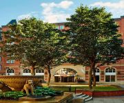
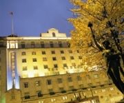
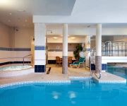
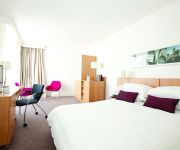
If you need a hotel, we compiled a list of available hotels close to the map centre further down the page.
While being here, you might want to pay a visit to some of the following locations: Shadwell, Morley, Wakefield, Scarcroft and Gildersome. To further explore this place, just scroll down and browse the available info.
Local weather forecast
Todays Local Weather Conditions & Forecast: 10°C / 50 °F
| Morning Temperature | 9°C / 48 °F |
| Evening Temperature | 8°C / 46 °F |
| Night Temperature | 5°C / 41 °F |
| Chance of rainfall | 0% |
| Air Humidity | 69% |
| Air Pressure | 1016 hPa |
| Wind Speed | Moderate breeze with 11 km/h (7 mph) from East |
| Cloud Conditions | Scattered clouds, covering 42% of sky |
| General Conditions | Light rain |
Saturday, 20th of April 2024
11°C (51 °F)
6°C (42 °F)
Broken clouds, gentle breeze.
Sunday, 21st of April 2024
7°C (45 °F)
6°C (42 °F)
Overcast clouds, gentle breeze.
Monday, 22nd of April 2024
6°C (42 °F)
8°C (46 °F)
Light rain, gentle breeze, overcast clouds.
Hotels and Places to Stay
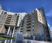
Quebecs Luxury Apartments 3 Infirmary Street
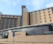
Leeds Marriott Hotel
THE QUEENS - QHOTELS
Hilton Leeds City
DoubleTree by Hilton Hotel Leeds City Centre
Quebecs
Clayton Leeds
Gateway Apartments
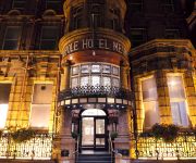
The Met Hotel PH Hotels
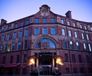
Malmaison Leeds
Videos from this area
These are videos related to the place based on their proximity to this place.
Car Locksmith Leeds | Call: 07966 986 939
Car Locksmith Leeds. If you need a Car Locksmith based in Leeds or an Auto Locksmith Leeds specialist stay on this page. Here you will find specialist expert Car Locksmith Leeds and Emergency...
Magellan House, City Centre, Leeds LS10 1JE - Apartment / Flat to let
SPECTACULAR UNFURNISHED TWO BEDROOM DOCK FACING APARTMENT. This superb apartment is on the fourth floor of Magellan House. Views throughout the apartment and from the balcony ...
GREAT VALUE ONE BED APARTMENT TO LET IN LEEDS CITY CENTRE
Studio / crashpad that sits on the border of the ever expanding city centre and suburbia. Hallway leading to an open plan lounge with sofa and dining table overlooking the contemporary roof...
Echo Central 2 properties to rent in Leeds 2 bedrooms
STUNNING 7th floor apartment in this fantastic development. This 2 bedroom property enjoys great views from it's large balcony and has a very light and spacious feel to it. The large open plan...
Vita Surge nail care with Vitamins by Sally Hansen
Sally Hansen Vita Surge nail care with Vitamins http://www.sallyhansen.com/product.cfm?product=113 This is the one I used in video and one I been using and totaly love it I am not having...
Minecraft Lets Play (The City of Testifica 2] Episode 1
cool map with Reece ------------------------------------------------[download]------------------------------------------------ http://www.minecraftmaps.com/adventure-maps/the-city-of-testifica-2/v...
How to make a YouTube intro in Blender
[TheGamingProject]========== How to make a YouTube intro in Blender By Ben607070 Blender Program Download http://www.blender.org/ the Safe file ...
Micky Fridays Edit - 09 - Leeds BMX
A short edit filmed over a series of months, at one of our local parks every friday.
Videos provided by Youtube are under the copyright of their owners.
Attractions and noteworthy things
Distances are based on the centre of the city/town and sightseeing location. This list contains brief abstracts about monuments, holiday activities, national parcs, museums, organisations and more from the area as well as interesting facts about the region itself. Where available, you'll find the corresponding homepage. Otherwise the related wikipedia article.
Leeds and Liverpool Canal
The Leeds and Liverpool Canal is a canal in Northern England, linking the cities of Leeds and Liverpool. Over a distance of 127 miles, it crosses the Pennines, and includes 91 locks on the main line. It has several small branches, and in the early 21st century a new link was constructed into the Liverpool docks system.
Middleton Railway
The Middleton Railway is the world's oldest continuously working public railway. It was founded in 1758 and is now a heritage railway run by volunteers from The Middleton Railway Trust Ltd. since 1960. The railway operates passenger services at weekends and on public holidays over approximately 1 mile of track between its headquarters at Moor Road, Hunslet, Leeds, West Yorkshire, England and Park Halt on the outskirts of Middleton Park.
Quarry Hill, Leeds
Quarry Hill is an area of central Leeds, West Yorkshire, England. It is surrounded by the Leeds Inner Ring Road to the east and north. The Leeds - York / Hull railway runs just south of the district into the city centre. In Victorian times Quarry Hill was known as a particularly lawless area of Leeds with frequent anti-Jewish and anti-Irish riots.
Joseph Priestley College
Joseph Priestley College was a further education college founded in 1955 serving the communities of South Leeds, West Yorkshire, England. It was named after Joseph Priestley, the famous scientist and co-discoverer of oxygen who was born nearby. The college had three campuses, in Rothwell, Morley and Beeston. Following financial problem the college was merged with Leeds City College in August 2011.
Clarence Dock Student Residence
Clarence Dock Student Residence in Hunslet, is student accommodation made up of fourteen blocks belonging to the University of Leeds. It accommodates over 600 students and two resident members of staff. It is one of only three residences not to lie on the A660 road in Headingley or on the University campus. CLOSED July 2012.
Leeds College of Music
Leeds College of Music, located in Leeds’ Quarry Hill cultural quarter, is the largest music college in the United Kingdom, with over 1,000 full-time and 1,000 part-time students. The college is best known for its leading role in jazz education and started one of the first jazz degrees in Europe. It is also the only music conservatoire in the UK to offer both Higher and Further Education courses, ranging from BTEC Extended Diploma courses to undergraduate and postgraduate degrees.
Neville Hill depot
Neville Hill is a railway Train Maintenance Depot located in Osmandthorpe, Leeds, England on the Leeds to Selby railway line. The depot code is NL.
Osmondthorpe
Osmondthorpe a district of east Leeds in West Yorkshire, England is considered part of the Halton Moor district. It is situated in the LS9 Leeds postcode area, two miles (3 km) to the east of Leeds city centre between East End Park and Halton Moor. At the edge of Osmondthorpe lies the Neville Hill rail depot on the Leeds to York main line.
Leeds Minster
Leeds Minster, or the Minster and Parish Church of Saint Peter-at-Leeds, formerly Leeds Parish Church, in Leeds, West Yorkshire is a large Church of England foundation of major architectural and liturgical significance. It is dedicated to Saint Peter and was the Parish Church of Leeds before becoming a Minster in 2012. It has been designated a grade I listed building by English Heritage.
Royal Armouries Museum
The Royal Armouries Museum in Leeds, West Yorkshire, England, is a national museum which displays the National Collection of Arms and Armour. It is part of the Royal Armouries family of museums, the other sites being the Tower of London, its traditional home, Fort Nelson, Hampshire, for the display of its National Collection of Artillery, and permanent galleries within the Frazier History Museum in Louisville, Kentucky, USA.
Clarence Dock (Leeds)
Clarence Dock is a shopping and leisure destination in central Leeds, West Yorkshire, England. It also hosts a large residential population in waterside apartments, as well as a significant office presence. Clarence Dock was developed as a £250 million mixed-use development between 2001 and 2007 and is located by the River Aire next to the Royal Armouries Museum which faces onto Armouries Square.
Cross Green, Leeds
Cross Green is a mainly industrial area of Leeds, West Yorkshire, England. It is around 1 mile to the south east of Leeds city centre. The area lies in the LS9 Leeds postcode area between Osmondthorpe, Richmond Hill and Hunslet. Cross Green Comprehensive School was a medium sized secondary school set in large grounds on Cross Green Lane. In 1996, it changed its name to Copperfields College and was closed because of falling numbers and poor results and demolished in 2008.
Stourton, Leeds
Stourton is a mainly industrial area of the city of Leeds, West Yorkshire, England. The area is 2 miles (3 km) to the south east of Leeds city centre and lies between Hunslet, the M1 motorway and Cross Green in the LS10 postcode area. Until the local boundary changes in the 1970s, Stourton was a village in the Rothwell Urban District attached to the southernmost border of Leeds, and governed by the old West Riding County Council.
Woodhouse Hill Ground, Leeds
Woodhouse Hill was a stadium in the Hunslet district of Leeds which was used for cricket and rugby football.
Mabgate
Mabgate is an inner city area of Leeds, West Yorkshire, England. The name Mabgate comes from Mable-gate, Mable being a middle English reference to 'loose women'. This is perhaps somewhat apt as for many years Mabgate has been one of the city's red light districts, although less so then Spencer Place in Chapeltown and in recent years Water Lane in Holbeck. The area defined as Mabgate is a small area, mainly made up of derelict and unused industrial units.
Lincoln Green
Lincoln Green is an area of Leeds, West Yorkshire, England. The area is mainly residential with a small local shopping centre. The area also has a public house, The Harp, and a working men's club, The North Leeds WMC. Most housing in Lincoln Green is council-owned high-rise flats; these are in a significantly worse condition then those in other areas of the city. Lincoln Green is one of the most deprived areas of the city.
Hunslet Rural District
Hunslet was a rural district of the administrative county of Yorkshire, West Riding from 1894 to 1937. The rural district was created by the Local Government Act 1894 as successor to the Hunslet Rural Sanitary District. It lay to the south of the county borough of Leeds, and initially consisted of four civil parishes: Middleton Oulton with Woodlesford Templenewsham Thorpe Stapleton The council offices were in Hunslet within the county borough.
Parkside, Hunslet
Parkside was a rugby league stadium in Hunslet, Leeds, England. It was home to Hunslet rugby league club and the source of their nickname the Parksiders. Hunslet Hawks now play at the South Leeds Stadium which is less than half a mile from the former site of Parkside.
Knowsthorpe
Knowsthorpe, Knostrop or Knostropp is an area of Leeds, West Yorkshire, England, on the River Aire. The spelling "Knostrop" is predominantly used for the large water treatment works in the area. Atkinson Grimshaw painted Knostrop Cut, Leeds, Sunday Night, 1893.
42 The Calls (Hotel)
42 The Calls is a 4-star hotel with 41 rooms. The hotel is located in Leeds opposite Leeds Parish Church and near to Leeds Corn Exchange. A former corn mill, the 18th century Fletland Mill was bought by hotelier Jonathan Wix in 1991 and renovated at a cost of £19.5 million. In 2007 The Eton Collection took over the management of the hotel.
Leeds City bus station
Leeds City bus station serves the city of Leeds, West Yorkshire, England. The bus station is owned and managed by Metro. It is situated between the Quarry Hill and Leeds City Markets areas of Leeds city centre. The National Express Dyer Street Coach Station adjoins the bus station. It can be accessed from York Street and Dyer Street.
The Calls
The Calls is an area and street by the River Aire in Leeds city centre, West Yorkshire, England. Coupled with Call Lane and Lower Briggate the area makes up the heart of the Leeds gay village. The Calls area is the location of the second part of Leeds Pride after the Pride Parade has left the stage and stalls in Millennium Square.
Acting School North
Acting School North was an independent drama school in Leeds, Yorkshire, which opened in 2009. The school followed a technique established by drama theoretician Rogelio Nevares.
Thwaite Mills
Thwaite Mills is an industrial museum in Leeds, West Yorkshire, England. It is a fully restored working water-powered mill built in 1823-25, harnessing the power of the River Aire, and claims to be "one of the best last remaining examples of a water-powered mill in Britain. " It is administered by Leeds City Council. The mill, the manager's house, and three associated buildings are all grade 2 listed buildings.
U-8047 Submarine Museum
The U-8047 Submarine Museum is a floating museum currently moored at Clarence Dock, Leeds, England, having travelled along the Leeds and Liverpool Canal. The 45-foot narrowboat has been converted, both inside and out, into a reduced-scale replica of a German submarine or U-boat, and offers historical education to children. The museum was previously called the U-8047 Replica Submarine but changed its name in 2012.





!['Minecraft Lets Play (The City of Testifica 2] Episode 1' preview picture of video 'Minecraft Lets Play (The City of Testifica 2] Episode 1'](https://img.youtube.com/vi/lU8omHswPnA/mqdefault.jpg)


