Safety Score: 3,0 of 5.0 based on data from 9 authorites. Meaning we advice caution when travelling to United Kingdom.
Travel warnings are updated daily. Source: Travel Warning United Kingdom. Last Update: 2024-04-19 08:03:45
Delve into Farnley
Farnley in Leeds (England) is located in United Kingdom about 169 mi (or 272 km) north of London, the country's capital town.
Current time in Farnley is now 10:26 PM (Friday). The local timezone is named Europe / London with an UTC offset of one hour. We know of 9 airports close to Farnley, of which 5 are larger airports. The closest airport in United Kingdom is Leeds Bradford Airport in a distance of 6 mi (or 9 km), North. Besides the airports, there are other travel options available (check left side).
There are several Unesco world heritage sites nearby. The closest heritage site in United Kingdom is Liverpool – Maritime Mercantile City in a distance of 36 mi (or 58 km), South-East. Also, if you like playing golf, there are some options within driving distance. If you need a hotel, we compiled a list of available hotels close to the map centre further down the page.
While being here, you might want to pay a visit to some of the following locations: Gildersome, Morley, Leeds, Drighlington and Pool. To further explore this place, just scroll down and browse the available info.
Local weather forecast
Todays Local Weather Conditions & Forecast: 9°C / 48 °F
| Morning Temperature | 8°C / 47 °F |
| Evening Temperature | 7°C / 45 °F |
| Night Temperature | 4°C / 40 °F |
| Chance of rainfall | 0% |
| Air Humidity | 70% |
| Air Pressure | 1017 hPa |
| Wind Speed | Moderate breeze with 11 km/h (7 mph) from East |
| Cloud Conditions | Scattered clouds, covering 41% of sky |
| General Conditions | Light rain |
Saturday, 20th of April 2024
10°C (50 °F)
5°C (42 °F)
Broken clouds, gentle breeze.
Sunday, 21st of April 2024
6°C (43 °F)
5°C (41 °F)
Overcast clouds, light breeze.
Monday, 22nd of April 2024
5°C (41 °F)
7°C (45 °F)
Light rain, gentle breeze, overcast clouds.
Hotels and Places to Stay
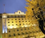
THE QUEENS - QHOTELS
Weetwood Hall
Clayton Leeds
Quebecs
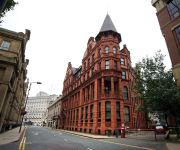
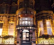
The Met Hotel PH Hotels
VILLAGE LEEDS SOUTH
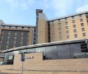
Novotel Leeds Centre
The Chambers - Park Place - Apartments
Crowne Plaza LEEDS
Headingley Lodge
Videos from this area
These are videos related to the place based on their proximity to this place.
Video Request For althegamefreak Aphasia Village Part 1
This is the first part of kingsley's adventure for althegamefreak.
Video Request For althegamefreak Aphasia Village Part 3
3rd part of the video request for althegamefreak.
Video Request For althegamefreak Aphasia Village Part 2
Here's another part of the video request for althegamefreak.
Video Request For althegamefreak PoorLuck Village Part 3
3rd part of the video request for althegamefreak.
Video Request For althegamefreak PoorLuck Village Part 5
Final part of the video request for althegamefreak.
Video Request For althegamefreak PoorLuck Village Part 2
2nd part of the video request for althegamefreak.
2000x..ZOOM.From Wortley LEEDS12-to-Seacroft LEEDS 14
This video is filmed x2000 sony handy-cam ,from the top of cabbage hill in leeds 12 towards seacroft , swarcliffe, and city center.
Ahead of Time: A Science Fiction Nightmare (2008)
Short Sci-Fi Drama - A young man attempts to escape from someone or something, leading to a confrontation nobody could have ever imagined....A Time Travel Action Short. Written one day, filmed...
Videos provided by Youtube are under the copyright of their owners.
Attractions and noteworthy things
Distances are based on the centre of the city/town and sightseeing location. This list contains brief abstracts about monuments, holiday activities, national parcs, museums, organisations and more from the area as well as interesting facts about the region itself. Where available, you'll find the corresponding homepage. Otherwise the related wikipedia article.
Farnley Hall (West Yorkshire)
Farnley Hall is a stately home in Farnley, west Leeds, West Yorkshire, England. It is a grade II listed building. It was built in Elizabethan times by the Danbys. The manor is recorded in the 1086 Domesday Book as Fernelei, so it is probable that this house was a replacement for earlier medieval structures. The Danbys owned part of the manor and the hall until 1799, when it was sold to James Armitage. Thomas Danby was first Mayor of Leeds, and Thomas Danby College in Leeds is named after him.
Agbrigg and Morley
Agbrigg and Morley was a wapentake of the West Riding of Yorkshire, England. It was split into two divisions, which in the mid-nineteenth century became wapentakes in their own right. The Agbrigg Division included the parishes of Almondbury, Emley, Kirkburton, Kirkheaton, Normanton, Rothwell, Sandal Magna, Thornhill, Wakefield and Warmfield with Heath and parts of Batley, Dewsbury, Featherstone, Huddersfield and Rochdale.
Armley Park
Armley Park, or Gott's Park, is a large public park situated next to Stanningley Road in Armley, Leeds, England. The park stretches from Armley all the way down the hill to the Leeds and Liverpool Canal, near the canal the park turns to dense woodland. The park has many amenities, including: Football pitches. Tennis courts. Basketball courts. Children's playground. Municipal Gardens.
Barley Mow, Bramley
Barley Mow was a former home ground of the Bramley Rugby League Club in Leeds, West Yorkshire, England who moved there in 1881, just two years after their foundation. The club used the nearby Barley Mow public house as changing rooms. In 1907 Barley Mow became the first ground to stage a club match against the touring New Zealanders. In 2007, a blue plaque was added to the Barley Mow pub to mark the anniversary of the tour match.
A657 road
The A657 is an A road in West Yorkshire, England that begins in Bramley and ends in Saltaire near Shipley. The road is approximately 8 miles long. The road starts from the Bramley Town End and ends at the Saltaire Roundabout.
Kirkstall Power Station
Kirkstall power station was a coal fired unit opened in 1931, serving the city of Leeds, West Yorkshire. It was situated by the River Aire north west of Leeds and had its own wharf for delivery of coal via the Leeds and Liverpool Canal. The station was converted to oil firing but closed in 1976. The power station has now been demolished. The wharf used to unload coal is now a Marina for canal and pleasureboats.
St Bartholomew's Church, Armley
St Bartholomew’s Church, Armley is a parish church in the Church of England located in Armley, West Yorkshire
Gamble Hill
Gamble Hill is an area of Bramley a few miles away from Leeds city centre, in the City of Leeds District, in the English county of West Yorkshire.


