Safety Score: 3,0 of 5.0 based on data from 9 authorites. Meaning we advice caution when travelling to United Kingdom.
Travel warnings are updated daily. Source: Travel Warning United Kingdom. Last Update: 2024-04-18 08:12:24
Discover Belle Isle
Belle Isle in Leeds (England) is a city in United Kingdom about 167 mi (or 268 km) north of London, the country's capital city.
Local time in Belle Isle is now 05:24 AM (Friday). The local timezone is named Europe / London with an UTC offset of one hour. We know of 9 airports in the vicinity of Belle Isle, of which 5 are larger airports. The closest airport in United Kingdom is Leeds Bradford Airport in a distance of 9 mi (or 14 km), North-West. Besides the airports, there are other travel options available (check left side).
There are several Unesco world heritage sites nearby. The closest heritage site in United Kingdom is Liverpool – Maritime Mercantile City in a distance of 33 mi (or 53 km), South-East. Also, if you like golfing, there are a few options in driving distance. Looking for a place to stay? we compiled a list of available hotels close to the map centre further down the page.
When in this area, you might want to pay a visit to some of the following locations: Leeds, Morley, Wakefield, Gildersome and Shadwell. To further explore this place, just scroll down and browse the available info.
Local weather forecast
Todays Local Weather Conditions & Forecast: 9°C / 49 °F
| Morning Temperature | 7°C / 45 °F |
| Evening Temperature | 8°C / 47 °F |
| Night Temperature | 6°C / 43 °F |
| Chance of rainfall | 1% |
| Air Humidity | 71% |
| Air Pressure | 1018 hPa |
| Wind Speed | Moderate breeze with 11 km/h (7 mph) from South-East |
| Cloud Conditions | Broken clouds, covering 51% of sky |
| General Conditions | Light rain |
Saturday, 20th of April 2024
10°C (51 °F)
5°C (42 °F)
Scattered clouds, gentle breeze.
Sunday, 21st of April 2024
10°C (51 °F)
5°C (42 °F)
Overcast clouds, gentle breeze.
Monday, 22nd of April 2024
9°C (49 °F)
7°C (44 °F)
Broken clouds, gentle breeze.
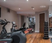
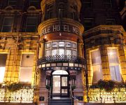
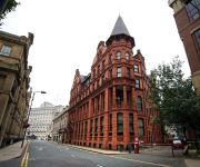
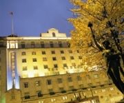
Hotels and Places to Stay
Quebecs Luxury Apartments 3 Infirmary Street
The Chambers - Park Place - Apartments
Novotel Leeds Centre
The Met Hotel PH Hotels
Quebecs
THE QUEENS - QHOTELS
Leeds Radisson Blu Hotel
Park Plaza Leeds
Hilton Leeds City
Clayton Leeds
Videos from this area
These are videos related to the place based on their proximity to this place.
Timelapse Leeds
Leeds Time Lapse a journey around the city and surrounding areas film over 4 months.
Wakefield Westgate to Leeds: Views from a train - 12th June, 2012
Forward facing left side views from an East Coast Trains Class 92 as it travels along the Doncaster to Leeds line from Wakefield Westgate to Leeds. The footage begins with views of the departure...
L20LAK Belle Isle Road Nesfield View Careful Driving Near Miss
Did the driver not see me? Did they just terribly misjudge the distance? If I hadn't have braked and swerved several metres out of the cycle lane, I would have been under her wheels. Apr 1 2014 18:49.
G-Star Competition - Leeds - Boys C 1 Meter
Michael dives in the first G Star competition at the new pool in Leeds.
RESERVES Hunslet Hawks v Keighely Cougars 14th August 2009
Cougars Reserves had a nightmare evening at South Leeds Stadium when they they were outmuscled by a much larger, older and more experienced Hunslet Hawks.
Michael & Joe at the NER Leg 3 - 3M Synchro Mens Open
Michael & Joe at the NER Leg 3 - 3M Synchro Mens Open.
Vita Surge nail care with Vitamins by Sally Hansen
Sally Hansen Vita Surge nail care with Vitamins http://www.sallyhansen.com/product.cfm?product=113 This is the one I used in video and one I been using and totaly love it I am not having...
Videos provided by Youtube are under the copyright of their owners.
Attractions and noteworthy things
Distances are based on the centre of the city/town and sightseeing location. This list contains brief abstracts about monuments, holiday activities, national parcs, museums, organisations and more from the area as well as interesting facts about the region itself. Where available, you'll find the corresponding homepage. Otherwise the related wikipedia article.
Stratford Street Mosque
Stratford Street Mosque (officially the Omar Mosque or Masjid-e-Umar) is a mosque in Beeston, Leeds, England. Three people responsible for the 7 July 2005 London bombings were regulars at Friday prayers at the mosque. The mosque is close to the home of Tanweer, who caused the Aldgate explosion. Stratford Street mosque is just a two streets away from his Colwyn Road home.
Middleton Railway
The Middleton Railway is the world's oldest continuously working public railway. It was founded in 1758 and is now a heritage railway run by volunteers from The Middleton Railway Trust Ltd. since 1960. The railway operates passenger services at weekends and on public holidays over approximately 1 mile of track between its headquarters at Moor Road, Hunslet, Leeds, West Yorkshire, England and Park Halt on the outskirts of Middleton Park.
Joseph Priestley College
Joseph Priestley College was a further education college founded in 1955 serving the communities of South Leeds, West Yorkshire, England. It was named after Joseph Priestley, the famous scientist and co-discoverer of oxygen who was born nearby. The college had three campuses, in Rothwell, Morley and Beeston. Following financial problem the college was merged with Leeds City College in August 2011.
John Charles Centre for Sport
The John Charles Centre for Sport is a sports facility in South Leeds, West Yorkshire, England. It was previously named (and is still known locally as) the South Leeds Stadium and was renamed to honour John Charles (1931–2004), the former Leeds United, Juventus F.C. and Wales footballer. It is located to the south of Leeds city centre roughly on the border of Beeston, Belle Isle and Hunslet. The sports centre opened in 1996.
Woodhouse Hill Ground, Leeds
Woodhouse Hill was a stadium in the Hunslet district of Leeds which was used for cricket and rugby football.
Hunslet Rural District
Hunslet was a rural district of the administrative county of Yorkshire, West Riding from 1894 to 1937. The rural district was created by the Local Government Act 1894 as successor to the Hunslet Rural Sanitary District. It lay to the south of the county borough of Leeds, and initially consisted of four civil parishes: Middleton Oulton with Woodlesford Templenewsham Thorpe Stapleton The council offices were in Hunslet within the county borough.
Parkside, Hunslet
Parkside was a rugby league stadium in Hunslet, Leeds, England. It was home to Hunslet rugby league club and the source of their nickname the Parksiders. Hunslet Hawks now play at the South Leeds Stadium which is less than half a mile from the former site of Parkside.
St Mary the Virgin, Middleton
The Church of St Mary the Virgin, Middleton is a church in Middleton, West Yorkshire, England. It is an active Anglican parish church and part of the Armley deanery in the archdeaconry of Leeds and the diocese of Ripon and Leeds. The church and its lych gate are Grade II listed buildings.


