Safety Score: 3,0 of 5.0 based on data from 9 authorites. Meaning we advice caution when travelling to United Kingdom.
Travel warnings are updated daily. Source: Travel Warning United Kingdom. Last Update: 2024-04-26 08:02:42
Touring Radbourne
Radbourne in Derbyshire (England) is a town located in United Kingdom about 115 mi (or 186 km) north-west of London, the country's capital place.
Time in Radbourne is now 01:47 AM (Saturday). The local timezone is named Europe / London with an UTC offset of one hour. We know of 8 airports nearby Radbourne, of which 5 are larger airports. The closest airport in United Kingdom is East Midlands Airport in a distance of 12 mi (or 20 km), South-East. Besides the airports, there are other travel options available (check left side).
There are several Unesco world heritage sites nearby. The closest heritage site in United Kingdom is Liverpool – Maritime Mercantile City in a distance of 41 mi (or 66 km), North-East. Also, if you like the game of golf, there are several options within driving distance. We collected 1 points of interest near this location. Need some hints on where to stay? We compiled a list of available hotels close to the map centre further down the page.
Being here already, you might want to pay a visit to some of the following locations: Derby, Yeldersley, Shirley, Bradley and Rodsley. To further explore this place, just scroll down and browse the available info.
Local weather forecast
Todays Local Weather Conditions & Forecast: 10°C / 49 °F
| Morning Temperature | 3°C / 37 °F |
| Evening Temperature | 8°C / 46 °F |
| Night Temperature | 6°C / 43 °F |
| Chance of rainfall | 0% |
| Air Humidity | 64% |
| Air Pressure | 1006 hPa |
| Wind Speed | Moderate breeze with 11 km/h (7 mph) from South-West |
| Cloud Conditions | Overcast clouds, covering 99% of sky |
| General Conditions | Overcast clouds |
Sunday, 28th of April 2024
7°C (45 °F)
4°C (39 °F)
Moderate rain, moderate breeze, overcast clouds.
Monday, 29th of April 2024
12°C (54 °F)
6°C (43 °F)
Light rain, moderate breeze, broken clouds.
Tuesday, 30th of April 2024
16°C (60 °F)
10°C (49 °F)
Light rain, fresh breeze, scattered clouds.
Hotels and Places to Stay
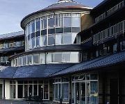
Hallmark Derby Mickleover Mickleover Court
Georgian House
The Boot
Derby West
Derby North West
Videos from this area
These are videos related to the place based on their proximity to this place.
Derby's Street Lighting PFI - Mackworth Estate (Night)
Commencing on Radbourne Lane, we travel along Ashbourne Road, Princes Charles Avenue, Brentford Drive, Beckenham Way, Enfield Road, Greenwich Drive North, Knightsbridge, Brackensdale ...
police witness C11 YNH 24112012
Video Submitted to www.policewitness.com Taken on MI-Witness HD camera 720P (www.mi-witness.co.uk) A38/A50 Inter change South of Derby Copyright Steven Warren.
Aktiv Transit Wheelchairs UK
www.wheelchairs-direct.com 0161 6679941 Wheelchairs Direct UK are dedicated suppliers of the leading Aktiv range of travel wheelchairs. On our website you will find a wide range of transit...
Derbyshire Day - Derbyshire Fire and Rescue Chip Pan and water demonstration.
This demonstration took place at this years Derbyshire Day at Kedleston Hall, near Derby. On Sunday 22nd September 2013. This is a perfect demonstration on why you should not put water onto...
A short drive around Mickleover, Derby
A short drive around Mickleover on Easter Day 2012. Best watched with the sound off as I left the mic on, so just car and camera sounds! Added sound track!
Dad's 80th. Birthday speech, Saturday, July 28th, 2012, The Great Northern, Mickleover, Derby
Vernon Moore addresses extended family and friends at his 80th birthday party.
Derby's Street Lighting PFI - Uttoxeter Road, Mickleover (Day)
Commencing at Vicarage Road, we travel to the Royal Derby Hospital roundabout before returning to Mickleover using the same route. At the time of filming, new columns were beginning to appear;...
Derby's Street Lighting PFI - Chain Lane, Mickleover (Day)
Commencing at Uttoxeter Road, we pass along the Mickleover stretch of Chain Lane. At the time of filming, the outgoing lighting was surviving on borrowed time, as commissioning of the new lighting...
Videos provided by Youtube are under the copyright of their owners.
Attractions and noteworthy things
Distances are based on the centre of the city/town and sightseeing location. This list contains brief abstracts about monuments, holiday activities, national parcs, museums, organisations and more from the area as well as interesting facts about the region itself. Where available, you'll find the corresponding homepage. Otherwise the related wikipedia article.
Kedleston Hall
Kedleston Hall is an English country house in Kedleston, Derbyshire, approximately four miles north-west of Derby, and is the seat of the Curzon family whose name originates in Notre-Dame-de-Courson in Normandy. Today it is a National Trust property. The Curzon family have owned the estate at Kedleston since at least 1297 and have lived in a succession of manor houses near to or on the site of the present Kedleston Hall.
Mackworth Estate
Mackworth Estate is a large council estate situated to the north-west of Derby near to Markeaton Park and the suburb of Mickleover and also the village of the same name but which is linked by no other means. The area was developed during the 1950s (the first house completed in 1953) and was one of the largest housing estates to be built in the city. Mackworth's most noticeable landmark is a large water tower owned by Severn Trent and can be seen from much of the estate.
Mickleover Sports F.C
Mickleover Sports Football Club is an English football club based in the Mickleover suburb of Derby, Derbyshire. They are members of the Northern Premier League Division One South. The club plays its home matches at The Raygar Stadium, formerly known as The Mickleover Sports Ground and more commonly referred to as Station Road after the road on which it is located.
Mickleover railway station
Mickleover railway station was a railway station serving the village of Mickleover, Derbyshire, England (now part of the city of Derby). It was opened by the Great Northern Railway on its Derbyshire Extension in 1878.
Etwall railway station
Etwall railway station was a former railway station in Etwall, Derbyshire. It was opened by the Great Northern Railway (Great Britain) on its Derbyshire Extension in 1878.
Radbourne Hall
Radbourne Hall is an 18th century country house, the home of the Chandos-Pole family, situated at Radbourne, Derbyshire. It is a Grade I listed building. The Manor of Radbourne was held by the Chandos family from the time of the Norman Conquest. On the death of Sir John Chandos in 1369 it passed to his niece who married Sir Peter de la Pole of Newborough, Staffordshire.
Mackworth Castle
Mackworth Castle was a 14th- or 15th-century structure located in Derbyshire, at the upper end of Mackworth village near Derby. The home for several centuries of the Mackworth family, it was at some point reduced to the ruins of a gatehouse suggestive of a grand castle. A survey from 1911 suggested that though the gatehouse resembled a castle, the rest of the structure may have been more modest.
All Saints Church, Kedleston
All Saints Church, Kedleston, is a redundant Anglican church standing adjacent to Kedleston Hall, a country house in Derbyshire, England. It is designated by English Heritage as a Grade I listed building. Kedleston Hall is owned by the National Trust, and the church is under the care of the Churches Conservation Trust. Kedleston Hall has been occupied by the Curzon family for over 700 years.


