Safety Score: 3,0 of 5.0 based on data from 9 authorites. Meaning we advice caution when travelling to United Kingdom.
Travel warnings are updated daily. Source: Travel Warning United Kingdom. Last Update: 2024-04-18 08:12:24
Explore Trusley
Trusley in Derbyshire (England) is located in United Kingdom about 116 mi (or 187 km) north-west of London, the country's capital.
Local time in Trusley is now 11:07 PM (Thursday). The local timezone is named Europe / London with an UTC offset of one hour. We know of 8 airports in the wider vicinity of Trusley, of which 5 are larger airports. The closest airport in United Kingdom is East Midlands Airport in a distance of 14 mi (or 22 km), South-East. Besides the airports, there are other travel options available (check left side).
There are several Unesco world heritage sites nearby. The closest heritage site in United Kingdom is Liverpool – Maritime Mercantile City in a distance of 43 mi (or 68 km), North-East. Also, if you like golfing, there are multiple options in driving distance. We found 1 points of interest in the vicinity of this place. If you need a place to sleep, we compiled a list of available hotels close to the map centre further down the page.
Depending on your travel schedule, you might want to pay a visit to some of the following locations: Shirley, Yeldersley, Rodsley, Bradley and Derby. To further explore this place, just scroll down and browse the available info.
Local weather forecast
Todays Local Weather Conditions & Forecast: 10°C / 50 °F
| Morning Temperature | 2°C / 36 °F |
| Evening Temperature | 8°C / 46 °F |
| Night Temperature | 9°C / 49 °F |
| Chance of rainfall | 0% |
| Air Humidity | 58% |
| Air Pressure | 1022 hPa |
| Wind Speed | Moderate breeze with 12 km/h (8 mph) from East |
| Cloud Conditions | Overcast clouds, covering 97% of sky |
| General Conditions | Overcast clouds |
Friday, 19th of April 2024
12°C (53 °F)
3°C (38 °F)
Light rain, fresh breeze, broken clouds.
Saturday, 20th of April 2024
10°C (50 °F)
3°C (37 °F)
Few clouds, gentle breeze.
Sunday, 21st of April 2024
10°C (50 °F)
3°C (38 °F)
Broken clouds, moderate breeze.
Hotels and Places to Stay
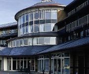
Hallmark Derby Mickleover Mickleover Court
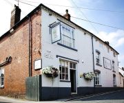
The Boot
Videos from this area
These are videos related to the place based on their proximity to this place.
police witness C11 YNH 24112012
Video Submitted to www.policewitness.com Taken on MI-Witness HD camera 720P (www.mi-witness.co.uk) A38/A50 Inter change South of Derby Copyright Steven Warren.
July Braai Video 2010
Official video covering events over the four days of the last July Braai - see if you can spot yourself or your camp? DVD available from Neil via www.finalsounds.co.za - order your own copy directly!
Aktiv Transit Wheelchairs UK
www.wheelchairs-direct.com 0161 6679941 Wheelchairs Direct UK are dedicated suppliers of the leading Aktiv range of travel wheelchairs. On our website you will find a wide range of transit...
Brailsford & District 107th Annual Ploughing Match video 2
As John Milnes continues, Rob Worthington completes the last furrow of the day.
Brailsford & District 107th Annual Ploughing Match video 1
This shows 101 Rob Worthington from Doncaster in the Class 1: Horses -- Open ploughing one furrow, then pans to John Milnes of Penistone competing in Tractor Ploughing, Class 3: Open.
Derby's Street Lighting PFI - Uttoxeter Road, Mickleover (Day)
Commencing at Vicarage Road, we travel to the Royal Derby Hospital roundabout before returning to Mickleover using the same route. At the time of filming, new columns were beginning to appear;...
Derby's Street Lighting PFI - Etwall Road, Mickleover (Night - SOX Lighting)
Commencing and ending at the 'Woodlands' Roundabout, we travel along Etwall Road until Uttoxeter Road. At the time of filming, the outgoing street lighting was still in use, but only for a...
Derby's Street Lighting PFI - Uttoxeter Road, Mickleover (Night - SON Lighting)
Travelling from Vicarage Road along Uttoxeter Road after nightfall, with the new lighting in operation, and the majority of the old lighting removed from site. See also: http://streetlightonline....
Videos provided by Youtube are under the copyright of their owners.
Attractions and noteworthy things
Distances are based on the centre of the city/town and sightseeing location. This list contains brief abstracts about monuments, holiday activities, national parcs, museums, organisations and more from the area as well as interesting facts about the region itself. Where available, you'll find the corresponding homepage. Otherwise the related wikipedia article.
A516 road
The A516 road is a road in Derbyshire that is used mostly for traffic flowing from the A50 to the A38. It finishes in Derby.
Thurvaston
Thurvaston is a small village in South Derbyshire. In 1970 the population was put at 200. This represents a general fall since 1871 when the population was just below 400.
Etwall railway station
Etwall railway station was a former railway station in Etwall, Derbyshire. It was opened by the Great Northern Railway (Great Britain) on its Derbyshire Extension in 1878.


