Safety Score: 3,0 of 5.0 based on data from 9 authorites. Meaning we advice caution when travelling to United Kingdom.
Travel warnings are updated daily. Source: Travel Warning United Kingdom. Last Update: 2024-04-25 08:17:04
Delve into Duffield
Duffield in Derbyshire (England) with it's 4,687 habitants is located in United Kingdom about 117 mi (or 189 km) north-west of London, the country's capital town.
Current time in Duffield is now 12:08 AM (Friday). The local timezone is named Europe / London with an UTC offset of one hour. We know of 9 airports close to Duffield, of which 5 are larger airports. The closest airport in United Kingdom is East Midlands Airport in a distance of 13 mi (or 20 km), South-East. Besides the airports, there are other travel options available (check left side).
There are several Unesco world heritage sites nearby. The closest heritage site in United Kingdom is Liverpool – Maritime Mercantile City in a distance of 35 mi (or 57 km), North-East. Also, if you like playing golf, there are some options within driving distance. If you need a hotel, we compiled a list of available hotels close to the map centre further down the page.
While being here, you might want to pay a visit to some of the following locations: Derby, Matlock, Yeldersley, Bradley and Shirley. To further explore this place, just scroll down and browse the available info.
Local weather forecast
Todays Local Weather Conditions & Forecast: 7°C / 44 °F
| Morning Temperature | 3°C / 38 °F |
| Evening Temperature | 7°C / 44 °F |
| Night Temperature | 2°C / 35 °F |
| Chance of rainfall | 1% |
| Air Humidity | 80% |
| Air Pressure | 1003 hPa |
| Wind Speed | Moderate breeze with 10 km/h (6 mph) from South-East |
| Cloud Conditions | Overcast clouds, covering 97% of sky |
| General Conditions | Light rain |
Friday, 26th of April 2024
5°C (42 °F)
2°C (36 °F)
Light rain, gentle breeze, broken clouds.
Saturday, 27th of April 2024
5°C (41 °F)
4°C (39 °F)
Light rain, moderate breeze, overcast clouds.
Sunday, 28th of April 2024
5°C (42 °F)
3°C (38 °F)
Moderate rain, moderate breeze, overcast clouds.
Hotels and Places to Stay
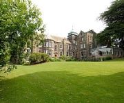
Makeney Hall Belper
Luxe Serviced Apartments
Lumb Farm Country Club
Morley Hayes
pentahotel Derby
Best Western The Stuart Hotel-Derby
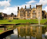
Breadsall Priory Marriott Hotel & Country Club
Hallmark Derby Mickleover Mickleover Court
Holiday Inn DERBY - RIVERLIGHTS
Jurys Inn Derby
Videos from this area
These are videos related to the place based on their proximity to this place.
Fast drive from Belper to Holbrook to Makeney to Milford to Duffield
Belper to Duffield (the back way) A back road drive from Belper to Holbrook to Makeney to Milford to Duffield, Derbyshire. 22nd February 2009. View a map of the route ... http://bit.ly/rjtwO.
Derbyshire by Car - Hazelwood to Duffield in HD July 2009, A Time-lapse journey.
Andy's Driving videos around Derbyshire, UK : Are you an ex-pat of Derbyshire, feeling homesick? Or perhaps you just want a clear way of giving someone directions to a location in Derbyshire...
Helicopter Crash.This in morning Valhalla
was go to Helicopter this morning( god is good too us ) Helicopter Crash.This in morning Valhalla Helicopter Crash.This in morning Valhalla Helicopter Crash.This in morning Valhalla.
Daleks at Milford School Maids of the Mill 2012.
Milford School Derbyshire May Fair 2012 hosts Dalek invasion with olympic sports theme!
My Grunge not mini To Remember
Hi everybody, here is my a bit grunge a bit romantic a bit huge album :D I took inspiration for rosete flower from Kay channel,so go check it out,so many beautiful projects are over there...
Altered old sewing box
Hi to everyone ; ) my auntie gave to me old sewing box to make it more shabby chic so I tried to do this. My lovely mum was help me again of course so here you can see how its turns out. Hope...
Victoria Design / Madame Payraud vintage File Folder
Hi everybody I made small teachers notebook or file folder for my lovely friend Natalie. I really hope she will like it and I hope you will like it as well :D Here is a link for Victoria Design...
CBBC: Walk on The Wild Side - Snow Love
We get the feeling this wolf really loves snow! To watch more funny animal clips and full episodes from Walk on The Wild Side visit the CBBC website at http://www.bbc.co.uk/cbbc/shows/walk-on-the-...
Videos provided by Youtube are under the copyright of their owners.
Attractions and noteworthy things
Distances are based on the centre of the city/town and sightseeing location. This list contains brief abstracts about monuments, holiday activities, national parcs, museums, organisations and more from the area as well as interesting facts about the region itself. Where available, you'll find the corresponding homepage. Otherwise the related wikipedia article.
North Midlands
The North Midlands is a loosely-defined area of England. It is typically held to include South Yorkshire and the northern parts of Derbyshire and Nottinghamshire, and in some definitions also covers southern Cheshire and parts of Lincolnshire and Staffordshire. The region's largest city is Sheffield. The North Midlands Helicopter Support Unit operated jointly by Nottinghamshire and Derbyshire Police covers these counties.
Duffield railway station
Duffield railway station is a railway station serving the village of Duffield in Derbyshire, England. The station is located on the Midland Main Line from Derby to Leeds. It is also a junction with the former branch line to Wirksworth, which has now been reopened as the Ecclesbourne Valley heritage railway. The unmanned station is served by East Midlands Trains, who operate local services from Derby to Matlock via the Derwent Valley Line.
Milford Tunnel
Milford Tunnel in Derbyshire is a twin track railway tunnel on the Midland Main Line which runs under a hill called the Chevin between Duffield and Belper. It was built in 1840 by the Stephensons for the North Midland Railway. When finished, it was 855 yards long. The west side of the Derwent valley has a number of gritstone outcrops, one being Burley Hill to the south of Duffield, another being Castle Hill in Duffield itself.
Milford, Derbyshire
Milford is a village in Derbyshire, England, on the River Derwent, between Duffield and Belper on the A6 trunk road. Until the end of the 18th century it was no more than a few houses near the point, about a quarter of a mile further south, where a Roman road from the Wirksworth lead mines forded the river. The road still exists as it passes across the Chevin hill and descends into the village by what is now Sunny Hill.
Duffield Castle, Derbyshire
Duffield Castle was a Norman Castle in Duffield, Derbyshire. The site is a Scheduled Ancient Monument. It was on a rocky promontory facing the river, easily defended, though it is debatable whether it was inhabited in prehistoric times. It is also controversial whether the Romans maintained a military presence to protect the ford, nearby, across which the convoys of lead from Lutudarum Wirksworth joined Rykneld Street at Derventio (now part of Derby), en route for the North Sea ports.
Duffield Bank Railway
The Duffield Bank Railway was built by Sir Arthur Percival Heywood in the grounds of his house on the hillside overlooking Duffield, Derbyshire in 1874. Although the Ordnance Survey map circa 1880 does not show the railway itself, it does show two tunnels and two signal posts.
Duffield Hall
Duffield Hall is a 17th century country house situated in the Amber Valley, Derbyshire, which is now the headquarters of the Derbyshire Building Society. It is a Grade II* listed building. The manor of Duffield was granted by King Charles I to the Newton family who built a new mansion house there in the 1620s. The Newtons sold the house to Henry Coape, High Sheriff of Derbyshire in 1703. His granddaughter and heiress brought the estate to her husband Henry Porter.
St Alkmund's Church, Duffield
Saint Alkmund's Church is a church dating back to the first millennium, situated on the banks of the River Derwent to the south of Duffield, Derbyshire. It is the parish church of Duffield and associated with the nearby church of St Paul's in Little Eaton. In times past the Parish of Duffield was much larger than it is now, covering the area known as Duffield Frith.


