Safety Score: 3,0 of 5.0 based on data from 9 authorites. Meaning we advice caution when travelling to United Kingdom.
Travel warnings are updated daily. Source: Travel Warning United Kingdom. Last Update: 2024-04-19 08:03:45
Delve into Dalbury Lees
Dalbury Lees in Derbyshire (England) is located in United Kingdom about 117 mi (or 188 km) north-west of London, the country's capital town.
Current time in Dalbury Lees is now 11:41 PM (Friday). The local timezone is named Europe / London with an UTC offset of one hour. We know of 8 airports close to Dalbury Lees, of which 5 are larger airports. The closest airport in United Kingdom is East Midlands Airport in a distance of 14 mi (or 22 km), South-East. Besides the airports, there are other travel options available (check left side).
There are several Unesco world heritage sites nearby. The closest heritage site in United Kingdom is Liverpool – Maritime Mercantile City in a distance of 41 mi (or 67 km), North-East. Also, if you like playing golf, there are some options within driving distance. We encountered 1 points of interest near this location. If you need a hotel, we compiled a list of available hotels close to the map centre further down the page.
While being here, you might want to pay a visit to some of the following locations: Shirley, Yeldersley, Rodsley, Bradley and Derby. To further explore this place, just scroll down and browse the available info.
Local weather forecast
Todays Local Weather Conditions & Forecast: 13°C / 55 °F
| Morning Temperature | 9°C / 48 °F |
| Evening Temperature | 7°C / 45 °F |
| Night Temperature | 3°C / 37 °F |
| Chance of rainfall | 0% |
| Air Humidity | 66% |
| Air Pressure | 1015 hPa |
| Wind Speed | Fresh Breeze with 16 km/h (10 mph) from South-East |
| Cloud Conditions | Broken clouds, covering 80% of sky |
| General Conditions | Light rain |
Saturday, 20th of April 2024
10°C (50 °F)
3°C (37 °F)
Scattered clouds, gentle breeze.
Sunday, 21st of April 2024
7°C (45 °F)
2°C (36 °F)
Overcast clouds, gentle breeze.
Monday, 22nd of April 2024
4°C (39 °F)
5°C (42 °F)
Light rain, light breeze, overcast clouds.
Hotels and Places to Stay
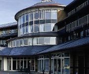
Hallmark Derby Mickleover Mickleover Court
Derby North West
Videos from this area
These are videos related to the place based on their proximity to this place.
Aktiv Transit Wheelchairs UK
www.wheelchairs-direct.com 0161 6679941 Wheelchairs Direct UK are dedicated suppliers of the leading Aktiv range of travel wheelchairs. On our website you will find a wide range of transit...
Brailsford & District 107th Annual Ploughing Match video 2
As John Milnes continues, Rob Worthington completes the last furrow of the day.
ScotRail BUO & RFO Coaches
For high quality: http://www.youtube.com/watch?v=ZRf3n88ztWI&fmt=18 A close up view of 2 converted Lima Mk2's (By Interespray) coaches.These are the coaches that None of the RTR manufacturer'.
Brailsford & District 107th Annual Ploughing Match video 1
This shows 101 Rob Worthington from Doncaster in the Class 1: Horses -- Open ploughing one furrow, then pans to John Milnes of Penistone competing in Tractor Ploughing, Class 3: Open.
A short drive around Mickleover, Derby
A short drive around Mickleover on Easter Day 2012. Best watched with the sound off as I left the mic on, so just car and camera sounds! Added sound track!
Dad's 80th. Birthday speech, Saturday, July 28th, 2012, The Great Northern, Mickleover, Derby
Vernon Moore addresses extended family and friends at his 80th birthday party.
Derby's Street Lighting PFI - Uttoxeter Road, Mickleover (Day)
Commencing at Vicarage Road, we travel to the Royal Derby Hospital roundabout before returning to Mickleover using the same route. At the time of filming, new columns were beginning to appear;...
Derby's Street Lighting PFI - Etwall Road, Mickleover (Night - SOX Lighting)
Commencing and ending at the 'Woodlands' Roundabout, we travel along Etwall Road until Uttoxeter Road. At the time of filming, the outgoing street lighting was still in use, but only for a...
Derby's Street Lighting PFI - Uttoxeter Road, Mickleover (Night - SON Lighting)
Travelling from Vicarage Road along Uttoxeter Road after nightfall, with the new lighting in operation, and the majority of the old lighting removed from site. See also: http://streetlightonline....
Videos provided by Youtube are under the copyright of their owners.
Attractions and noteworthy things
Distances are based on the centre of the city/town and sightseeing location. This list contains brief abstracts about monuments, holiday activities, national parcs, museums, organisations and more from the area as well as interesting facts about the region itself. Where available, you'll find the corresponding homepage. Otherwise the related wikipedia article.
Brailsford
Brailsford is a small red-brick village in Derbyshire on the A52 midway between Derby and Ashbourne. The village has a pub, a post office, a petrol station and a school. There are many fine houses in the district including two 20th-century country houses: Brailsford Hall built in 1905 in Jacobean style, and Culland Hall.
Thurvaston
Thurvaston is a small village in South Derbyshire. In 1970 the population was put at 200. This represents a general fall since 1871 when the population was just below 400.
Radbourne Hall
Radbourne Hall is an 18th century country house, the home of the Chandos-Pole family, situated at Radbourne, Derbyshire. It is a Grade I listed building. The Manor of Radbourne was held by the Chandos family from the time of the Norman Conquest. On the death of Sir John Chandos in 1369 it passed to his niece who married Sir Peter de la Pole of Newborough, Staffordshire.


