Safety Score: 3,0 of 5.0 based on data from 9 authorites. Meaning we advice caution when travelling to United Kingdom.
Travel warnings are updated daily. Source: Travel Warning United Kingdom. Last Update: 2024-05-07 07:59:51
Discover Bainsford
The district Bainsford of in Falkirk (Scotland) is a district in United Kingdom about 346 mi north-west of London, the country's capital city.
Looking for a place to stay? we compiled a list of available hotels close to the map centre further down the page.
When in this area, you might want to pay a visit to some of the following locations: Falkirk, Alloa, Stirling, Livingston and Motherwell. To further explore this place, just scroll down and browse the available info.
Local weather forecast
Todays Local Weather Conditions & Forecast: 11°C / 52 °F
| Morning Temperature | 9°C / 48 °F |
| Evening Temperature | 12°C / 54 °F |
| Night Temperature | 9°C / 49 °F |
| Chance of rainfall | 6% |
| Air Humidity | 88% |
| Air Pressure | 1025 hPa |
| Wind Speed | Light breeze with 5 km/h (3 mph) from West |
| Cloud Conditions | Overcast clouds, covering 100% of sky |
| General Conditions | Moderate rain |
Wednesday, 8th of May 2024
15°C (59 °F)
12°C (53 °F)
Light rain, gentle breeze, overcast clouds.
Thursday, 9th of May 2024
16°C (61 °F)
12°C (54 °F)
Overcast clouds, gentle breeze.
Friday, 10th of May 2024
15°C (59 °F)
12°C (54 °F)
Light rain, light breeze, overcast clouds.
Hotels and Places to Stay
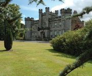
Airth Castle Hotel and Spa
Grange Manor
Macdonald Inchyra Grange
Craignish House
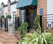
BEST WESTERN PARK HOTEL
Leapark
FALKIRK
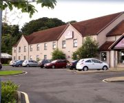
Premier Inn Falkirk Central
Falkirk East
Premier Inn
Videos from this area
These are videos related to the place based on their proximity to this place.
Making Award-Winning Pasta at Amodo Mio (Hands on Falkirk)
Part of the video series Hands On Falkirk, which showcases the skills and talents of BID businesses in Falkirk. Business: Amodo Mio www.amodo-mio.co.uk.
Review: Best Western Park Hotel, Falkirk, Stirlingshire, Scotland - 30th November, 2014
I stayed for one night at the Best Western Park Hotel in late November, 2014. I found the hotel to be warm and comfortable, the staff were friendly and the food was excellent. Overall I very...
Accountants in Falkirk transform your business ideas – Call 01324 460 288 for business advice on how
http://www.wabt.co.uk from Robertson Associates Chartered Accountants in can help you if you are typical of many small business owners. Are you… Stuck in a rut? Working long hours? Struggling...
Emergency Roof Repair Falkirk - Uncover A Roofer
Emergency Roof Repairs Falkirk - http://www.uncoveraplumber.com Hello my name is Paul and I am the founder of Uncover A Plumber. Every day people are searching online for plumbing services...
Winter Kelpies Horse Sculptures Forth And Clyde Canal Falkirk Scotland
Tour Scotland Winter video of The Kelpies by the Forth and Clyde Canal on ancestry visit to Falkirk. The kelpie is a supernatural water horse from Celtic folklore that is believed to haunt...
Falkirk Grahamston Train Station
Train Service From Glasgow Queen Street To Falkirk Grahamston Calling At Falkirk Grahamston.
FDAMH Media Group - The Journey
'The Journey' was produced in association with Falkirk and District Association for Mental Health (FDAMH) - adult service users recovering from Mental Health issues. The short film explores...
The Kelpies - Scotland's newest visitor attraction.
Scotland's newest tourist attraction. this massive sculpture of two horse heads is amazing.
DMA Driving Lessons Falkirk - Call 07902 993 943 - Happy Students - Facebook Story
DMA Driving Lessons Falkirk http://dmadrivingtuition.co.uk/ This is the video from DMA Driving Lessons Falkirk's Facebook Page. It shows all the happy students that passed their test with...
The Falkirk Wheel and The Kelpies
EXPAND FOR MORE INFO******** I wasn't having a great day so i didn't feel like talking to the camera but my family took a short trip to Falkirk so i thought id take some short clips...
Videos provided by Youtube are under the copyright of their owners.
Attractions and noteworthy things
Distances are based on the centre of the city/town and sightseeing location. This list contains brief abstracts about monuments, holiday activities, national parcs, museums, organisations and more from the area as well as interesting facts about the region itself. Where available, you'll find the corresponding homepage. Otherwise the related wikipedia article.
Falkirk (council area)
Falkirk is one of the 32 unitary authority council areas of Scotland. It borders onto North Lanarkshire to the south west, Stirling to the north west, West Lothian to the south east and across the Firth of Forth to the north east, Clackmannanshire and Fife. The council area was formed on 1 April 1996 from the exact boundaries of Falkirk District Council by way of the Local Government etc. (Scotland) Act 1994.
M9 motorway (Scotland)
The M9 is a major motorway in Scotland. It runs from the outskirts of Edinburgh, bypassing the towns of Linlithgow, Falkirk, Grangemouth and Stirling to end at Dunblane.
Battle of Falkirk
For the battle in 1746 see Battle of Falkirk Muir.
M876 motorway
The M876 motorway is a motorway in Scotland. The motorway runs from Denny to Airth in the Falkirk council area, forming an approach road to the Kincardine Bridge. It was opened in 1980. The road is 8 miles long. It begins by turning off junction 8 (formerly junction 5 until 2011) the M80 and bypasses Falkirk and Stenhousemuir.
Westerglen transmitting station
The Westerglen transmitting station is a facility for longwave and mediumwave broadcasting established in 1932 at Westerglen Farm, 3 km south west of Falkirk, Stirlingshire, Scotland. Four medium wave radio programmes are broadcast from the site on frequencies of 810, 909, 1089 and 1215 kHz and a long wave service on 198 kHz. There are three guyed steel lattice mast radiators on the site, which are insulated against ground. These carry combinations of the above services.
Battle of Falkirk Muir
During the Second Jacobite Rising, the Battle of Falkirk Muir was the last noteworthy Jacobite success. The battlefield has been inventoried and protected by Historic Scotland under the Historic Environment (Amendment) Act 2011.
Brockville Park
Brockville Park was a football stadium located on Hope Street in Falkirk, Scotland, 0.25 miles north-west of the town centre. It was the home of Falkirk F.C. from 1885 until the end of 2002–03 Scottish football season. The record attendance at Brockville Park was 23,100 on 21 February 1953 in a match against Celtic. Nowadays the stadium has since been replaced with a Morrisons supermarket. An old turnstile is on display next to the supermarket's car park.
Airth Castle
Airth Castle is a castle overlooking the village of Airth and the River Forth, in the Falkirk area of Scotland. The castle is currently operated as a hotel and spa. The castle is a major historic building, and retains much medieval fabric, and is designated as a Category A listed building by Historic Scotland.
Falkirk Steeple
The Falkirk Steeple is a landmark which dominates the skyline of Falkirk in central Scotland. The present structure on the High Street was built in 1814, and replaced an earlier steeple dating from the late 17th century, which itself replaced a still earlier structure. The Falkirk Steeple is protected as a category A listed building. A stylised image of the steeple appears on the crest of Falkirk Football Club.
Firs Park
Firs Park was a football stadium in Falkirk, which was the home of East Stirlingshire F.C. between 1921 and 2008. It was located on Firs Street, 0.3 miles north-east of the town centre. At the time of closing the ground had a capacity of 1,800 with 200 seated.
Woodlands, Falkirk
Woodlands is a large, prosperous central area (ward) of Falkirk, Stirlingshire, Scotland, which is mainly residential. Much of the ward is taken up by leafy streets where property prices are among the highest in Central Scotland (with several houses selling at over £800,000) and includes Lochgreen, Slamannan, Rosebank, Gartcows and Southern Pleasance areas (excluding property in Pleasance Gardens and Pleasance Court).
Rosebank distillery
The Rosebank distillery was situated in Camelon on the banks of the Forth and Clyde canal between Edinburgh and Glasgow. Its name originated after the roses which grew along the side of the canal.
A88 road
The A88 is a trunk road in Scotland, United Kingdom. It runs from Stenhousemuir to Larbert, a mere 3 miles, making it Britain's shortest two-digit road. It connects the A9 with the A905.
St Andrew's West
St. Andrew's West Parish Church is the largest church in Falkirk, Scotland, founded in 1843 and situated in the town centre on Upper Newmarket Street and known for its conservative evangelical preaching, aligning itself with the Forward Together group and the Evangelical Alliance. It is a congregation of the Church of Scotland. Originally known as the Free Church of Falkirk, from 1900 it became St. Andrew's United Free Church, and with the union of the Church of Scotland became St.
Comely Park School
Comely Park School is a primary school in Woodlands, Falkirk, Scotland. It was founded in 1879 as a replacement for the local Charity School. In its early days it was also known as "Cochrane's Academy" after its first headmaster. The original Victorian school buildings (which housed over 1,000 pupils in 1909) were demolished in 1996, and Comely Park was the first school in Falkirk to be rebuilt, along with a Games Hall and a large astro turf pitch. It currently accommodates around 500 pupils.
Abbotshaugh Community Woodland
Abbotshaugh Community Woodland is situated north of Falkirk. The first community planting was the result of an advert in the local newspaper. The area planted in March 1996 was the site of Dalderse Mill Farm which was the last working farm in the Dawson ward of Falkirk. The second area planted in March 1998 was Farm Road Community Woodland which incorporated memorial plantings. The third area planted was Coblebrae Community Woodland in March 2000.
Falkirk High School
Founded in 1886, Falkirk High School has a strong tradition of academic, musical and sporting excellence.
Graeme High School
Graeme High School is a non-denominational public secondary school located in Falkirk, Scotland. The school is run by Falkirk Council on behalf of the Scottish Government Education Department. The catchment area is served by Hallglen, Laurieston, St. Margaret's, Victoria and Westquarter primary schools.
Central Region, Scotland
Central Region (Roinn Meadhanach in Gaelic) was a local government region of Scotland from 1975 to 1996. It is now divided into the council areas of Falkirk, Stirling, and Clackmannanshire, which had previously been districts within Central. Central Regional Council's HQ was at Viewforth in Stirling which had been previously the HQ of Stirlingshire County Council.
Millennium Link
The Millennium Link is one of the biggest engineering projects ever undertaken by British Waterways. The Union Canal and the Forth & Clyde Canal were joined by a flight of locks. The Millennium Link project replaced the lock with an ingenious and unique boat lift, the Falkirk Wheel. The project launch was in October 1994, and it received a grant of £ 32 million from the Millennium Commission; the total cost of the project was £ 78 million. Work started in 1998.
Airth Road railway station
Airth Road was a railway station serving Airth in the Scottish county of Stirlingshire.
Arthur's O'On
Arthur's O'On was a Roman temple which, until 1743, stood on rising ground above the north bank of the River Carron not far from the old Carron ironworks in Stenhousemuir, near Falkirk, Scotland.
Carronvale House
Carronvale House is a category A listed country house in Larbert, Stirlingshire, Scotland. It is a large two-storey house with neo-Georgian details. Its outer walls date from the 18th century, with two new wings added in the 1820s, and it was extensively remodelled in 1897 by architect Sir John Burnet. It is home to the Boys' Brigade Scottish Headquarters, and is used as a training, conference and activity centre.
St. Mungo's High School
St Mungo's High School is the only Catholic High School in the area of Falkirk and is situated in Merchiston Avenue in the town. Stephen Phee is Head Teacher and the school chaplain is Father Simon Hughes, who works mainly within St. Francis Xavier's Church, Hope Street, Falkirk.
Falkirk Old Parish Church
Falkirk Old & St. Modan's Parish Church is a congregation of the Church of Scotland in Falkirk, central Scotland. The medieval Old Parish Church is located in the centre of Falkirk, and may have been founded as early as the 7th century. The church was largely rebuilt in the 19th century, though the 18th-century steeple was retained. The church building is protected as a category A listed building.


