Safety Score: 3,0 of 5.0 based on data from 9 authorites. Meaning we advice caution when travelling to United Kingdom.
Travel warnings are updated daily. Source: Travel Warning United Kingdom. Last Update: 2024-04-23 08:18:23
Discover Laurieston
Laurieston in Falkirk (Scotland) with it's 2,670 citizens is a town in United Kingdom about 343 mi (or 553 km) north-west of London, the country's capital city.
Current time in Laurieston is now 09:21 PM (Tuesday). The local timezone is named Europe / London with an UTC offset of one hour. We know of 11 airports near Laurieston, of which 5 are larger airports. The closest airport in United Kingdom is Edinburgh Airport in a distance of 15 mi (or 24 km), East. Besides the airports, there are other travel options available (check left side).
There are two Unesco world heritage sites nearby. The closest heritage site in United Kingdom is Old and New Towns of Edinburgh in a distance of 37 mi (or 60 km), East. Also, if you like playing golf, there are a few options in driving distance. Looking for a place to stay? we compiled a list of available hotels close to the map centre further down the page.
When in this area, you might want to pay a visit to some of the following locations: Falkirk, Alloa, Stirling, Livingston and Motherwell. To further explore this place, just scroll down and browse the available info.
Local weather forecast
Todays Local Weather Conditions & Forecast: 12°C / 54 °F
| Morning Temperature | 5°C / 40 °F |
| Evening Temperature | 11°C / 51 °F |
| Night Temperature | 4°C / 40 °F |
| Chance of rainfall | 0% |
| Air Humidity | 48% |
| Air Pressure | 1024 hPa |
| Wind Speed | Gentle Breeze with 7 km/h (4 mph) from West |
| Cloud Conditions | Few clouds, covering 23% of sky |
| General Conditions | Few clouds |
Wednesday, 24th of April 2024
11°C (51 °F)
4°C (40 °F)
Sky is clear, moderate breeze, clear sky.
Thursday, 25th of April 2024
10°C (49 °F)
4°C (39 °F)
Light rain, gentle breeze, broken clouds.
Friday, 26th of April 2024
8°C (47 °F)
4°C (40 °F)
Overcast clouds, gentle breeze.
Hotels and Places to Stay
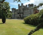
Grange Manor
Macdonald Inchyra Grange
Airth Castle Hotel and Spa
Leapark
BEST WESTERN PARK HOTEL
Craignish House
FALKIRK
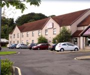
Premier Inn
Falkirk East
Premier Inn Falkirk Central
Videos from this area
These are videos related to the place based on their proximity to this place.
Falkirk 2-0 Livi - Sat 21st Feb '15
Match highlights Falkirk 2-0 Livingston SPFL Championship Saturday 21st February 2015.
Falkirk 2-0 Livi - Sat 21st Feb '15 - GOALS
GOALS Falkirk 2-0 Livingston SPFL Championship Saturday 21st February 2015.
Falkirk 0-0 Livi - Tue 21st Oct '14 - 60 seconds
Match highlights in 60 seconds. Falkirk 0-0 Livingston SPFL Championship Tuesday 21st October 2014.
The Kelpies Forth And Clyde Canal Between Falkirk And Grangemouth Scotland
Tour Scotland December video of The Kelpies horse head sculptures on a visit to the Forth and Clyde Canal between Falkirk and Grangemouth. The kelpie is a supernatural water horse from Celtic...
Falkirk JFC 0 - 1 Haddington Ath (23 Aug 14)
McBookie.com South Division, The Falkirk Stadium, Falkirk.
60007 Doing The Forth Circle On 24/4/11 - 10. Through Polmont Junction
60007 Doing The Forth Circle On 24/4/11 - 10. Through Polmont Junction.
Forth Circle SRPS, 61994 The Great Marquess joins the line at Polmont 1255hrs 05-04-2009
61994 The Great Marquess joins the Glasgow Edinburgh line at Polmont on the SRPS Forth Circle tour morning train 1255hrs 05-04-2009.
BillyWatson.TV - Sam Porter - Superhoot - 18/2/14
http://www.billywatson.tv A performer at Superhoot in Henry's Cellar Bar. http://www.henryscellarbar.com Check out my other channel at http://www.billywatson.tv Please subscribe to my channel...
Videos provided by Youtube are under the copyright of their owners.
Attractions and noteworthy things
Distances are based on the centre of the city/town and sightseeing location. This list contains brief abstracts about monuments, holiday activities, national parcs, museums, organisations and more from the area as well as interesting facts about the region itself. Where available, you'll find the corresponding homepage. Otherwise the related wikipedia article.
M9 motorway (Scotland)
The M9 is a major motorway in Scotland. It runs from the outskirts of Edinburgh, bypassing the towns of Linlithgow, Falkirk, Grangemouth and Stirling to end at Dunblane.
Battle of Falkirk
For the battle in 1746 see Battle of Falkirk Muir.
Polmont rail accident
The Polmont rail accident occurred on 30 July 1984 at Polmont, near Falkirk, Scotland, when an express train from Edinburgh to Glasgow, travelling at high speed, struck a cow which had wandered onto the track near Polmont station. Several of the carriages were derailed, resulting in 13 deaths and 61 injuries. The accident led to a debate about the safety of push-pull trains on British Rail.
Firs Park
Firs Park was a football stadium in Falkirk, which was the home of East Stirlingshire F.C. between 1921 and 2008. It was located on Firs Street, 0.3 miles north-east of the town centre. At the time of closing the ground had a capacity of 1,800 with 200 seated.
Comely Park School
Comely Park School is a primary school in Woodlands, Falkirk, Scotland. It was founded in 1879 as a replacement for the local Charity School. In its early days it was also known as "Cochrane's Academy" after its first headmaster. The original Victorian school buildings (which housed over 1,000 pupils in 1909) were demolished in 1996, and Comely Park was the first school in Falkirk to be rebuilt, along with a Games Hall and a large astro turf pitch. It currently accommodates around 500 pupils.
HM Prison Polmont
Her Majesty's Young Offenders Institution Polmont is the largest of its kind in Scotland. Despite its name, the institution is located in Reddingmuirhead in the Falkirk region, and not in Polmont. It is designed to hold up to 454 inmates between the ages of 16 and 21, although there have been several reports and complaints about the literal figures. Reports of living conditions have also been criticized, including an alleged lack of food for inmates and the practice of slopping out.
Abbotshaugh Community Woodland
Abbotshaugh Community Woodland is situated north of Falkirk. The first community planting was the result of an advert in the local newspaper. The area planted in March 1996 was the site of Dalderse Mill Farm which was the last working farm in the Dawson ward of Falkirk. The second area planted in March 1998 was Farm Road Community Woodland which incorporated memorial plantings. The third area planted was Coblebrae Community Woodland in March 2000.
Graeme High School
Graeme High School is a non-denominational public secondary school located in Falkirk, Scotland. The school is run by Falkirk Council on behalf of the Scottish Government Education Department. The catchment area is served by Hallglen, Laurieston, St. Margaret's, Victoria and Westquarter primary schools.


