Safety Score: 3,0 of 5.0 based on data from 9 authorites. Meaning we advice caution when travelling to United Kingdom.
Travel warnings are updated daily. Source: Travel Warning United Kingdom. Last Update: 2024-04-19 08:03:45
Touring Plean
Plean in Stirling (Scotland) with it's 1,920 residents is a town located in United Kingdom about 350 mi (or 563 km) north-west of London, the country's capital place.
Time in Plean is now 07:29 PM (Friday). The local timezone is named Europe / London with an UTC offset of one hour. We know of 11 airports nearby Plean, of which 5 are larger airports. The closest airport in United Kingdom is Edinburgh Airport in a distance of 21 mi (or 34 km), East. Besides the airports, there are other travel options available (check left side).
There are two Unesco world heritage sites nearby. The closest heritage site in United Kingdom is Old and New Towns of Edinburgh in a distance of 43 mi (or 69 km), East. Also, if you like the game of golf, there are several options within driving distance. Need some hints on where to stay? We compiled a list of available hotels close to the map centre further down the page.
Being here already, you might want to pay a visit to some of the following locations: Stirling, Alloa, Falkirk, Motherwell and Kirkintilloch. To further explore this place, just scroll down and browse the available info.
Local weather forecast
Todays Local Weather Conditions & Forecast: 10°C / 49 °F
| Morning Temperature | 5°C / 42 °F |
| Evening Temperature | 9°C / 48 °F |
| Night Temperature | 4°C / 39 °F |
| Chance of rainfall | 0% |
| Air Humidity | 55% |
| Air Pressure | 1019 hPa |
| Wind Speed | Moderate breeze with 11 km/h (7 mph) from South-East |
| Cloud Conditions | Broken clouds, covering 78% of sky |
| General Conditions | Broken clouds |
Saturday, 20th of April 2024
12°C (53 °F)
7°C (45 °F)
Broken clouds, light breeze.
Sunday, 21st of April 2024
9°C (49 °F)
9°C (48 °F)
Overcast clouds, light breeze.
Monday, 22nd of April 2024
16°C (60 °F)
8°C (47 °F)
Light rain, moderate breeze, overcast clouds.
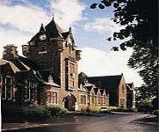
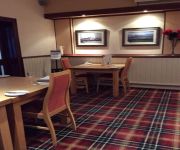
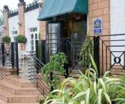
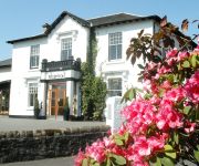
Hotels and Places to Stay
Colessio
Stirling Highland
Willow Court
Holiday Inn Express STIRLING
King Robert Hotel
Craignish House
BEST WESTERN PARK HOTEL
Castlecary House
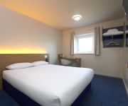
TRAVELODGE STIRLING M80
FALKIRK
Videos from this area
These are videos related to the place based on their proximity to this place.
Tornado through Larbert, 16/06/13
Five year old Peppercorn A1 pacific 60163 "Tornado" passes through Larbert station on the SRPS Forth Circle railtour.
70013 Oliver Cromwell On The SRPS Forth Circle Railtour Passing Larbert Station On 18/4/10
70013 Oliver Cromwell On The SRPS Forth Circle Railtour Passing Larbert Station On 18/4/10.
70004 Passing Through Larbert Station On 15/9/10
70004 passing through Larbert station on 6G10 headed for Longannet PS on 15/9/10.
river carron 18AUG 2012
A walk through the lower middle stretch of the river carron Larbert,am no expert when it comes to speycasting, but aye know my river. I will take through some of the best pools on the river system,thi.
RIVER CARRON LAST DAY OF WORMING 2012
TODAY IS THE LAST DAY OF WORMING ON THE RIVER CARRON FALKIRK, I WILL FISH THE BONNYWATER JUNCTION POOL DOWN TO THE VIADUCT LARBERT, WITH PLENTY FISH ON THE ...
Find out more about Kip McGrath Falkirk Tutors
Meet some of our teachers and specialist tutors at Kip McGrath Falkirk. If you would like to arrange a FREE educational assessment to find out more about our English, Maths, English, Science...
DVD/Bluray Update November 2012
Films I bought recently. Checkout my film Blog: www.raydvd.blogspot.com.
Videos provided by Youtube are under the copyright of their owners.
Attractions and noteworthy things
Distances are based on the centre of the city/town and sightseeing location. This list contains brief abstracts about monuments, holiday activities, national parcs, museums, organisations and more from the area as well as interesting facts about the region itself. Where available, you'll find the corresponding homepage. Otherwise the related wikipedia article.
Stirling and Falkirk
Stirling and Falkirk is a lieutenancy area of Scotland. It consists of the local government areas of Stirling and Falkirk, which cover the same areas as the previous districts from 1975—1996.
Battle of Sauchieburn
The Battle of Sauchieburn was fought on June 11, 1488, at the side of Sauchie Burn, a stream about two miles south of Stirling, Scotland. The battle was fought between the followers of King James III of Scotland and a large group of rebellious Scottish nobles including Alexander Home, 1st Lord Home, nominally led by the king's 15-year-old son, Prince James, Duke of Rothesay.
Torwood Castle
Torwood Castle is a castle ruin near the village of Torwood, in the Falkirk Council area of central Scotland. It has been estimated as being built around 1566 for Sir Alexander Forrester. It was once the seat of Clan Forrester. The castle was built by the Lords Forrester, who supplied the Crown with timber and were in charge of a royal hunting area. The castle is a Scottish Baronial style castle. The castle is undergoing a slow restoration, now under the auspices of the Torwood Castle Trust.
Cowie, Aberdeenshire
Cowie is an historic fishing village in Aberdeenshire, Scotland. This village has existed since the Middle Ages, but in current times it is effectively subsumed into the town of Stonehaven.
Plean
Plean is a former mining village, in the Stirling Council area of central Scotland located on the main A9 road from Falkirk. At the 2001 census, Plean had a population of 1,740. Plean has some historic buildings, some council houses and an estate.
Fallin, Stirling
Fallin (Scottish Gaelic: Faillean Innis, the meadow of twigs or pasture) is a village in the Stirling council area of Scotland. It lies on the A905 road 3 miles east of Stirling on a bend in the River Forth. The United Kingdom Census 2001 recorded the population as 2710. It was formerly a pit village, the site of the Polmaise colliery, originally opened in 1904 by Archibald Russell Ltd. At its peak, in 1957, it employed 778 people.
Cowie, Stirling
Cowie is a village in the Stirling council area of Scotland. It lies on the minor B9124 road approximately 4 miles south-east of Stirling and about a mile north of the A9 road. The United Kingdom Census 2001 recorded the population as 2387. Cowie was formerly a pit village and stone quarrying was carried on in the surrounds. It is now the site of a factory manufacturing engineered wood products and other light industries.
Throsk
Throsk (In Scottish Gaelic: Badan Deathach, meaning the thicket among the mist) is a settlement in the Stirling council area of Scotland. It lies on the A905 road east of Fallin close to the River Forth. The United Kingdom Census 2001 recorded the population as 231. Throsk was formerly the site of the Royal Navy's Bandeath armaments depot. This closed in 1978 and now serves as an industrial estate owned by the local council.


