Safety Score: 3,0 of 5.0 based on data from 9 authorites. Meaning we advice caution when travelling to United Kingdom.
Travel warnings are updated daily. Source: Travel Warning United Kingdom. Last Update: 2024-05-12 08:29:37
Discover Fisherrow
The district Fisherrow of Musselburgh in East Lothian (Scotland) is a subburb in United Kingdom about 328 mi north of London, the country's capital city.
If you need a hotel, we compiled a list of available hotels close to the map centre further down the page.
While being here, you might want to pay a visit to some of the following locations: Dalkeith, Edinburgh, Glenrothes, Haddington and Livingston. To further explore this place, just scroll down and browse the available info.
Local weather forecast
Todays Local Weather Conditions & Forecast: 18°C / 64 °F
| Morning Temperature | 13°C / 56 °F |
| Evening Temperature | 16°C / 61 °F |
| Night Temperature | 13°C / 55 °F |
| Chance of rainfall | 10% |
| Air Humidity | 74% |
| Air Pressure | 1012 hPa |
| Wind Speed | Moderate breeze with 9 km/h (6 mph) from North-West |
| Cloud Conditions | Overcast clouds, covering 94% of sky |
| General Conditions | Moderate rain |
Monday, 13th of May 2024
13°C (55 °F)
11°C (52 °F)
Moderate rain, gentle breeze, overcast clouds.
Tuesday, 14th of May 2024
13°C (55 °F)
11°C (53 °F)
Light rain, moderate breeze, overcast clouds.
Wednesday, 15th of May 2024
11°C (52 °F)
11°C (52 °F)
Light rain, gentle breeze, overcast clouds.
Hotels and Places to Stay
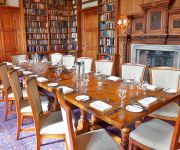
Carberry Tower Mansion House and Estate
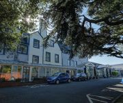
BEST WESTERN KINGS MANOR HOTEL
Aynetree Guest House
Emerald Guest House
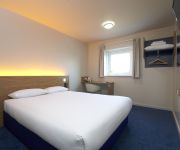
TRAVELODGE EDINBURGH MUSSELBURGH
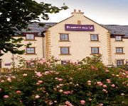
Edinburgh Lodges
Edinburgh East
Edinburgh A1 (Newcraighall)
Edinburgh A1 (Musselburgh)
Edinburgh A7 (Dalkeith)
Videos from this area
These are videos related to the place based on their proximity to this place.
Road Trips in Scotland - Edinburgh to Haddington Part 1
Part 1 of a 2 part journey to Haddington in East Lothian - not forgetting a break for morning coffee! Filmed safely with the camera hands-free on a neck sling.
Bermuda Kite Overlooks Musselburgh Links
Panasonic Lumix FT3 Camera attached to a Bermuda Moonie kite is flown over Musselburgh Links. The video is crap but the idea is cool!
Nae Need Musselburgh 13/06/09
Young band from Dalkeith St Davids called Nae Need get a turn at Musselburgh Fun Day 13th June 2009.
Musselburgh Fireworks
The end of the fireworks 2013. Taken with an iPhone 4 so not the very best of quality...
Musselburgh Rugby Sevens
Musselburgh 7s Tournament and AndyG (POTY) Highlights (MRFC 7s 2008 - Musselburgh v QMU, Musselburgh Select, Edinburgh University, Watsonians RFC)
Musselburgh Golf Club
Musselburgh Golf Club is part of the Edinburgh Golf initiative - a working partnership between 13 golf clubs in and around Edinburgh, Scotland. Visit the website for more information, www.edinburgh...
A few laps of Musselburgh BMX track with my KM Baja following Bri's Maverick Blackout XB
My KM Baja 29cc following Bri's Maverick Blackout XB around Musselburgh BMX track. Kept it slow as I didn't want to destroy my cam and Bri was having diff drive problems, also didn't want to...
Horseracing in 2006 at Musselburgh Racetrack
Some of a race at Musselburgh Racecourse in Scotland. I think it was the home straight, I'm not to sure though.It's not much so enjoy it while you can...... :D Please rate. :)
4 Headed Bermuda Kite in Musselburgh
A pink and black, four headed Bermuda kite flown in Musselburgh, Scotland.
Videos provided by Youtube are under the copyright of their owners.
Attractions and noteworthy things
Distances are based on the centre of the city/town and sightseeing location. This list contains brief abstracts about monuments, holiday activities, national parcs, museums, organisations and more from the area as well as interesting facts about the region itself. Where available, you'll find the corresponding homepage. Otherwise the related wikipedia article.
Midlothian
Midlothian is one of the 32 council areas of Scotland, and a lieutenancy area. It borders the City of Edinburgh, East Lothian and the Scottish Borders council areas. The County of Midlothian used for local government purposes formerly encompassed the city of Edinburgh, and within these borders still serves as a registration county. As a result, the county was formerly known as Edinburghshire. Midlothian Council area was created in 1996, under the Local Government etc.
Lothian
Lothian (forms a traditional region of the Scottish Lowlands, lying between the southern shore of the Firth of Forth and the Lammermuir Hills. The Lothian region includes Edinburgh City, West Lothian, Mid Lothian and East Lothian. The principal settlement in Lothian is the Scottish capital, Edinburgh. Towns include Livingston, Linlithgow, Bathgate and Dunbar. Historically, the term Lothian is used for a province encompassing the present area plus the Scottish Borders region.
Dalkeith Palace
Dalkeith Palace in Dalkeith, Midlothian, Scotland, is a historic house and the former seat of the Duke of Buccleuch. The present house was built in 1702 on the site of an earlier castle.
River Esk, Lothian
The River Esk is a river which flows through Midlothian and East Lothian, Scotland. It initially runs as two separate rivers, the North Esk and the South Esk. The North Esk rises in the North Esk Reservoir in the Pentland Hills, in Midlothian, a mile (1½ km) north of the village of Carlops. It flows north-east past Penicuik, Auchendinny, through Roslin Glen, past Hawthornden Castle, Polton, Lasswade and Melville Castle.
Inveresk
Inveresk is a village in East Lothian, Scotland situated immediately to the south of Musselburgh. It forms one of the finest conservation areas in Scotland having been designated a conservation area since 1969. It is situated on slightly elevated ground on the north bank of a loop of the River Esk. This ridge of ground, 20 to 25 metres above sea level, was used by the Romans as the location for a fort in the second century AD.
Queen Margaret University
Queen Margaret University (formerly Queen Margaret University College and Queen Margaret College) is a Modern University located in Musselburgh, East Lothian near Edinburgh in Scotland. It is named after Saint Margaret, wife of King Malcolm III of Scotland.
Brunstane
Brunstane is a southeastern suburb of the city of Edinburgh, Scotland. It lies on the A1 and is served by Brunstane railway station on the Edinburgh Crossrail. Some of Brunstane is covered by new housing, such as the Gilberstoun estate. Prominent local features include the Milton Road campus of the Jewel and Esk Valley College and Edinburgh's largest Asda supermarket.
Whitecraig
Whitecraig is a village in East Lothian in Scotland. It is between Musselburgh and Dalkeith, to the east of the city of Edinburgh.
Eastfield, Edinburgh
Eastfield is a primarily residential district on the north eastern outskirts of Edinburgh, the capital of Scotland. It lies between Joppa and the Edinburgh City boundary with Musselburgh. The district is bounded on the north by the Firth of Forth, on the west by Joppa and the main East Coast rail line, and on the south by farmland and the grounds of Newhailes House a National Trust for Scotland property.
Joppa, Edinburgh
Joppa is an eastern suburb of Edinburgh, the capital of Scotland. It is bounded on the north by the coast of the Firth of Forth, on the west by Portobello of which it was a suburb when Portobello was a burgh, to the south by the open area south of Milton Road and to the east by Musselburgh in East Lothian. The name "Joppa" appears in the late 18th century and is of uncertain origin.
Danderhall
Danderhall is a village in Midlothian, Scotland. It is just outside the city of Edinburgh, but inside the Edinburgh City Bypass. The village includes a large amount of council housing — although much of this is now privately owned by the occupiers. Danderhall was formerly a "mining village", supplying labour for the nearby coal mines of Edmonstone to the northwest, Sheriffhall to the southeast, Woolmet to the east and Monktonhall beyond that.
Dalkeith High School
Dalkeith High School is a non-denominational secondary state school located in Dalkeith, Midlothian, Scotland.
St. David's RC High School
St David's RC High School is a Catholic secondary state school located at Cousland Road in Dalkeith, Midlothian, Scotland. It has shared the same campus with Dalkeith High School since 2003.
John Muir Way
The John Muir Way is a 73-kilometre continuous coastal path in East Lothian, Scotland, UK. It is named in honour of the Scottish 19th-century conservationist John Muir, who was born at Dunbar, East Lothian, in 1838 and became a founder of America's national park system. The path runs from the Edinburgh City boundary along the coast through East Lothian to the Scottish Borders.
Musselburgh Racecourse
Musselburgh Racecourse, known until the 1990s as Edinburgh Racecourse, is a horse racing venue located in the Millhill area of Musselburgh, East Lothian, Scotland, UK, close to the River Esk. At first, race meetings were held on the sands at Leith, but in 1816 they moved to Musselburgh. The course offers both flat racing and National Hunt meetings (though it only introduced jumping in 1987) and is 2 km long. In the middle of the course is a nine hole golf course, dating from at least 1672.
Pinkie House
Pinkie House is a historic house, built around a three-storey tower house located in Musselburgh, East Lothian, Scotland. The house dates from the 16th century, was substantially enlarged in the early 17th century, and has been altered several times since. Its location at grid reference NT348726 is to the east of the town centre, on the south side of the High Street. The building now forms part of Loretto School, an independent boarding school.
Shawfair railway station
Shawfair railway station will be a newly planned station to be opened on the Waverley Line, a railway line to be reopened between Edinburgh and Tweedbank, just beyond Galashiels in Scotland. There is planned to be a half-hourly service at this stop to Gorebridge. This station is to serve the new development of Shawfair, a settlement south-east of Edinburgh.
Fort Kinnaird
Fort Kinnaird is a large outdoor retail park, which is located in the village of Newcraighall, just off the A1 in the southeast of Edinburgh, Scotland. It opened in 1989. Fort Kinnaird has many shops, restaurants and entertainment complexes and is soon to be extended for the second time in as many years in the area that once housed Megabowl, Chiquito, Frankie & Benny's, Odeon and Harveys..
Shawfair
Shawfair is the name of a new town planned to be built on the site of the former Monktonhall Colliery in the south-east wedge of Edinburgh. The name is derived from a local farm steading of the same name. Although it is within the boundary of the city-bypass, it will not technically be a suburb of Edinburgh as it is outwith the city council boundary and instead will actually be wholly within the Midlothian council area.
Inveresk Lodge Garden
Inveresk Lodge Garden is a garden in the care of the National Trust for Scotland, in the village of Inveresk, East Lothian, Scotland, UK, south of Musselburgh.
Levenhall Links
Levenhall Links is a coastal, industrial, and recreational area at Musselburgh, East Lothian, Scotland, UK; it is adjacent to Musselburgh Racecourse, Morrison's Haven and Prestongrange Industrial Heritage Museum. Levenhall Links is 134 hectares of land reclaimed from the sea by building a sea wall and pumping of large amounts of pulverised fuel ash into a number of ash lagoons.
Fisherrow
Fisherrow is a harbour and former fishing village at Musselburgh, East Lothian, Scotland, UK, to the east of Portobello and Joppa, and on the left bank of the River Esk.
Elginhaugh
Elginhaugh Roman Fort was a Roman fort of the 1st century AD, located in Midlothian, Scotland. Elginhaugh is the most completely excavated timber-built auxiliary fort in the Roman Empire. The site of the Flavian (1st century) fort lies 1 km to the west of the modern town of Dalkeith, south-east of Edinburgh. The fort, discovered in 1979 by aerial reconnaissance, takes its name from the nearby hamlet of Elginhaugh.
Musselburgh Grammar School
Musselburgh Grammar School is a large state secondary school that serves as the main secondary school for Musselburgh and the surrounding areas. It dates back to the sixteenth century, although the present building was erect in 1835. Until the 1950s the school was a 'proper' Grammar School, and fees were paid for there. As of December 2005 the school's roll was 1510. The current headteacher is Ronald Summers who has been in position since 2003.
Smeaton House
Smeaton House, also known as Smeaton Castle, and now as Dalkeith Home Farm, is a courtyard castle dating from the fifteenth century, about 2 miles north of Dalkeith, and 1 mile south of Inveresk in East Lothian, Scotland.


