Safety Score: 3,0 of 5.0 based on data from 9 authorites. Meaning we advice caution when travelling to United Kingdom.
Travel warnings are updated daily. Source: Travel Warning United Kingdom. Last Update: 2024-04-26 08:02:42
Delve into Standish
Standish in Wigan (England) is located in United Kingdom about 179 mi (or 288 km) north-west of London, the country's capital town.
Current time in Standish is now 05:26 PM (Friday). The local timezone is named Europe / London with an UTC offset of one hour. We know of 9 airports close to Standish, of which 4 are larger airports. The closest airport in United Kingdom is Liverpool John Lennon Airport in a distance of 19 mi (or 30 km), South-West. Besides the airports, there are other travel options available (check left side).
There are several Unesco world heritage sites nearby. The closest heritage site in United Kingdom is Pontcysyllte Aqueduct and Canal in a distance of 44 mi (or 70 km), South. Also, if you like playing golf, there are some options within driving distance. If you need a hotel, we compiled a list of available hotels close to the map centre further down the page.
While being here, you might want to pay a visit to some of the following locations: Wigan, Chorley, Haigh, St Helens and Winwick. To further explore this place, just scroll down and browse the available info.
Local weather forecast
Todays Local Weather Conditions & Forecast: 10°C / 49 °F
| Morning Temperature | 3°C / 37 °F |
| Evening Temperature | 8°C / 46 °F |
| Night Temperature | 5°C / 42 °F |
| Chance of rainfall | 2% |
| Air Humidity | 55% |
| Air Pressure | 1004 hPa |
| Wind Speed | Light breeze with 5 km/h (3 mph) from West |
| Cloud Conditions | Scattered clouds, covering 31% of sky |
| General Conditions | Light rain |
Saturday, 27th of April 2024
11°C (51 °F)
6°C (43 °F)
Overcast clouds, gentle breeze.
Sunday, 28th of April 2024
6°C (44 °F)
6°C (42 °F)
Moderate rain, gentle breeze, overcast clouds.
Monday, 29th of April 2024
12°C (54 °F)
9°C (48 °F)
Light rain, gentle breeze, broken clouds.
Hotels and Places to Stay
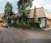
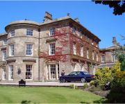
Macdonald Kilhey Court & Spa
Britannia Wigan
Mercure Wigan Oak Hotel
Best Western Park Hall Village
Best Western Park Hall Preston
Shaw Hill Golf & Country Club
Travel Inn
Wigan (M6 Jct 27)
Holiday Inn Express WIGAN
Wigan Town Centre
Videos from this area
These are videos related to the place based on their proximity to this place.
Pitch invasion at end of Wigan Athletic 3 Wolves 2 at DW Stadium May 2012
Latics fans get on the pitch to celebrate the end of the 2011 - 12 Premier League season after Wigan Athletic beat already relegated Wolverhampton Wanderers 3 - 2.
Wigan Athletic lap parade of honour after the win over Wolves May 2012
Wigan Athletic players and manager do a lap of honour after the final game of the 2011 - 12 season.
Rob Kiernan's first senior goal for Wigan Athletic
Rob Kiernan's first senior goal, which put Wigan Athletic 2-1 ahead against Leicester City, The match ended in a 2-2 draw.
Trotting Match at Springfield Park Wigan (1904)
This film is part of the Mitchell and Kenyon collection - an amazing visual record of everyday life in Britain at the beginning of the twentieth century. To buy the DVD click here - http://www.bf...
Melton Mowbray (North) by John Spence and Steve Weston at Wigan Exhibition 2013
Melton Mowbray (North) by John Spence and Steve Weston. An N Gauge model railway layout as it could have been in 1957 to 1962 and as seen at Wigan Exhibition JUNE 2013. A Video by Black and.
Blackpool FC enter for the 1st time in the premiership
The mighty mighty seasiders enter the stadium to a rapturous applause.
Smart Car 0.7 2003 Turbo 2012-09-05-13-23-45.mp4
Bought this Smart for £1400.00, Two burnt out valves & 1 piston ring, Spent £975.00 on it for the engine inc x1 dump valve for the turbo, x1 exhaust manifold & x1 wheel bearing. Yes I do...
Videos provided by Youtube are under the copyright of their owners.
Attractions and noteworthy things
Distances are based on the centre of the city/town and sightseeing location. This list contains brief abstracts about monuments, holiday activities, national parcs, museums, organisations and more from the area as well as interesting facts about the region itself. Where available, you'll find the corresponding homepage. Otherwise the related wikipedia article.
Wigan Rural District
Wigan was a rural district in Lancashire, England from 1894 to 1974. It comprised an area to the north, but did not include the town Wigan. The district was created by the Local Government Act 1894 as the successor to the Wigan Rural Sanitary District. It consisted of six civil parishes: Dalton, Haigh, Parbold, Shevington, Worthington and Wrightington. The parish of Haigh was an exclave, separated from the rest of the district by Standish with Langtree Urban District.
Springfield Park (Wigan)
Springfield Park was a multi-purpose stadium in Wigan, Greater Manchester. It was the home ground of Wigan Athletic F.C. until the club moved to the new JJB Stadium (now DW Stadium) after the 1998/99 season. At its largest, the stadium held 40,000. In its 102 year existence the ground only saw 32 years as a Football League venue, 11 years for Wigan Borough F.C. and 21 years for Wigan Athletic FC, before it was demolished to make way for a housing estate in 1999.
Westhoughton (UK Parliament constituency)
Westhoughton was a parliamentary constituency in Lancashire, England. Centred on the former mining and cotton town of Westhoughton, it returned one Member of Parliament (MP) to the House of Commons of the Parliament of the United Kingdom. The constituency was created for the 1885 general election, and abolished for the 1983 general election.
Church of St Wilfrid, Standish
The Church of St Wilfrid is located in Market Place, Standish, Wigan, Greater Manchester, England. It is an active Anglican parish church in the Diocese of Blackburn. It is listed by English Heritage as a Grade I listed building. The authors of the Buildings of England series describe it as "one of the most interesting churches in Lancashire". {{#invoke:Footnotes|sfn}}
Worthington Lakes
Worthington Lakes is a series of three reservoirs situated near to Standish off the A5106 Wigan to Chorley road in the north-west of England. They were constructed in the early 1880s to provide the water demands of the rapidly growing town of Wigan. The water supply comes from a diversion of the River Douglas.
Standish Community High School
Chisnall Hall Colliery
Chisnall Hall Colliery a colliery in Coppull in Lancashire, England. It was the largest coal mine on the Lancashire Coalfield north of Wigan. The colliery on Coppull Moor was owned by Pearson and Knowles Coal and Iron Company in 1896 when it employed 135 underground and 48 surface workers. It appeared on maps in 1908 as a coal mine with two shafts and railway sidings connecting its 1.5 mile mineral railway to the London and North Western Railway's Wigan–Preston main line.
H. J. Heinz, Wigan
The H. J. Heinz, Wigan factory is food manufacturing plant owned by H. J. Heinz Company, based in Kitt Green, Wigan in Greater Manchester, England. It is presently the largest food processing plant in Europe, and the largest H. J. Heinz facility in the world.


