Safety Score: 3,0 of 5.0 based on data from 9 authorites. Meaning we advice caution when travelling to United Kingdom.
Travel warnings are updated daily. Source: Travel Warning United Kingdom. Last Update: 2024-04-28 08:22:10
Delve into High Ercall
High Ercall in Telford and Wrekin (England) with it's 686 habitants is a city located in United Kingdom about 136 mi (or 219 km) north-west of London, the country's capital town.
Current time in High Ercall is now 08:31 AM (Monday). The local timezone is named Europe / London with an UTC offset of one hour. We know of 10 airports closer to High Ercall, of which 5 are larger airports. The closest airport in United Kingdom is Hawarden Airport in a distance of 33 mi (or 53 km), North-West. Besides the airports, there are other travel options available (check left side).
There are several Unesco world heritage sites nearby. The closest heritage site in United Kingdom is Pontcysyllte Aqueduct and Canal in a distance of 20 mi (or 32 km), North-West. Also, if you like playing golf, there are some options within driving distance. In need of a room? We compiled a list of available hotels close to the map centre further down the page.
Since you are here already, you might want to pay a visit to some of the following locations: Withington, Shawbury, Eyton upon the Weald Moors, Astley and Wellington. To further explore this place, just scroll down and browse the available info.
Local weather forecast
Todays Local Weather Conditions & Forecast: 11°C / 53 °F
| Morning Temperature | 7°C / 45 °F |
| Evening Temperature | 11°C / 51 °F |
| Night Temperature | 10°C / 50 °F |
| Chance of rainfall | 0% |
| Air Humidity | 81% |
| Air Pressure | 1010 hPa |
| Wind Speed | Fresh Breeze with 16 km/h (10 mph) from North |
| Cloud Conditions | Overcast clouds, covering 100% of sky |
| General Conditions | Light rain |
Tuesday, 30th of April 2024
16°C (60 °F)
9°C (48 °F)
Overcast clouds, fresh breeze.
Wednesday, 1st of May 2024
14°C (58 °F)
9°C (49 °F)
Light rain, light breeze, overcast clouds.
Thursday, 2nd of May 2024
10°C (51 °F)
9°C (48 °F)
Moderate rain, moderate breeze, overcast clouds.
Hotels and Places to Stay
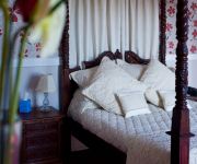
The Wroxeter Hotel
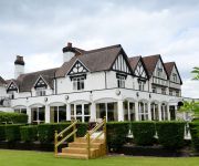
Buckatree Hall
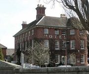
The Mytton & Mermaid Hotel
TRAVELODGE TELFORD SHAWBIRCH
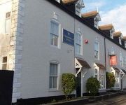
Lord Nelson Hotel
Videos from this area
These are videos related to the place based on their proximity to this place.
When Faith Descends - Six Foot Under Live @ The Haygate
Six Foot Under Live @ The Haygate, Wellington UK.
British Traffic Light
Traffic lights in Britain have a unique sequence. Red, then Red and Amber, then Green. The Amber lets you know to expect green soon.
Videos provided by Youtube are under the copyright of their owners.
Attractions and noteworthy things
Distances are based on the centre of the city/town and sightseeing location. This list contains brief abstracts about monuments, holiday activities, national parcs, museums, organisations and more from the area as well as interesting facts about the region itself. Where available, you'll find the corresponding homepage. Otherwise the related wikipedia article.
High Ercall
High Ercall, also known in the past as Ercall Magna, is a village in the borough of Telford and Wrekin and ceremonial county of Shropshire, England. The civil parish is still called Ercall Magna, and had a total population of 1,679 at the 2001 census. The parish also includes the villages of Rowton, Ellerdine, Cold Hatton, and a number of small hamlets. Its name is locally pronounced "Arkle". The village lies on the junction of the B5062 and B5063 roads.
Roden, Shropshire
Roden is a hamlet in the borough of Telford and Wrekin and ceremonial county of Shropshire, England. The little River Roden flows past the village. Roden Hall, dating in part from the 14th century, was rebuilt in 1868 by the Co-operative Wholesale Society as a convalescent home for millworkers from Lancashire and Yorkshire, and is now a care home.
River Roden, Shropshire
The River Roden is a river in Shropshire, England, which rises near Wem Moss and meets the River Tern at Walcot. Villages and towns it flows through or near to include: Wem Lee Brockhurst Shawbury Roden Rodington
Longdon-on-Tern
Longdon-Upon-Tern (also known as Longdon-on-Tern or colloquially Longdon) is a village in east central Shropshire, England. It is in the unitary district of Telford and Wrekin, and is approximately 11 kilometres east of Shrewsbury and 11 kilometres north-west of Telford. Longdon-Upon-Tern is situated on the River Tern, a tributary of the River Severn.
Osbaston, Telford
Osbaston is a hamlet in the English county of Shropshire. Osbaston forms part of the civil parish of Ercall Magna and the unitary authority of Telford and Wrekin, it lies eleven miles north-west from the centre of Telford.
Siege of High Ercall Hall
The siege of High Ercall Hall in High Ercall, Shropshire, England took place during the English Civil War. There were a total of three sieges, In each the Hall was held by Royalists and besieged by Parliamentarians. The final and longest siege took place from July 1645 to March 1646, when the Cavalier commander surrendered the hall to the Roundheads.
High Ercall Hall
High Ercall Hall or Ercall Hall is the remaining part of a larger complex in the village of High Ercall, Shropshire, 8 miles (13 km) north-east of Shrewsbury. The present structure is a Grade II* L-shaped, three storey building of 16th century origin, constructed of sandstone and brick. It has 5 bays with 3 alternate projecting gables. Adjacent to the house is a row of arches, the only remainder of a larger 17th century house building that was badly damaged during the Civil war.
St Michael's Church, High Ercall
St Michael's Church, High Ercall, is located in the village of High Ercall, Shropshire, England. It is an active Anglican parish church in the deanery of Wrockwardine, the archdeaconry of Salop, and the diocese of Lichfield. Its benefice is united with those of twelve local churches. The church is designated by English Heritage as a Grade I listed building.


