Safety Score: 3,0 of 5.0 based on data from 9 authorites. Meaning we advice caution when travelling to United Kingdom.
Travel warnings are updated daily. Source: Travel Warning United Kingdom. Last Update: 2024-04-15 07:59:01
Explore Longnor
Longnor in Shropshire (England) is a city in United Kingdom about 135 mi (or 217 km) north-west of London, the country's capital.
Local time in Longnor is now 07:39 AM (Tuesday). The local timezone is named Europe / London with an UTC offset of one hour. We know of 10 airports in the vicinity of Longnor, of which 5 are larger airports. The closest airport in United Kingdom is Hawarden Airport in a distance of 41 mi (or 66 km), North. Besides the airports, there are other travel options available (check left side).
There are several Unesco world heritage sites nearby. The closest heritage site in United Kingdom is Pontcysyllte Aqueduct and Canal in a distance of 26 mi (or 43 km), North. Also, if you like golfing, there is an option about 28 mi (or 46 km). away. If you need a place to sleep, we compiled a list of available hotels close to the map centre further down the page.
Depending on your travel schedule, you might want to pay a visit to some of the following locations: Cardington, Berrington, Bayston Hill, Great Hanwood and Shrewsbury. To further explore this place, just scroll down and browse the available info.
Local weather forecast
Todays Local Weather Conditions & Forecast: 9°C / 47 °F
| Morning Temperature | 6°C / 43 °F |
| Evening Temperature | 6°C / 43 °F |
| Night Temperature | 2°C / 36 °F |
| Chance of rainfall | 0% |
| Air Humidity | 58% |
| Air Pressure | 1016 hPa |
| Wind Speed | Fresh Breeze with 17 km/h (11 mph) from South-East |
| Cloud Conditions | Few clouds, covering 16% of sky |
| General Conditions | Few clouds |
Wednesday, 17th of April 2024
7°C (44 °F)
1°C (35 °F)
Light rain, moderate breeze, broken clouds.
Thursday, 18th of April 2024
9°C (49 °F)
5°C (42 °F)
Light rain, gentle breeze, scattered clouds.
Friday, 19th of April 2024
11°C (51 °F)
6°C (43 °F)
Light rain, moderate breeze, overcast clouds.
Hotels and Places to Stay
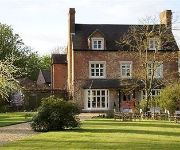
Brompton Farmhouse B&B
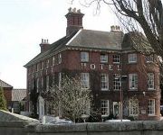
The Mytton & Mermaid Hotel
TRAVELODGE SHREWSBURY BAYSTON HILL
Videos from this area
These are videos related to the place based on their proximity to this place.
View of Church Stretton and Long Mynd
Taken from the top of Hazler Hill looking down on Church Stretton which is a small town and civil parish in Shropshire, England. The town lies entirely in the Shropshire Hills on the A49 road...
The Power of Toltec witches is waiting for you! Tour to Mexico – Tamara Ra
New amazing tour to Mexico will help you become successful, powerful and feminine. Tamara Ra will open you the power of Toltec witches. Do you want to take part in our travel? Join us! http://sansa...
DJI F450 Quadcopter FPV Flying above the clouds at sunset
1st flight above the clouds with my DJI f450 Very low cloud base so not a high flight but stunning once i broke through the cloud layer. DJI f450 quadcopter with Gopro Hero4 and Zenmuse H3...
DJI F450 Aerial photography over the Shire Shropshire
1st week filming with my DJ f450 quadcopter and Gopro Hero 4 black shot in 1080p 30 frames per second using protune and edited with Final cut pro. Shropshire is a fantastic location all clips...
Holiday Home CCTV and The Talking Birds (UK)
http://holidayhomestars.com/cctv The little birdies in this video may not be around YOUR holiday home to tell you what's going on, and it can be a real worry when you can't be there. But Michael...
Mountain biking Long Mynd - Batch Valley descent
Short descent off the Long Mynd via Batch Valley into All Stretton.
Arriva Trains Wales Trains At Church Stretton 17 April 2015
Some Arriva Trains Wales trains seen at Church Stretton station during the evening of Friday 17 April 2015.
Videos provided by Youtube are under the copyright of their owners.
Attractions and noteworthy things
Distances are based on the centre of the city/town and sightseeing location. This list contains brief abstracts about monuments, holiday activities, national parcs, museums, organisations and more from the area as well as interesting facts about the region itself. Where available, you'll find the corresponding homepage. Otherwise the related wikipedia article.
Shropshire
Shropshire is a county in the West Midlands region of England. It borders Wales to the west, Cheshire to the north, Staffordshire to the east, Worcestershire to the south-east and Herefordshire to the south. A unitary authority was created on 1 April 2009, taking over from the previous county council and 5 district councils, and covers most of the county. The borough of Telford and Wrekin has been a separate unitary authority since 1998 but continues to be included in the ceremonial county.
Shrewsbury and Atcham
Shrewsbury and Atcham was, between 1974 and 2009, a local government district with borough status in Shropshire, England. Shrewsbury was the only town in the borough; Atcham, although itself only a village, was included in the name as a reflection of the incorporation into the borough of the former Atcham Rural District. Other notable villages included Bayston Hill, Bomere Heath, Condover, Cressage, Cross Houses, Ford, Minsterley, Nesscliffe, Pontesbury, Uffington and Westbury.
Dorrington, Shropshire
Dorrington is a large village in Shropshire, England, located 6 miles (10 km) south of Shrewsbury. The population of the village was estimated as being 619 in 2008. The Cound Brook flows to the east of the village, and to the southwest is Netley Hall & Netley Old Hall Farm. The A49 road runs through the village, which has a number of businesses located both in a small business park and along the main road.
Frodesley
Frodesley is a tiny village and civil parish in the English county of Shropshire, and is situated partly within the Shropshire Hills Area of Outstanding Natural Beauty. The name probably derives from an Anglo-Saxon chief "Frod" who was the founder,and leah or clearing. It is mentioned in the Domesday Book: one hide paying tax,land for two ploughs, woodland for 30 pigs, valued at eight shillings.
Great Ryton
Great Ryton is a small village in Shropshire, England. It is located less than a mile to the northeast of the village of Dorrington and the A49 road there. Together with the neighbouring hamlet of Little Ryton and Ryton Grove, the combined community is often referred to as simply "Ryton". (Not to be confused however with the village and parish of Ryton, which also is in Shropshire. ) Ryton lies at around 106m above sea level. The population was estimated as being 142 in 2008.


