Safety Score: 3,0 of 5.0 based on data from 9 authorites. Meaning we advice caution when travelling to United Kingdom.
Travel warnings are updated daily. Source: Travel Warning United Kingdom. Last Update: 2024-04-28 08:22:10
Discover Hadnall
Hadnall in Shropshire (England) is a town in United Kingdom about 140 mi (or 226 km) north-west of London, the country's capital city.
Current time in Hadnall is now 02:09 PM (Sunday). The local timezone is named Europe / London with an UTC offset of one hour. We know of 10 airports near Hadnall, of which 5 are larger airports. The closest airport in United Kingdom is Hawarden Airport in a distance of 30 mi (or 48 km), North. Besides the airports, there are other travel options available (check left side).
There are several Unesco world heritage sites nearby. The closest heritage site in United Kingdom is Pontcysyllte Aqueduct and Canal in a distance of 16 mi (or 26 km), North-West. Also, if you like playing golf, there are a few options in driving distance. Looking for a place to stay? we compiled a list of available hotels close to the map centre further down the page.
When in this area, you might want to pay a visit to some of the following locations: Astley, Clive, Shawbury, Shrewsbury and Bayston Hill. To further explore this place, just scroll down and browse the available info.
Local weather forecast
Todays Local Weather Conditions & Forecast: 5°C / 42 °F
| Morning Temperature | 1°C / 35 °F |
| Evening Temperature | 8°C / 47 °F |
| Night Temperature | 4°C / 39 °F |
| Chance of rainfall | 17% |
| Air Humidity | 96% |
| Air Pressure | 1004 hPa |
| Wind Speed | Moderate breeze with 12 km/h (8 mph) from South-East |
| Cloud Conditions | Overcast clouds, covering 100% of sky |
| General Conditions | Rain and snow |
Monday, 29th of April 2024
12°C (54 °F)
10°C (49 °F)
Light rain, fresh breeze, overcast clouds.
Tuesday, 30th of April 2024
14°C (57 °F)
9°C (48 °F)
Light rain, fresh breeze, overcast clouds.
Wednesday, 1st of May 2024
13°C (55 °F)
11°C (51 °F)
Light rain, gentle breeze, overcast clouds.
Hotels and Places to Stay
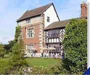
Albright Hussey Manor
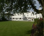
Mercure Shrewsbury Albrighton Hall Hotel and Spa
HAWKSTONE PARK
Three Tuns Hotel
The Lion Hotel Shrewsbury by Compass Hospitality
Holiday Inn Express SHREWSBURY
TRAVELODGE SHREWSBURY BATTLEFIELD
Shrewsbury North (Harmer Hill)
Shrewsbury Town Centre
ABBOTS MEAD HOTEL
Videos from this area
These are videos related to the place based on their proximity to this place.
Trains at Shrewsbury Feb 2015
I spent an hour at Shrewsbury station before going off to discover the town and my heritage. Whilst at the station I spied Class 153 327 for Wrexham, Class 170 504 for Birmingham New Street...
Julie Nicholas Florist | Shrewsbury Florist
http://www.julienicholasflorist.co.uk Florists Shrewsbury Flowers For All Occasions | Design - Create - Hire Weddings | Funerals | Birthdays | Anniversaries | New Arrivals Call - Julie...
Shrewsbury Railway Station Feb 2015
A video tour of Shrewsbury Railway Station on a dull and cold February Saturday morning.
AMF Bowling Shrewsbury trick shot competition
Hello Youtube and facebook! This is our first video and we thought of no better way to celebrate but to make a competition out of it! Have a look at the trick shot videos we've liked on our...
RAF Shawbury 17.06.12 Cosford air show red arrows
RAF Shawbury on the 17.06.12 with aircraft taking off and landing to go to RAF Cosford air show for my blog go to: http://bgrsteam.blogspot.co.uk/
RAF Shawbury Storage Hangar Visit May 2000
A visit to RAF Shawbury in May 2000 to view the contents of the aircraft storage hangars and to see the resident units, 2FTS and the DHFS at close quarters. The hangars contained a flock of...
Eurofighter Typhoon at RAF Shawbury landowners day 2014
Typhoon taking off at RAF Shawbury landowners day 2014 quality could of been better!!
Shawbury Airfield Riders Day 2013
Novice group. Still learning the track and getting use to the different surfaces. Taken with Go Pro Silver edition.
Moreton Corbet Castle and a bit of Time Lapse - Shropshire
Take the Moreton Corbet Castle virtual tour: http://uktripper.com/visits/moreton-corbet-castle/ Standing just outside Shawbury, Shropshire, are the remains of Moreton Corbet Castle - probably...
Mozart has a panic attack
My pet dog, Mozart on a walk. In today's vlog... She finds a cat and try's to trip me up at the start of the vid.
Videos provided by Youtube are under the copyright of their owners.
Attractions and noteworthy things
Distances are based on the centre of the city/town and sightseeing location. This list contains brief abstracts about monuments, holiday activities, national parcs, museums, organisations and more from the area as well as interesting facts about the region itself. Where available, you'll find the corresponding homepage. Otherwise the related wikipedia article.
Battle of Shrewsbury
The Battle of Shrewsbury was a battle fought on 21 July 1403, waged between an army led by the Lancastrian King, Henry IV, and a rebel army led by Henry "Harry Hotspur" Percy from Northumberland. The battle, the first in which English archers fought each other on English soil, demonstrated "the deadliness of the longbow" and ended the Percy challenge to Henry IV.
Battlefield, Shropshire
Battlefield is a village 3 miles north of Shrewsbury town centre in Shropshire, England. The village is today split between three parishes - Shrewsbury, Astley and Pimhill.
Upper Battlefield, Shropshire
Upper Battlefield is a small village in Shropshire, England. It lies on the A49 just north of Battlefield. The Welsh Marches railway line runs through the village, and it lies in the parish of Astley. Recent developments between the village and the town of Shrewsbury have almost merged the two settlements. Upon the recent completion of the new service station and livestock market site at the Battlefield Roundabout, there is only a small field separating the town and Upper Battlefield.
Grinshill
Grinshill is a small village, hill and civil parish in Shropshire, England, United Kingdom. The parish is one of the smallest in the district. The hill rises to 192m above sea level. Grinshill is near to the village of Clive. The A49 runs just to the east of the village. Stone has been quarried at Grinshill since at least the twelfth century.
Astley, Shropshire
Astley is a small village and civil parish in Shropshire, England. The official 2001 census recorded 454 people living in the parish and 116 in the village itself. The village lies near to (and between) the A53 and A49 roads. Upper Astley is a hamlet on the A53 about half a mile to the South of the village of Astley. There is a public house there - the Dog in the Lane.
A5112 road
The A5112 is a road in Shropshire, England that runs north-south through the town of Shrewsbury. It runs around the town centre, to the east, and acts as a quicker route through the town than going via the town centre. Starting north at Battlefield Island where it joins the A49, it consists of Battlefield Road, Whitchurch Road, Telford Way, Robertsford Way, Bage Way, Pritchard Way, Hazeldine Way and Hereford Road.
Hadnall
Hadnall is a village and civil parish in Shropshire, England. It lies on the A49, some 9 km north-north-east of Shrewsbury. The Welsh Marches Line runs just outside the village and there was once a railway station. Today, Hadnall has a primary school, a successful village shop, a pub and a two AA rosette restaurant. The village church is dedicated to St. Mary Magdalene. General Sir Rowland Hill, 1st Viscount Hill, who lived at nearby Hardwick Grange, is buried here.
St Mary Magdalene's Church, Battlefield
St Mary Magdalene's Church, Battlefield, is a redundant Anglican church in the village of Battlefield, Shropshire, England. It has been designated by English Heritage as a Grade II* listed building, and is under the care of the Churches Conservation Trust.


