Safety Score: 3,0 of 5.0 based on data from 9 authorites. Meaning we advice caution when travelling to United Kingdom.
Travel warnings are updated daily. Source: Travel Warning United Kingdom. Last Update: 2024-04-28 08:22:10
Discover Cressage
Cressage in Shropshire (England) with it's 707 citizens is a town in United Kingdom about 131 mi (or 211 km) north-west of London, the country's capital city.
Current time in Cressage is now 12:06 AM (Monday). The local timezone is named Europe / London with an UTC offset of one hour. We know of 10 airports near Cressage, of which 5 are larger airports. The closest airport in United Kingdom is Birmingham International Airport in a distance of 38 mi (or 61 km), East. Besides the airports, there are other travel options available (check left side).
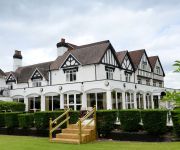
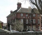
There are several Unesco world heritage sites nearby. The closest heritage site in United Kingdom is Pontcysyllte Aqueduct and Canal in a distance of 27 mi (or 43 km), North-West. Also, if you like playing golf, there are a few options in driving distance. Looking for a place to stay? we compiled a list of available hotels close to the map centre further down the page.
When in this area, you might want to pay a visit to some of the following locations: Harley, Kenley, Withington, Berrington and Wellington. To further explore this place, just scroll down and browse the available info.
Local weather forecast
Todays Local Weather Conditions & Forecast: 11°C / 51 °F
| Morning Temperature | 3°C / 38 °F |
| Evening Temperature | 9°C / 48 °F |
| Night Temperature | 3°C / 37 °F |
| Chance of rainfall | 2% |
| Air Humidity | 60% |
| Air Pressure | 1006 hPa |
| Wind Speed | Moderate breeze with 11 km/h (7 mph) from South-East |
| Cloud Conditions | Overcast clouds, covering 100% of sky |
| General Conditions | Light rain |
Monday, 29th of April 2024
11°C (53 °F)
9°C (48 °F)
Light rain, fresh breeze, overcast clouds.
Tuesday, 30th of April 2024
14°C (58 °F)
7°C (45 °F)
Light rain, fresh breeze, overcast clouds.
Wednesday, 1st of May 2024
14°C (57 °F)
11°C (52 °F)
Moderate rain, gentle breeze, overcast clouds.
Hotels and Places to Stay
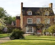
Brompton Farmhouse B&B
The Wroxeter Hotel
Gaskell Arms
The Fox Inn
Buckatree Hall
The Mytton & Mermaid Hotel
TRAVELODGE TELFORD SHAWBIRCH
The Raven
Videos from this area
These are videos related to the place based on their proximity to this place.
British Traffic Light
Traffic lights in Britain have a unique sequence. Red, then Red and Amber, then Green. The Amber lets you know to expect green soon.
Public Meeting to save the Lady Forester Community Nursing Home
Much Wenlock Town Council held a public meeting on 9th July 2010 to raise public awareness about the threatened closure of the Town's nursing home. This was successful because the owners, The...
Learning English - Lesson Seventy Nine - MEMORY
In this lesson, we look at the human memory and all the English words connected with it.
Edge Renewables Ltd - Renewable Wood Chip Fuel Drying System
Edge Renewables Ltd drying biomass wood chip fuel at Lea Quarry, Wenlock, Shropshire. Wood Chip Dryer: http://www.edgerenewables.com/woodchip-dryer.
Sunset over Shropshire 2013
The sun sets over the town of Shrewsbury. Filmed from my house in Much Wenlock on Monday June 3rd 2013.
Misterduncan's Summer Message - 2014
Join me on facebook MISTERDUNCAN.UK Where has Misterduncan been? What is he doing now? What will he be doing next? All these questions will be answered...here!
Videos provided by Youtube are under the copyright of their owners.
Attractions and noteworthy things
Distances are based on the centre of the city/town and sightseeing location. This list contains brief abstracts about monuments, holiday activities, national parcs, museums, organisations and more from the area as well as interesting facts about the region itself. Where available, you'll find the corresponding homepage. Otherwise the related wikipedia article.
Donnington, Shropshire
Donnington, Shropshire see also Donnington, Telford for another place in the same county and Donnington for outside Shropshire Donnington is a hamlet in the English county of Shropshire. It forms part of the civil parish of Wroxeter and Uppington. It lies near to Charlton Hill, which rises to 469 feet above sea level.
Eyton on Severn
Eyton on Severn is a small village in the English county of Shropshire. It is located on a ridge above the northern bank of the River Severn. The significant tributory of the Cound Brook joins the Severn at Eyton, albeit on the opposite bank. There is a historical octagonal tower here, built in 1607 as the summerhouse of a mansion then belonging to the Newport family of High Ercall.
Harley, Shropshire
Harley is a village and civil parish in the English county of Shropshire.
Eaton Constantine
Eaton Constantine is a small village in the English county of Shropshire. It is located just off the B4380 road, between Atcham and Buildwas, near The Wrekin hill. The theologian Richard Baxter (1615–1691) lived here in his boyhood. His childhood home, now called Baxter's House (a private residence), is a 16th-century timber-framed house in the centre of the village. Near Eaton Constantine are the remains of a Roman vexillation fortress and three marching camps near a bend in the River Severn.
Harnage
Harnage is a small village in the English county of Shropshire. It is located just SE of the village of Cound and the nearest notable settlement is Cressage. Harnage is considered a hamlet, not a village, as it does not have a post office. One road runs through the hamlet, passing residences, Harnage Farm, and Harnge House, a 17th century house built on the site of an older mansion, allegedly dating back to the 11th or 12th century.
Sheinton
Sheinton is a small rural village and civil parish just outside Telford, and within Shropshire. Shropshire is a county situated in mid-Britain bordering Wales. It is situated on the south bank of the River Severn opposite the Wrekin, a notable Shropshire landmark. The name comes from the Saxon shena - tun, meaning "beautiful place". On 23 October 2008 its historic bridge collapsed into the Hughley Brook.
Cound Brook
Cound Brook (pronounced COOnd) is a tributary of the River Severn in Shropshire, England, running to south of the county town Shrewsbury. The Cound Brook rises in the Stretton Hills and discharges into the River Severn at Eyton on Severn after winding its way for 25 miles across the southern Shropshire-Severn plains. The flow of the Cound Brook can vary from sluggish in a dry summer to a raging torrent in winter or spring.
Homer, Shropshire
Homer is a small village in Shropshire, England, north of the town of Much Wenlock. The name first appears in the 14th century as "Honemor". Originally common land called Homer Wood, the settlement developed from squatters' cottages encroaching on the common during the 17th century. During the 19th century it served as accommodation for quarrymen and farm labourers. The village expanded in the later 20th century with the construction of modern houses.


