Safety Score: 3,0 of 5.0 based on data from 9 authorites. Meaning we advice caution when travelling to United Kingdom.
Travel warnings are updated daily. Source: Travel Warning United Kingdom. Last Update: 2024-05-10 08:04:54
Discover Newtown
Newtown in Staffordshire (England) is a city in United Kingdom about 137 mi (or 221 km) north-west of London, the country's capital city.
Local time in Newtown is now 07:05 PM (Friday). The local timezone is named Europe / London with an UTC offset of one hour. We know of 8 airports in the vicinity of Newtown, of which 5 are larger airports. The closest airport in United Kingdom is Manchester Woodford Airport in a distance of 15 mi (or 25 km), North-West. Besides the airports, there are other travel options available (check left side).
There are several Unesco world heritage sites nearby. The closest heritage site in United Kingdom is Liverpool – Maritime Mercantile City in a distance of 41 mi (or 66 km), North-East. Also, if you like golfing, there are a few options in driving distance. We discovered 1 points of interest in the vicinity of this place. Looking for a place to stay? we compiled a list of available hotels close to the map centre further down the page.
When in this area, you might want to pay a visit to some of the following locations: Pott Shrigley, Disley, Bollington, Prestbury and Adlington. To further explore this place, just scroll down and browse the available info.
Local weather forecast
Todays Local Weather Conditions & Forecast: 20°C / 68 °F
| Morning Temperature | 13°C / 55 °F |
| Evening Temperature | 16°C / 61 °F |
| Night Temperature | 13°C / 56 °F |
| Chance of rainfall | 1% |
| Air Humidity | 65% |
| Air Pressure | 1024 hPa |
| Wind Speed | Light breeze with 5 km/h (3 mph) from North-West |
| Cloud Conditions | Overcast clouds, covering 100% of sky |
| General Conditions | Light rain |
Saturday, 11th of May 2024
17°C (62 °F)
12°C (53 °F)
Overcast clouds, gentle breeze.
Sunday, 12th of May 2024
18°C (65 °F)
13°C (56 °F)
Moderate rain, moderate breeze, overcast clouds.
Monday, 13th of May 2024
14°C (57 °F)
10°C (51 °F)
Moderate rain, moderate breeze, overcast clouds.
Hotels and Places to Stay
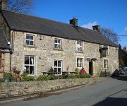
Ye Olde Cheshire Cheese Inn
Staden Grange Country House
Buxton
Videos from this area
These are videos related to the place based on their proximity to this place.
MX Training Buxton MX Track
This video is about Nitro Neo training at Buxton MX Track. Postcode SK17 0RR then follow small signs for 'Race Way', run by Barry and family. It's a soft dirt track that's very well maintained...
Stoxkarts on board action from Buxton Speedway
On Board with #27 Chris Butcher - 2 races from buxton (front view) and 2 action clips (rear view).
Buxton Raceway - BriSCA F2 Stock Cars 26/08/13 Bank Holiday Final Part 1 - Fast And Furious
BriSCA F2 Stock Cars 26/08/13 Bank Holiday Final Part 1 at Buxton Raceway Amazing bank holiday weekend at Buxton Raceway with SMASHES AND CRASHES Good Food and Beer - Great Family ...
Assembling an oak table using draw dowelling
A demonstration by Peter Fox of Fox Country Furniture showing an assembly technique called draw dowelling.
Derbyshire
Our trip to Derbyshire to Trentham Monkey Forest and our 17 mile bike ride thou the dales all taken on a Hitachi DZ-HV565E. YOUTUBE HAS REMOVED AUDIO :O( - check out lots more on my blog...
Bike and Trike trip, for Chernobyl Children 11-08-2013 - Setting Off
Setting off from "The Winking Man" pub, Buxton Road, Upper Hulme, Derbyshire UK.
DJI Phantom 2 Vision+ Drone vs Helicopter - UK (16th May 2014)
Drone vs Helicopter. We had a trip up to a great spot today called The Mermaid which is located between Staffordshire and Derbyshire, UK. When we got there there were a couple of dudes flying...
Videos provided by Youtube are under the copyright of their owners.
Attractions and noteworthy things
Distances are based on the centre of the city/town and sightseeing location. This list contains brief abstracts about monuments, holiday activities, national parcs, museums, organisations and more from the area as well as interesting facts about the region itself. Where available, you'll find the corresponding homepage. Otherwise the related wikipedia article.
River Hamps
The River Hamps is a river in Staffordshire, England. It is tributary of the River Manifold, which itself flows into the River Dove near Ilam. For its entire length the river flows through the Peak District National Park.
Parkhouse Hill
Parkhouse Hill is a small but distinctive hill in the Peak District National Park in the English county of Derbyshire. It lies on the north side of the River Dove, close to the border with Staffordshire. Geologically, the hill is the remains of an atoll which is believed to have existed during the Carboniferous period when what is now the Peak District was covered by a tropical sea.
Chrome Hill
Chrome Hill /ˈkruːm/ is a limestone reef knoll on the Derbyshire side of the upper Dove valley. It is adjacent to the more distinctive but lower Parkhouse Hill. Chrome Hill was declared open access land under the provisions of the Countryside and Rights of Way Act 2000. However, the only access from the North West remains along a concessionary footpath.
Fawfieldhead
Fawfieldhead is a civil parish in Staffordshire, England. It is situated north-east of Leek and south of Buxton, in the Peak District National Park.


