Safety Score: 3,0 of 5.0 based on data from 9 authorites. Meaning we advice caution when travelling to United Kingdom.
Travel warnings are updated daily. Source: Travel Warning United Kingdom. Last Update: 2024-05-01 08:01:32
Discover Hartington
Hartington in Derbyshire (England) is a place in United Kingdom about 133 mi (or 215 km) north-west of London, the country's capital city.
Current time in Hartington is now 04:56 PM (Wednesday). The local timezone is named Europe / London with an UTC offset of one hour. We know of 8 airports near Hartington, of which 5 are larger airports. The closest airport in United Kingdom is Manchester Woodford Airport in a distance of 20 mi (or 31 km), North-West. Besides the airports, there are other travel options available (check left side).
There are several Unesco world heritage sites nearby. The closest heritage site in United Kingdom is Liverpool – Maritime Mercantile City in a distance of 38 mi (or 61 km), North-East. Also, if you like playing golf, there are a few options in driving distance. We encountered 1 points of interest in the vicinity of this place. If you need a hotel, we compiled a list of available hotels close to the map centre further down the page.
While being here, you might want to pay a visit to some of the following locations: Bradley, Rodsley, Yeldersley, Shirley and Matlock. To further explore this place, just scroll down and browse the available info.
Local weather forecast
Todays Local Weather Conditions & Forecast: 15°C / 59 °F
| Morning Temperature | 8°C / 46 °F |
| Evening Temperature | 12°C / 54 °F |
| Night Temperature | 10°C / 51 °F |
| Chance of rainfall | 0% |
| Air Humidity | 76% |
| Air Pressure | 1009 hPa |
| Wind Speed | Moderate breeze with 11 km/h (7 mph) from South-West |
| Cloud Conditions | Broken clouds, covering 56% of sky |
| General Conditions | Light rain |
Thursday, 2nd of May 2024
15°C (59 °F)
8°C (47 °F)
Overcast clouds, fresh breeze.
Friday, 3rd of May 2024
10°C (50 °F)
7°C (45 °F)
Moderate rain, gentle breeze, overcast clouds.
Saturday, 4th of May 2024
9°C (47 °F)
7°C (45 °F)
Moderate rain, moderate breeze, overcast clouds.
Hotels and Places to Stay
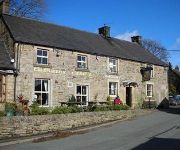
Ye Olde Cheshire Cheese Inn
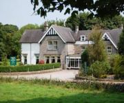
Newton House
Charles Cotton Hotel
Videos from this area
These are videos related to the place based on their proximity to this place.
Body Attack
Lesley Emma and Ruth teaching Body Attack and The Dolphin Centre Darlington. Body Attack is a Les Mills Programme (www.lesmills.com) it is an athletic based workout which will improve your...
Apes Tor & Ecton Hill Field Meeting April 21.
Oxford Geology Group Field Meeting, April 21, 2012 facilitated by Ecton Hill Field Studies Association (EHFSA).
Hartington - Staden Lane (ORPA, N-S)
Subscribe for the love of motorcycles and the great outdoors: http://www.youtube.com/subscription_center?add_user=wiltshirebyways Please click 'S H O W M O R E' for route info: ↓↓↓↓↓↓...
Olympic bells in Alstonefield
"All The Bells" (Work 1197) by Martin Creed. Villagers from Alstonefield ring many different types of bells for 3 minutes to celebrate the start of the London Olympics 2012 and to wake-up...
Mobile Belfry 2
The Lichfield Diocesan Mobile Belfry at Alstonefield Playing Field for the Wakes Festival 2012. Millie Allen and Mum, Tara having fun.
2011 Remembrance Sunday Bell Preparations St Margaret's Church - Wetton in the Peak District
2011 Remembrance Sunday Bell Preparations St Margaret's Church - Wetton in the Peak District.
Videos provided by Youtube are under the copyright of their owners.
Attractions and noteworthy things
Distances are based on the centre of the city/town and sightseeing location. This list contains brief abstracts about monuments, holiday activities, national parcs, museums, organisations and more from the area as well as interesting facts about the region itself. Where available, you'll find the corresponding homepage. Otherwise the related wikipedia article.
Tissington Trail
The Tissington Trail is a bridleway and walk/cycle path in Derbyshire, England. Opened in 1971, and now a part of the National Cycle Network, it runs for 13 miles from Parsley Hay in the north to Ashbourne in the south, along part of the trackbed of the former railway line connecting Ashbourne to Buxton. It takes its name from the village of Tissington, which it skirts.
Manifold Way
The Manifold Way is a footpath and cycle way in Staffordshire, England. Some 8 miles in length, it runs from Hulme End in the north to Waterhouses in the south, mostly through the Manifold Valley and the valley of its only tributary, the River Hamps, following the route of the former Leek and Manifold Valley Light Railway, a 30 gauge line which closed in 1934 after a short life.
Hulme End
Hartington railway station
Hartington railway station opened in 1899 about two miles away from the village it served - Hartington in Derbyshire, south east of Buxton. It was on the Ashbourne Line built by the LNWR as a branch from the Cromford and High Peak Railway at Parsley Hay. To the north of the station is Hand Dale viaduct. It was reported that when digging the foundations for the piers, remains of a lead mine, in which the miners had perished, were discovered.


