Safety Score: 3,0 of 5.0 based on data from 9 authorites. Meaning we advice caution when travelling to United Kingdom.
Travel warnings are updated daily. Source: Travel Warning United Kingdom. Last Update: 2024-04-25 08:17:04
Delve into Parwich
Parwich in Derbyshire (England) with it's 472 habitants is a city located in United Kingdom about 128 mi (or 206 km) north-west of London, the country's capital town.
Current time in Parwich is now 03:22 AM (Friday). The local timezone is named Europe / London with an UTC offset of one hour. We know of 8 airports closer to Parwich, of which 5 are larger airports. The closest airport in United Kingdom is East Midlands Airport in a distance of 24 mi (or 39 km), South-East. Besides the airports, there are other travel options available (check left side).
There are several Unesco world heritage sites nearby. The closest heritage site in United Kingdom is Liverpool – Maritime Mercantile City in a distance of 37 mi (or 59 km), North-East. Also, if you like playing golf, there are some options within driving distance. We saw 1 points of interest near this location. In need of a room? We compiled a list of available hotels close to the map centre further down the page.
Since you are here already, you might want to pay a visit to some of the following locations: Bradley, Yeldersley, Shirley, Rodsley and Matlock. To further explore this place, just scroll down and browse the available info.
Local weather forecast
Todays Local Weather Conditions & Forecast: 4°C / 40 °F
| Morning Temperature | 1°C / 35 °F |
| Evening Temperature | 6°C / 43 °F |
| Night Temperature | 3°C / 37 °F |
| Chance of rainfall | 1% |
| Air Humidity | 96% |
| Air Pressure | 1005 hPa |
| Wind Speed | Gentle Breeze with 9 km/h (5 mph) from South-West |
| Cloud Conditions | Broken clouds, covering 76% of sky |
| General Conditions | Light rain |
Saturday, 27th of April 2024
6°C (42 °F)
4°C (39 °F)
Light rain, gentle breeze, overcast clouds.
Sunday, 28th of April 2024
7°C (45 °F)
3°C (38 °F)
Moderate rain, gentle breeze, overcast clouds.
Monday, 29th of April 2024
11°C (51 °F)
6°C (43 °F)
Light rain, moderate breeze, scattered clouds.
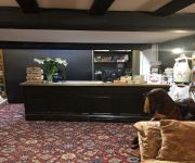
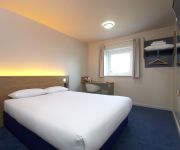
Hotels and Places to Stay
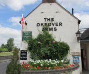
The Okeover Arms
The Izaak Walton Hotel
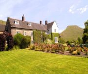
Newton House
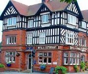
Station Hotel
The Dog and Partridge Country Inn
TRAVELODGE ASHBOURNE
CALLOW HALL COUNTRY HOUSE HOTE
Videos from this area
These are videos related to the place based on their proximity to this place.
Self catering holiday cabins at Hoe Grange
Luxury self catering log cabins set on a working farm in the spectacular Peak District, Derbyshire. Dramatic views of the white peak limestone scenery from the decking area. Rainster can be...
Boma 7 field test at Hoe Grange Holidays
Hoe Grange Holidays in Derbyshire test out the Boma 7 off-road wheelchair over the rough and hilly terrain. An ideal soluion for holiday guests with limited mobility wishing to access the countrysi...
Rainster self catering log cabin at Hoe Grange Holidays
One of four self catering log cabins on a working farm in the spectacular Derbyshire countryside. Our 4 star gold holiday accommodation has two bedrooms, which have flexible bed arrangements...
Daisybank delivery at Hoe Grange Holidays
Second half of the new self catering log cabin at Hoe Grange Holidays being towed through farmyard.
Electric bike test at Hoe Grange
A quick test on the steep hill leading up to our self catering log cabins shows that the electric bike is easy to use and makes short work of tough hills, without leaving the rider short of...
Rainster wet room shower at Hoe Grange
Rainster self catering log cabin at Hoe Grange is ideal for guests with limited mobility. It is rated Mobility Level 2 under the National Accessible Scheme and has a spacious wet room shower...
Official Top 30 World's Most Beautiful Women of 2014
Read More Here: http://bzzn.net/1ctd9ot Official Top 30 World's Most Beautiful Women of 2014 HollywoodBuzz: Thanks to all who have voted in the poll,The poll was closed on December 14, 2013,More ...
Urban Exploring - Wareham Cordite Factory
Urban Exploring Wareham Cordite Factory with Adam D Short and Mike Maynard.
Urban Exploring - Fire Engine Graveyard
Urban Exploring a Fire Engine / Truck Graveyard with Adam D Short and Marine Engineer Mike Maynard.
Videos provided by Youtube are under the copyright of their owners.
Attractions and noteworthy things
Distances are based on the centre of the city/town and sightseeing location. This list contains brief abstracts about monuments, holiday activities, national parcs, museums, organisations and more from the area as well as interesting facts about the region itself. Where available, you'll find the corresponding homepage. Otherwise the related wikipedia article.
Derbyshire Dales
Derbyshire Dales /ˈdɑrbɪʃə deɪlz/ or /ˈdɑrbiʃɪər deɪlz/ is a local government district in Derbyshire, England. Much of the district is situated in the Peak District, although most of its population lies along the River Derwent. The borough borders the districts of High Peak, Amber Valley, North East Derbyshire and South Derbyshire in Derbyshire and also Sheffield in South Yorkshire. The district offices are in Matlock. It was formed on 1 April 1974, originally under the name of West Derbyshire.
Minninglow
Minninglow (or Minning Low) is a hill in the Peak District National Park in Derbyshire, located within the White Peak area at grid reference SK209573. Within the clump of trees crowning the hill is a round barrow containing Neolithic burial chambers. Although it is within 200 metres of the High Peak Trail between Parwich and Longcliffe, there is no public right of way to the site.
Tissington Hall
Tissington Hall is an early 17th century Jacobean mansion house situated at Tissington, near Ashbourne. Derbyshire. It is a Grade II* listed building. The FitzHerberts, descended from the Norman family of Norbury Hall, acquired Tissington by the marriage of Nicholas FitzHerbert (the second son of John FitzHerbert of Somersal Herbert) to Ciceley Frauncis, heiress of Tissington, in 1465.
Ashbourne Line
The Ashbourne Line was a railway from Buxton via Ashbourne to Uttoxeter. It was built by the London and North Western Railway using a section of the Cromford and High Peak Railway (C&HPR) and it joined the North Staffordshire Railway at Ashbourne, proceeding to Uttoxeter with a junction onto the main line at Rocester.
Parwich Hall
Parwich Hall is a privately owned 18th century mansion house at Parwich, near Ashbourne, Derbyshire Dales. It is a Grade II* listed building. The Manor of Parwich was owned by the Cockaynes of Ashbourne until they sold it in about 1603 to Thomas Levinge of Norfolk. His great grandson, Richard Levinge, was Speaker of the House of Commons in Ireland and became the first of the Levinge Baronets.
Bradbourne Hall
Bradbourne Hall is a privately owned 17th century country house at Bradbourne, near Ashbourne, Derbyshire. It is a Grade II* listed building. The church of All Saints at Bradbourne was in the ownership of the Priory of Dunstable from 1278 until it was forfeited to the Crown in the 16th century at the time of the Dissolution of the Monasteries. The former glebe lands of some 260 acres and the advowson of All Saints were purchased by George Buxton in 1609.
All Saints Church, Ballidon
All Saints Church, Ballidon, is a redundant Anglican church located to the south of the village of Ballidon, Derbyshire, England. It has been designated by English Heritage as a Grade II listed building, and is under the care of the Friends of Friendless Churches.


