Safety Score: 3,0 of 5.0 based on data from 9 authorites. Meaning we advice caution when travelling to United Kingdom.
Travel warnings are updated daily. Source: Travel Warning United Kingdom. Last Update: 2024-05-04 08:22:41
Touring Kniveton
Kniveton in Derbyshire (England) with it's 392 residents is a town located in United Kingdom about 125 mi (or 202 km) north-west of London, the country's capital place.
Time in Kniveton is now 05:12 AM (Sunday). The local timezone is named Europe / London with an UTC offset of one hour. We know of 8 airports nearby Kniveton, of which 5 are larger airports. The closest airport in United Kingdom is East Midlands Airport in a distance of 21 mi (or 34 km), South-East. Besides the airports, there are other travel options available (check left side).
There are several Unesco world heritage sites nearby. The closest heritage site in United Kingdom is Liverpool – Maritime Mercantile City in a distance of 38 mi (or 60 km), North-East. Also, if you like the game of golf, there are several options within driving distance. We collected 1 points of interest near this location. Need some hints on where to stay? We compiled a list of available hotels close to the map centre further down the page.
Being here already, you might want to pay a visit to some of the following locations: Bradley, Yeldersley, Shirley, Rodsley and Matlock. To further explore this place, just scroll down and browse the available info.
Local weather forecast
Todays Local Weather Conditions & Forecast: 16°C / 60 °F
| Morning Temperature | 9°C / 47 °F |
| Evening Temperature | 13°C / 56 °F |
| Night Temperature | 10°C / 49 °F |
| Chance of rainfall | 0% |
| Air Humidity | 66% |
| Air Pressure | 1007 hPa |
| Wind Speed | Gentle Breeze with 6 km/h (4 mph) from North |
| Cloud Conditions | Broken clouds, covering 60% of sky |
| General Conditions | Light rain |
Monday, 6th of May 2024
15°C (59 °F)
9°C (49 °F)
Light rain, light breeze, overcast clouds.
Tuesday, 7th of May 2024
16°C (61 °F)
11°C (51 °F)
Light rain, gentle breeze, broken clouds.
Wednesday, 8th of May 2024
12°C (53 °F)
11°C (51 °F)
Light rain, gentle breeze, overcast clouds.
Hotels and Places to Stay
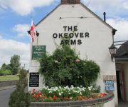
The Okeover Arms
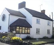
The Wheel House
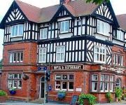
Station Hotel
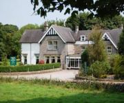
Newton House
TRAVELODGE ASHBOURNE
CALLOW HALL COUNTRY HOUSE HOTE
Videos from this area
These are videos related to the place based on their proximity to this place.
City of Exeter Pipes and Drums - Ashbourne 2014
The City of Exeter Pipes & Drums competing at the Ashbourne Highland Gathering in Grade 4.
Royal Shrovetide Football 2015 (15/15)
The Royal Shrovetide Football 2015 from 'turn up' to sundown. Filmed on the first day of the match, Shrove Tuesday. PS: Please excuse this raw, unstabilised GoPro footage. A shorter, properly...
Ashbourne Shrovetide Football, Tues 4th Mar 2014. Pt 2 of 7
This absolutely mad game of football with hundreds of players and goals 3 miles apart took place today. Hope you like my video. This is one of many parts Feel free to embed or link to this...
Ashbourne Royal Shrovetide Football 2014 - Play crosses down onto Ashbourne's Sports Fields.
The regular Football (Soccer) & Rugby goal post pale into insignificance when Ashbourne's Shrovetide Football takes to the fields!!
Ashbourne Shrovetide Football, Weds 5th Mar 2014. Pt 7 of 9
This absolutely mad game of football with hundreds of players and goals 3 miles apart took place today. Hope you like my video. This is one of many parts Feel free to embed or link to this...
Ashbourne Shrovetide Football, Weds 5th Mar 2014. Pt 4 of 9
This clip features my close encounter with the scrum. A bit too close for comfort!!! This absolutely mad game of football with hundreds of players and goals 3 miles apart took place today....
Ashbourne Royal Shrovetide Football 2014 - Play on the Sports Fields 3
Play breaks free from against the hedge and moves away towards the Henmore Brook!
Ashbourne Royal Shrovetide Football 2014 - ends up in the middle of Ashbourne Pond again.
It doesn't happen very often but play ended up in the town pond two time in two days this year!
Starflyer at Derby Market Place - 20 Apr 2014
Europe's Tallest Mobile Ride. With 68 meters in height, 14 rotation/min and 48km/h in speed. **Guest Starring** -Aakash Harrinanan -Ming K Lim -Thaiseng Ting **Passenger Starring** -Alvin...
Videos provided by Youtube are under the copyright of their owners.
Attractions and noteworthy things
Distances are based on the centre of the city/town and sightseeing location. This list contains brief abstracts about monuments, holiday activities, national parcs, museums, organisations and more from the area as well as interesting facts about the region itself. Where available, you'll find the corresponding homepage. Otherwise the related wikipedia article.
Ashbourne, Derbyshire
Ashbourne is one of the market towns in the Derbyshire Dales, England. It has a population of 7,302. It contains many historical buildings and many independent shops, and is famous for its historic annual Shrovetide football match. Due to its proximity to the southern edge of the Peak District and being the closest town to the popular area of Dovedale, the town is known as both 'The Gateway to Dovedale' and the 'Gateway to the Peak District'.
Derbyshire Dales
Derbyshire Dales /ˈdɑrbɪʃə deɪlz/ or /ˈdɑrbiʃɪər deɪlz/ is a local government district in Derbyshire, England. Much of the district is situated in the Peak District, although most of its population lies along the River Derwent. The borough borders the districts of High Peak, Amber Valley, North East Derbyshire and South Derbyshire in Derbyshire and also Sheffield in South Yorkshire. The district offices are in Matlock. It was formed on 1 April 1974, originally under the name of West Derbyshire.
Parwich Hall
Parwich Hall is a privately owned 18th century mansion house at Parwich, near Ashbourne, Derbyshire Dales. It is a Grade II* listed building. The Manor of Parwich was owned by the Cockaynes of Ashbourne until they sold it in about 1603 to Thomas Levinge of Norfolk. His great grandson, Richard Levinge, was Speaker of the House of Commons in Ireland and became the first of the Levinge Baronets.
Bradbourne Hall
Bradbourne Hall is a privately owned 17th century country house at Bradbourne, near Ashbourne, Derbyshire. It is a Grade II* listed building. The church of All Saints at Bradbourne was in the ownership of the Priory of Dunstable from 1278 until it was forfeited to the Crown in the 16th century at the time of the Dissolution of the Monasteries. The former glebe lands of some 260 acres and the advowson of All Saints were purchased by George Buxton in 1609.
RAF Ashbourne
RAF Ashbourne is a former Royal Air Force airfield located approximately 1.5 miles south-east of the town of Ashbourne, Derbyshire. Opened on 12 June 1942 before closing on 23 August 1954. Ashbourne was home to Armstrong Whitworth Whitley, Armstrong Whitworth Albemarle and Bristol Blenheim aircraft. Post World War II it was used for storage and maintenance of ordnance where the bombs were stored along the runways.
Ashbourne Hall
Ashbourne Hall is a Manor house originally built by the Cockayne family in the 13th century in Ashbourne, Derbyshire. The present Hall is part of a largely demolished, Georgian styled Hall build during the 18th century.
All Saints Church, Ballidon
All Saints Church, Ballidon, is a redundant Anglican church located to the south of the village of Ballidon, Derbyshire, England. It has been designated by English Heritage as a Grade II listed building, and is under the care of the Friends of Friendless Churches.


